
Fort Concho in San Angelo, Texas by Kathy Alexander.
There are dozens of forts, military installations, and old camps across the Lone Star State.
With the arrival of the first Spanish conquistadors in the region now known as Texas in 1519, it was already populated by numerous Native American tribes, whose ancestors had been there for thousands of years. Soon regions of Texas would be claimed by both royal France and imperial Spain, both of which would mount military expeditions to explore various areas. A small number of simple fortifications were established in this era to protect both French and Spanish claims from each other and to protect expeditionary operations from unwelcoming local inhabitants.
Fort Merrill
Fort Milam
Fort Parker
Fort Polk
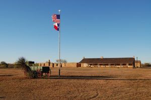
Fort Quitman
Fort Richardson
Fort Ringgold
Fort D. A. Russell
Fort Sabine
Fort Saint Louis
Fort San Jacinto
Fort Stubblefield
Fort Tenoxtitlan
Fort Terán
Fort Travis
Fort Trevino
Fort Worth
Jowell Family Fort
Lacy’s Fort
Little River Fort
Moore’s Fort
Presidio de la Virgen de los Dolores de los Tejas
Presidio de San Agustín de Ahumada
Presidio de San Antonio de Béjar
Presidio de San Elizario
Presidio Nuestra Señora de Loreto de la Bahia (Fort Defiance, Fort Goliad)
Princess Sophia’s Fort
Fort Chadbourne, Texas by Kathy Alexander.
For over two centuries, various groups fought over access and control over the region that would become Texas. From 1519 to 1848, all or parts of Texas were claimed by six countries: France, Spain, Mexico, the Republic of Texas, the United States of America, and the Confederate States of America in 1861–65.
Ownership of specific lands was also claimed and disputed by different ethnic groups, including numerous Native American tribes, Mexican residents, Anglo and African-American settlers, and European immigrants. Access to and control of resources were also claimed and disputed by various economic groups, such as farmers, ranchers, settlers, buffalo hunters, traders, bandits, and revolutionaries. Over the centuries, claims and disputes were enforced by Native American warriors, Spanish conquistadors, French cavaliers, Texas Rangers, local militias, and uniformed regular army regiments of Spain, Mexico, Texas, the United States, and the Confederacy.
During these years of dispute, numerous military camps, barracks, fortified trading posts, palisades, stockades, blockhouses, strongholds, and fortifications were built to establish, defend, or dispute the many claims to the area. Many of these are long gone, but the Lone Star State continues to preserve several historical buildings, some are still operational military installations, and historical markers designate sites.
© Kathy Alexander/Legends of America, updated November 2022.
See our Texas Forts Photo Gallery HERE
Also See:
Forts & Presidios Across America

The remains of the 1757 Presidio de San Saba in Menard, Texas by Kathy Alexander.
Sources:
Forts of Texas
Handbook of Texas On-Line
Texas Historical Markers
Texas Escapes
Texas State Parks