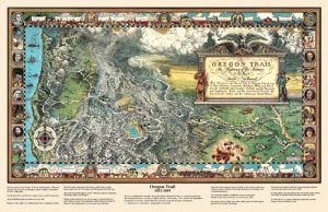
Oregon Trail Map
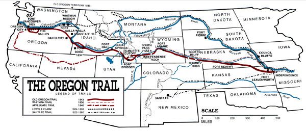
The Oregon Trail became one of the key migration routes that pioneers used to cross to the vast West. Spanning over half the continent, the trail proceeded 2,170 miles west through Missouri, Kansas, Nebraska, Wyoming, Idaho, and Oregon. The long journey through endless plains, rolling hills, and mountain passes began in Independence, Missouri, and ended at the Columbia River in Oregon.
Events & Stories:
The Cayuse War – Revenge for the Measles
Crime and Punishment on the Overland Trails
Danger and Hardship on the Oregon Trail
Disease and Death on the Overland Trails
A Ghost Story on the Oregon Trail
Ezra Meeker – Oregon Trail Pioneer
Oregon-California Trail Timeline
Sager Orphans on the Oregon Trail
Eye Witness Accounts:
Crossing the Great Plains in Ox-Wagons
People:
Benjamin Bonneville – Exploring & Defending the American West
Jim Bridger – Quintessential Guide of the Rocky Mountains
Ephraim Brown – Murdered on the Oregon Trail
Corps of Discovery – The Lewis & Clark Expedition
George Donner – Leading the Infamous Donner Party
John C. Fremont – The Pathfinder
Hall Jackson Kelley – Promoting the Oregon Trail
Charles Preuss – Mapping the Oregon Trail
Oregon Trail Historic Sites:
Landmarks Along the Oregon Trail
Independence, Missouri – Queen City of the Trails
Minor Park/Red Bridge Crossing – Kansas City, Missouri
Vieux Crossing, Kansas
Alcove Spring – Blue Rapids, Kansas
Rock Creek Station, Nebraska
Fort McPherson, Nebraska
Fort Kearny – Kearney, Nebraska
California Hill/Upper Crossing, Nebraska
Oregon Trail Through the Platte River Valley, Nebraska
Scotts Bluff, Nebraska
Oregon-California Trail Across Wyoming
Fort Laramie, Wyoming
Register Cliff, Guernsey, Wyoming
Guernsey Ruts (Deep Rut Hill) – Guernsey, Wyoming
South Pass – Gateway to the West, Wyoming
South Pass City, Wyoming
Soda Springs Complex – Soda Springs, Idaho
Fort Hall, Idaho
Three Island Crossing – Glenns Ferry, Idaho
Oregon Trail Interpretive Center – Baker City, Oregon
“When you start over these wide plains, let no one leave dependent on his best friend for anything, for if you do, you will certainly have a blow-out before you get far.”
— John Shivley, 1846
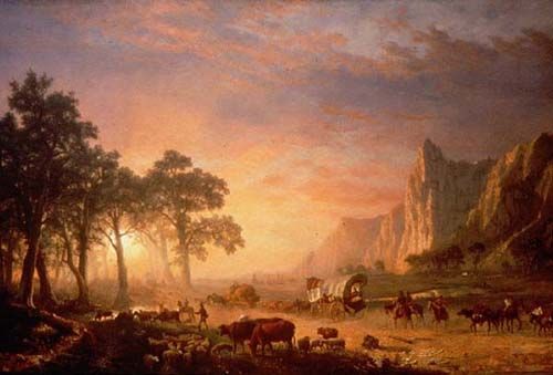
Oregon Trail, Albert Bierstadt, 1869.
Fur traders and explorers began scouting the Oregon Trail route as early as 1823. By the 1830s, it had become a regular means of transportation for mountain men, traders, missionaries, and military expeditions.
At the same time, small groups of individuals and the occasional family attempted to follow the trail, with some succeeding in arriving at Fort Vancouver, Washington.
On May 16, 1842, the first organized wagon train on the Oregon Trail set out from Elm Grove, Missouri, with more than 100 pioneers. On May 22, 1843, with up to 1,000 settlers, livestock, and more, the Great Migration departed to follow the same route from Independence, Missouri, arriving in the Willamette Valley in a massive wagon train. Hundreds of thousands more would follow, especially after gold was discovered in California in 1849.
While the first few parties organized and departed from Elm Grove, Missouri, the Oregon Trail’s generally designated starting point was Independence or Westport, Missouri. The trail ended at Oregon City, Oregon, the proposed capital of the Oregon Territory at the time. However, many settlers branched off or grew exhausted short of this goal and settled at convenient or promising locations.
At many places along the trail, alternate routes called “cutoffs” were established to shorten the trail or circumvent rugged terrain. The Lander and Sublette cutoffs provided shorter routes through the mountains than the main route, bypassing Fort Bridger, Wyoming. The Salt Lake cutoff later provided a route to Salt Lake City.
The Oregon Trail was too long and arduous for the standard Conestoga wagons used in the eastern U.S. for most freight transport. These big wagons were known for killing their oxen teams approximately two-thirds along the trail and leaving their unfortunate owners stranded in the desolate, isolated territory. The only solution was to abandon all belongings and trudge onward with the supplies and tools that could be carried or dragged. In one case in 1846, the Donner Party, en route to California, was stranded in the Sierra Nevada in November and had to resort to cannibalism to survive.
This led to the rapid development of the prairie schooner. Although this wagon looked similar, it was approximately half the size of the large Conestoga wagon and was manufactured in quantity by the Conestoga Brothers. It was designed for the conditions and was a marvel of engineering in its time.
Pioneers on the Oregon Trail followed various rivers and used landmarks along the trail to guide their way and gauge their progress. Within Nebraska, the Oregon Trail followed the Platte River and the North Platte River into Wyoming. Along this part of the journey, the Great Plains began to give way to bluffs and hills that were the precursor to the Rocky Mountains. After crossing the Rockies through South Pass, the trail followed the Snake River to the Columbia River. From there, emigrants could raft down the Columbia River to Fort Vancouver or take the Barlow Road to the Willamette Valley and other destinations in Washington and Oregon.
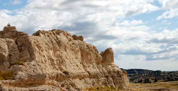
Many rock formations became famous landmarks that Oregon Trail pioneers used to navigate and leave messages for pioneers following behind them.
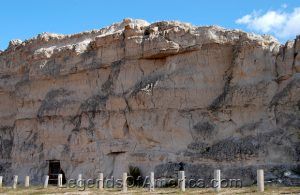
The pioneers’ first landmarks were in Western Nebraska, such as Court House Rock, Chimney Rock, and Scotts Bluff (where wagon ruts can still be seen today). Further west, in Wyoming, visitors can still read the names of pioneers carved into a landmark bluff called Register Cliff.
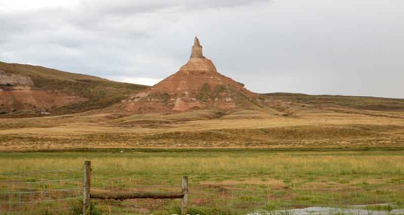
Chimney Rock in Nebraska, by Kathy Alexander. Several other trails followed the Oregon Trail for part of its length. These include the Mormon Trail from Illinois to Utah and the California Trail to the goldfields of California.
Other migration paths for early settlers before the transcontinental railroads involved taking passage on a ship rounding the Cape Horn of South America or to the Isthmus (now Panama) between North and South America. An arduous mule trek through treacherous swamps and rainforests lay ahead for the traveler. A ship was typically then taken to San Francisco, California.
The trail was still in use during the Civil War, but traffic declined after the completion of the transcontinental railroad in 1869.
However, in its more than 25 years of regular use, the trail carried an estimated 300,000 emigrants to the vast West, which took about five months to complete. The trail continued to be used into the 1890s, when modern highways began to take their place, eventually paralleling large portions of the trail. Today, U.S. Highway 26 has long followed the route of the Oregon Trail.
Some of the original routes from our nation’s early days remain today as reminders of our historic past. The Oregon National Historic Trail is an extended trail that follows much of the original path of the Oregon Trail.
In 1968, Congress enacted the National Trails System Act, and in 1978, National Historic Trail designations were added. The National Historic Trails System commemorates these historic routes, promoting preservation, interpretation, and appreciation.
In 1995, the National Park Service established the National Trails System Office in Salt Lake City, Utah. The Salt Lake City Trails Office administers the Oregon, California, Mormon Pioneer Trail, and Pony Express National Historic Trails.
The National Trails System does not manage trail resources on a day-to-day basis. The responsibility for managing trail resources remains with the current federal, state, local, and private trail managers.
National Historic Trails recognize the diverse facets of history, including significant exploration routes, migration, trade, communication, and military action. The historic trails generally consist of remnant sites and trail segments and thus are not necessarily contiguous.
Contact Information:
National Trails System Office
P.O. Box 45155
Salt Lake City, Utah 84145-0155
801- 741-1012
©Kathy Alexander/Legends of America, updated October 2025.
Also See:
Westward Expansion & Manifest Destiny
See Sources.

