
- Branches of the Santa Fe Trail.
The historic Santa Fe Trail trade route from Missouri through Kansas to Santa Fe, New Mexico, had two primary branches: the Cimarron Route and the Mountain Route. During the trail’s heyday, both were well traveled for different reasons.

William Becknell blazes the Santa Fe Trail.
When William Becknell and his companions first blazed the Santa Fe Trail in 1821, they followed the north bank of the Arkansas River, the international boundary between the United States and Mexico. After passing through Kansas and into eastern Colorado, they crossed the Arkansas River near its confluence with New Mexico. Historians have recorded that they then traveled over Raton Pass before making their way to Santa Fe, New Mexico. This route would become known as the Mountain Route of the Santa Fe Trail. That portion of the journey has been called into question following the discovery of Pedro Ignacio Gallego’s diary in 1993. Mexican Captain Gallego and his 400 men met Becknell on his first journey to Santa Fe. His writings and Becknell’s journal describing the landscape provide further evidence that he and his men likely misidentified the Canadian River and instead crossed another river or stream. Researchers now say evidence points to a location between the Arkansas River and Puertocito Piedra Lumbre in Kearny Gap, south of present-day Las Vegas, New Mexico. Later, wagon trains would take the known Mountain Route.
However, the Becknell party took another route home to Missouri on their return. This path extended into eastern New Mexico, Oklahoma, and Kansas, where it crossed the Arkansas River back into the United States. This route became known as the Cimarron Route or the Cimarron Cutoff.

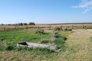
Raton Pass, New Mexico.
Becknell’s first trip was so successful that he and 22 men made a second trip in 1822. Loading three prairie schooners with goods, they decided to travel the Cimarron Route again, knowing their wagons couldn’t cross the mountains.
Though there were various paths and trails at different times throughout the history of the Santa Fe Trail, the journey was essentially the same until travelers reached western Kansas, in the area of present-day Cimarron, where the trail divided into two alternative routes — the Mountain Branch, following the Arkansas River further west to the site of Bent’s Fort, Colorado, south through Raton Pass into New Mexico; and the Cimarron Cutoff which, made a more direct diagonal route southwest through Oklahoma. The two paths rejoined in present-day Watrous, New Mexico, continuing southward to Santa Fe.
Cimarron Route:

The Plains of Southwest Kansas by Kathy Alexander.
The Cimarron Route, also known as the Cimarron Cutoff and Cimarron Crossing, was the most favored in the earliest days of the Santa Fe Trail, even though the path was known for its water scarcity. This route was shorter by about 100 miles, shortened the traveling time by ten days, and was more suited to wagon travel.
The Cimarron River, which gives the route its name, flows through southwestern Kansas and northeastern Oklahoma. Depending upon where the travelers left the Arkansas River, it was a journey of fifty or more miles to reach the Cimarron River. With poor grass and scant water, the sandy Cimarron River, often dry, defined the landscape as one of the riskiest sections of the entire Trail. This much-dreaded, waterless area was often called the Cimarron Desert, Waterscape, and, by Mexicans, the Jornada del Muerte, or Journey of Death.
Wagon Bed Spring Box on the Santa Fe Trail in Grant County, Kansas, by Kathy Alexander.
The trail cut southwest across the Cimarron River valley near Ulysses, Kansas, before finding its first reliable water supply since leaving the Arkansas River. Lower Cimarron Spring, also known as Lower Springs and Wagon Bed Springs, is on the north bank of the Cimarron River, approximately 11 miles south and 1.5 miles west of Ulysses, about two miles west of the markers on U.S. Highway 25 south of the Cimarron River bridge. Travelers breathed a sigh of relief upon finding Lower Spring, as it meant they had survived. However, that would not be the case for all travelers, as near here, the famous hunter, trapper, and explorer Jedediah Strong Smith would lose his life. In 1831, Smith’s well-equipped wagon train became lost in the maze of buffalo trails. Seeking water for the dying animals and suffering men, Smith finally found the Cimarron River but was killed by the Comanche Indians near Wagon Bed Springs. His body was never recovered.

Cimarron National Grasslands, Kansas, by Kathy Alexander.
The path then continued into Morton County, past Point of Rocks, and through the Cimarron National Grasslands, which appear very much as they did during the Santa Fe Trail’s heydays. Following the Cimarron River, the trail moved south into present-day Cimarron County, Oklahoma, where it crossed the river at Willowbar Crossing and continued southwest to Cold Springs. There, Autograph Rock (on private land) still displays the names that scores of travelers carved into the ledges at the springs. The trail then passed by Camp Nichols, a short-lived military post established by Christopher “Kit” Carson in 1865. The trail exited Oklahoma and entered Union County, New Mexico. Subsequently, the trail passed several historic sites and landmarks, including Rabbit Ears Mountain, McNee’s Crossing, and Wagon Mound, before joining the northern branch at Watrous, New Mexico.
But, for the Cimarron Route, lack of water wasn’t the only problem. Another, often greater fear, was Indian attacks. Although the government had made treaties with the Kanza and Osage tribes in Kansas to guarantee safe passage, no such treaties were made with the Comanche, Kiowa, Cheyenne, Pawnee, or Apache. These people had long roamed the Plains through which the Cimarron Cutoff was blazed. In the early days of trail travel, the Indians saw the travelers as more of a curiosity than anything else. At that time, they were generally content to allow passage in exchange for a few supplies.

U.S. Calvary chasing Indians.
However, this began to change over time as more people encroached on their territory. Many Santa Fe traders began taking a second look at the Mountain Branch of the Santa Fe Trail, especially after the construction of Bent’s Fort along the Arkansas River banks near present-day La Junta, Colorado, in 1833. The dangers from Indian attacks got so bad that the Cimarron Cutoff was almost closed down in the 1840s.
Indian attacks all along the trail increased due to the Pike’s Peak gold rush in 1858 and by more and more settlers moving westward after the passage of the Homestead Act in 1862. The slaughter of Black Kettle’s band of Cheyenne by Colonel John Chivington’s Colorado Militia at Sand Creek in 1864 further angered the Plains Indians. In retaliation, Indian raiders began to roam all of the Santa Fe Trail west of Council Grove, Kansas, falling on scattered homesteads, killing travelers, and driving away livestock. In response to the increased Indian hostility, several forts were established, including Fort Larned in 1859 and Forts Zarah, Dodge, and Aubrey in 1864, all in Kansas.

Indian Attack on a Wagon Train by Charles Marion Russell.
Realizing they were being driven out of their lands and believing that the white men had not fulfilled the terms of several treaties, the attacks continued. In 1867-68, some 210 people were killed by Indians in Kansas. Union Pacific Railroad tracks reached Sheridan, Kansas, in June 1868, and westbound freight headed southwest over a wagon road to Fort Lyon, Colorado, on the main trail. The Cimarron Route was abandoned after that time, and most long-distance Mountain Route traffic ceased east of Fort Lyon.
Mountain Route:
Although the Mountain Route of the Santa Fe Trail posed challenges, particularly the crossing of Raton Pass, it offered advantages, including abundant water and relative safety from Indian attacks. About 100 miles longer than the Cimarron Route, it became the favored route at various times due to drought and hostile Indian raids along the Cimarron Cutoff through the southwest corner of Kansas and the Oklahoma panhandle.
The Mountain Branch of the Santa Fe Trail continued to follow the Arkansas River from west of Dodge City through Gray, Finney, Kearny, and Hamilton Counties of Kansas. Several historic sites and Santa Fe Trail ruts can still be seen in this area of southwest Kansas, including Cimarron Crossing, the natural landmark Indian Mound, the old Fort Aubrey site, and others.

Bent’s Fort, Colorado by Kathy Alexander
The trail then entered Colorado, passing Old Granada, Bent’s Fort, Boggsville, Fort Lyon, and the old Wootton Ranch before traversing the treacherous, steep, and unforgiving Raton Pass. Here, wagons were often dismantled and hoisted over rocks and ledges, which could add days to the trip to Santa Fe. Early travelers observed broken wagon remnants strewn along Raton Pass.
The Cimarron Cutoff became the most popular route to Santa Fe in the early years of the trail because it avoided Raton Pass and was better suited to wagon travel. It was also shorter by over one hundred miles, and if a savvy trader could beat his competition to Santa Fe, that only meant more profit. But the Cimarron Cutoff had its problems, too. It was a waterless route after crossing the Arkansas River west of present-day Dodge City, Kansas, until the traders reached the Cimarron River (which could also be dry in some years). Furthermore, it ran through the heart of Comanche and Kiowa territory, making it more vulnerable to Indian attacks. However, the Mountain Branch became the favored route over the years due to the dramatic increase in Indian attacks caused by more and more people entering their territory.

Fort Union, New Mexico, by Kathy Alexander.
The route of the Mountain Branch follows present-day I-25 over Raton Pass (along the railroad tracks). It parallels Highway 64 to Cimarron, New Mexico, crossing in front of the Visitor Center and across the Cimarron River to Old Town. The two branches converged near the modern town of Watrous, New Mexico, and the sprawling complex of Fort Union. It then continued through several Hispanic settlements and the historic ruins of Pecos Pueblo before finally emerging from the Sangre de Cristo Mountains and into the Santa Fe Plaza.
Regardless of their route, travelers faced numerous hardships along the Santa Fe Trail. The caravans could not escape the harsh elements of the Plains, desert, and mountains during the 900-mile trek. These included dry spells, torrential rains, severe lightning, wolves, fires, and stampeding bison herds. Summers were hot and dry, and the winters were often long and bitterly cold. The lack of food and water also made the trail highly risky. River crossings were particularly troublesome. Although shallow, Plains rivers were filled with sinkholes, quicksand, and other hazards that required careful maneuvering.
In 1825, Congress voted for federal protection for the Santa Fe Trail, even though much of it lay in the Mexican territory. Though the Cimarron Route was much more prone to Indian attacks, raids intensified along the trail as the Native economies began to crumble, making the Santa Fe trade a dangerous business. Over time, travelers began to use more oxen than horses and mules because the Indians did not want to risk raiding caravans for only a few oxen.
For years after the trail fell into disuse, it was marked by an unbroken string of destroyed wagons, animal remains, and remnants of old supplies.
©Kathy Alexander/Legends of America, updated December 2025.

Santa Fe Trail Wagon Sculpture in Santa Fe, New Mexico, courtesy of the National Park Service.
Also See:
Santa Fe Trail – Highway To the Southwest
“Uncle Dick” Wooton – American Frontiersman
Sources: See Santa Fe Trail Site Map & Writing Credits