
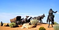
Arkansas River near Lakin, Kansas, by Kathy Alexander.
The Mountain Branch of the Santa Fe Trail followed the north side of the Arkansas River from Finney County into Kearny County, Kansas, snaking its way through the present-day site of Deerfield. About three miles west of Deerfield on the north side of US Highway 50, a set of parallel ruts can still be seen ascending a hill to the east. Known as Charlie’s Ruts or Bentrup’s Ruts, these 12 intact swales span approximately 800 feet.

Indian Mound near Lakin, Kansas, on the Santa Fe Trail by Kathy Alexander.
The trail continued southwest toward present-day Lakin, Kansas. About six miles southwest of this community, on the north side of the river road, is a place called Indian Mound. Even before the Santa Fe Trail was established, this naturally occurring rock formation was used as a wayfinder for nearby Chouteau’s Island. After establishing trade with Santa Fe, this mound was used to denote the location of the Upper Arkansas River crossings and the last major opportunity to choose between the Mountain or Cimarron routes of the Santa Fe Trail.
During the trail’s active days, the mound was much bigger and was once visible from Lakin. However, over the years, people seeking relics have hastened its erosion, although the view from atop the mound remains impressive today.
Somewhere in this area was Bluff Station, which was thought to have been built by Major Bennett Riley’s troops in 1829. It was later used as a relay station by stage companies in the mid-19th century. Although the remains of the station’s walls were reportedly visible as late as 1900, their location remains unknown today.
Located south of Indian Mound was Chouteau’s Island. Although it has long since been eroded by the Arkansas River, it was once a significant landmark on the trail. It was near here, in the spring of 1816, that Auguste P. Chouteau’s hunting party was traveling east with a winter’s catch of furs when they were attacked near the river by 200 Pawnee Indians. The men retreated to Chouteau’s Island to resist the attack and repel the Indians. In the Battle of Chouteau’s Island, the trappers lost one man, and three were wounded. Seven of the Indians were killed.

Francis Xavier Aubry.
In 1825, increased travel on the Santa Fe Trail prompted a government survey, and Chouteau’s Island was designated as a turning point for the trek to the Cimarron River and southward on the Cimarron Branch to Santa Fe. This route was sometimes called the “Aubry Route” because Francis X. Aubry is known to have partially followed it on at least one of his famous rides between Santa Fe, New Mexico, and Independence, Missouri. It was a much better-watered route than the one via Cimarron Crossing.
In 1829, the first military escort on the Trail camped here while the trader caravan proceeded to Santa Fe. At that time, the Arkansas River was the international boundary. But the soldiers didn’t need to worry about Mexicans; instead, they spent the summer fighting off Indians, losing several men and part of their oxen. The caravan’s return from Santa Fe with a Mexican escort was much celebrated.
Beyond Chouteau’s Island, as the wagon trains turned south to go down to the Cimarron River, they skirted the west side of a small, bottomless lake called Clear Lake. It was approximately 50 feet in diameter and, at one time, was sounded to a depth of 250 feet without encountering any bottom. When the wagons passed this point, they followed Bear Creek Pass through the sandhills.
This section of the trail was abandoned by March 1870, when the Kansas-Pacific Railroad reached Kit Carson, Colorado.
©Kathy Alexander/Legends of America, updated December 2025.


West to Aubrey Cutoff or Hamilton County
Also See:
Kansas Santa Fe Trail Photo Gallery
Santa Fe Trail – Pathway to the Southwest
Sources: See Santa Fe Trail Site Map & Writing Credits