
Fort Ouiatenon Blockhouse in Lafayette, Indiana, courtesy Wikipedia.
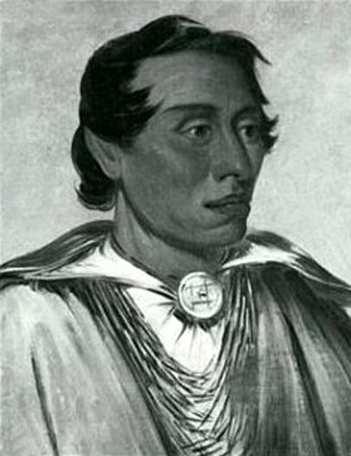
Fort Ouiatenon (wee-ah-teh-non), built in 1717, was the first fortified European settlement in what is now Indiana. That year, Ensign François Picote de Beletre arrived at the mouth of the Tippecanoe and Wabash Rivers with four soldiers, three men, including a blacksmith named Jean Richard, and supplies to trade with the nearby Wea people, an Algonquian-speaking nation closely related to the Miami people. They built a stockade on the Wabash River, 18 miles below the mouth of the Tippecanoe River. It was named for a French rendering of the Wea language name waayaahtanonki, meaning “place of the whirlpool.”
It was constructed as a military outpost to protect against Great Britain’s western expansion. Its location among the unsettled woodlands of the Wabash River Valley made it a key center of trade for fur trappers. French merchants and trappers from Quebec arrived at Fort Ouiatenon in search of beaver pelts and to take advantage of trade relations with the native Wea Indian tribes.
It was one of three French forts built during the 18th century in what was then New France, later the Northwest Territory. The other two were Fort Miami and Fort Vincennes. Flourishing under French rule, the palisade stockade with a log blockhouse was approximately three miles southwest of modern-day West Lafayette.

Wea Brave by George Catlin.
François-Marie Bissot, the Sieur de Vincennes, assumed command of the fort sometime in the 1720s. The French settled on the north bank, with Wea villages on the south bank. The boundary between the French colonies of Louisiana and Canada, although inexact in the first years of the settlement, was decreed in 1745 to run between Ouiatenon and Fort Vincennes.
To convince the Wea to trade exclusively with the French, the Governor-General of New France, Philippe de Rigaud Vaudreuil, issued trade permits at Ouiatenon. Traders immediately began to bring a steady flow of goods to the new town. Soon, the officials in Louisiana sent more men to help Vincennes hold the Wabash River. Ouiatenon was described as “the finest palisaded fort in the upper country,” and was one of the most successful trading posts in the region. At its peak in the mid-18th century, Fort Ouiatenon may have supported over 3,000 residents and served as a hub for five Wea and two Kickapoo villages.
By the mid-18th century, a substantial French settlement grew up around the fort.
After the surrender of New France to the British in September 1760, the fort was ceded to the British and abandoned during the French and Indian War (1754-63). Robert Rogers, a colonial frontiersman, dispatched troops to occupy Ouiatenon. A contingent of British soldiers led by Lieutenant Edward Jenkins arrived in 1761, capturing and occupying the fort. Under British management, relations with the Native Americans declined
Kennekuk, Kickapoo Prophet
On June 1, 1763, during Pontiac’s War, the Wea, Kickapoo, and Mascouten peoples captured Ouiatenon. They surprised Lieutenant Jenkins and his men and captured Fort Ouiatenon without firing a shot. Seven similar posts were also captured during the widespread Indian uprising against British rule.
In 1778, 900 Europeans and Natives were reported to live there. That year, Captain Leonard Helm and Lieutenant Bailey arrived to secure the fort for the rebelling Americans. A British Indian agent named Celeron controlled the fort and tried to evacuate, but was captured with a force of 40 men. Shortly after the Americans captured Vincennes in 1779, Captain I. Shelby arrived in Ouiatenon and received promises of cooperation from the Wea.
During the 1780s, however, local Indian tribes used it as a base of operations to resist the westward expansion of white American settlers.
After the American Revolution ended in 1783, the fort continued its decline and passed into Indian hands. In 1791, during the Northwest Indian War, President George Washington ordered the fort destroyed.
In May 1791, 750 members of the Kentucky militia marched to the Ouiatenon area, at which time, the Indians fled. The militia then burned the village to the ground and destroyed several other nearby villages. During the attack, 38 Native Americans were killed, and another 58 were taken prisoner, mostly women and children. The Kentucky militia had no men killed and only five wounded.
Afterward, its location was lost.
In the 1870s, “several silver crosses and a silver disc inscribed with the arms of France” were discovered near Purdue University in Lafayette, Indiana, along the Wabash River. This discovery led to a determined search for the fort’s location by successive historical societies in Tippecanoe County.
By the 20th century, the land was converted into a farm. The Daughters of the American Revolution placed a small commemorative marker near this spot in 1909.
In 1928, eight acres were acquired to preserve what was perceived to be the site of Fort Ouiatenon. In 1930, a replica of Fort Ouiatenon was built by a local physician named Richard Wetherill. Since few useful records of the original structure exist, the replica was mostly a conjecture. Dr. Wetherill’s blockhouse was patterned after more typical British fortifications, using horizontal logs, and does not match the style or construction of the original Fort Ouiatenon, which used vertical logs.
By the 1960s, it was becoming increasingly clear that the preserve was in the wrong place. Field studies at a site a mile west of the preserve were turning up artifacts associated with French forts and Native settlements. In 1968, archaeological excavations led by Indiana University seemed to confirm the fort’s actual location. Subsequent excavations by Purdue University, Indiana University, Michigan State University, and the University of Southern Indiana confirmed the location. It was listed on the National Register of Historic Places in 1970.
A full 20 acres, including the French fort, were acquired and protected by the Tippecanoe County Historical Society in 1972.
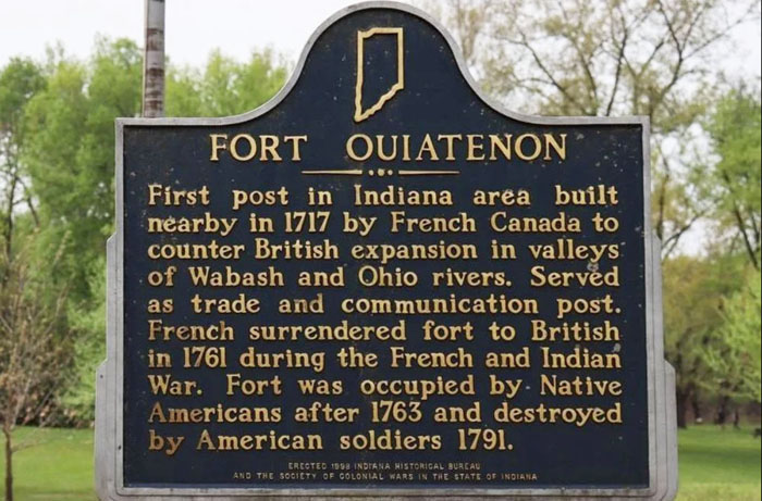
Fort Ouiatenon, Indiana Historic Marker.
The replica blockhouse is now the focal point of Fort Ouiatenon Historical Park. Today, the Fort Ouiatenon Blockhouse Museum is open to tourists in the summer and hosts the annual Feast of the Hunters’ Moon. Many rare artifacts from the original Fort Ouiatenon are displayed by the Tippecanoe County Historical Association during the Feast. It also features a reenactment of pioneer life. Picnic facilities are also available.
The Ouiatenon Preserve is located about a mile west of the Fort Ouiatenon Historical Park along South River Road and the Wabash River. It contains the site of the original 1700s era Fort Ouiatenon and nearly 200 acres of land surrounding it. It was designated a National Historic Landmark in 2021.
©Kathy Alexander/Legends of America, updated March 2026.
Also See:
Sources: