
Fort Zarah, Kansas.
Fort Zarah was a fort in Barton County, Kansas, located northeast of present-day Great Bend, which was used from 1864 to 1869.
Before there was a fort in the area, a small town called Kiowa was established in the vicinity that received a post office on April 8, 1864
Due to the frequent Indian attacks in the area, Camp Dunlap was established two miles east of present-day Great Bend, Kansas, in July 1864. Situated at the point where the Santa Fe Trail crossed Walnut Creek, it was initially little more than a camp of tents and dugouts near the site of the old Rath Ranch Trading Post.
However, work soon began on a more permanent facility about 100 yards distant that was commanded by General Samuel R. Curtis. The post was renamed Fort Zarah for General Curtis’ son, Major H. Zarah Curtis, who was killed at the Baxter Springs Massacre during the Civil War. On April 28, 1865, the Kiowa post office’s name was changed to Fort Zarah.
In 1866, the post was replaced by a more substantial fort about ½ mile up Walnut Creek. Built of sandstone moved from the bluffs about three miles away, the fort was 116 feet long and about 50 feet wide, and cost about $100,000 to build. The stone building held quarters for officers and troops, a kitchen, a mess hall, and storerooms.
The Fort Zarah military reservation was established on September 30, 1868, by order of President Andrew Johnson and surveyed the same year. It contained about 3,700 acres and extended from the Atchison, Topeka & Santa Fe Railroad north to the hills. The fort was dismantled in December 1869 when it was felt that the Indian threat was not sufficient to warrant a second post so close to Fort Larned.
The Fort Zarah post office closed on January 7, 1870. On February 24, 1871, an act of Congress approved the survey and sale of the reservation. However, the Fort Zarah post office reopened on June 15, 1871, but the name was changed to Zarah on July 6, 1871. It closed for the last time on April 2, 1873.
The assets were offered for public sale in July 1874 at Salina, Kansas, but less than 50 acres were sold at that time, and the rest sat abandoned.
Fort Zarah site in Barton County, Kansas by Kathy Alexander.
Bernard Bryan Smyth, in his book Heart of the New Kansas, published in 1880, said:
“After the abandonment of the fort, it became a den of thieves and a general rendezvous for bats and marauders. These occupied it day and night by turns — he, former hiding by day, the latter by night.”
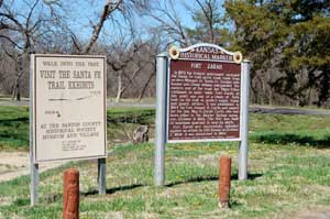
The stone used in the fort’s construction was gradually appropriated by the settlers in the vicinity, and the “bats and marauders” were finally rendered homeless. Nothing remains of the site today, but it is designated with a historical marker located about 1.5 miles east of Great Bend on the north side of U.S. Highway 56.
© Kathy Alexander/Legends of America, updated June 2025.
Also See:
Haunted Forts & Battle Grounds
See Sources.