
Front Street in Natchitoches, Louisiana, by the Historic American Building Survey.
Natchitoches, Louisiana, officially the City of Natchitoches, is a small city located in and serving as the parish seat of Natchitoches Parish. At the 2020 United States census, the city’s population was 18,039, and the city had a total area of 25.1 square miles, comprising 21.6 square miles of land and 3.5 square miles of water. It is the most populous city in Natchitoches Parish.
French traders settled in the area as early as 1699.

Governor Jean-Baptiste Le Moyne.
Governor Jean-Baptiste Le Moyne de Bienville, accompanied by Canadian explorer Louis Juchereau de St. Denis, visited the Natchitoches and Yatasi Indians in March 1700. The old village was about two miles south of Aloha. Bienville was turned back at the upper village of the Yatasi tribe by some visiting Caddo Indians, who informed him that, due to high water, the route was impassable. Bienville and St. Denis returned down the Red River, in canoes, to the French settlement at Biloxi. They were the first white men upon the bosom of the Red River.
With its picturesque location on the banks of the 36-mile-long Cane River Lake, Natchitoches was established in 1714 by Canadian explorer Louis Juchereau de St. Denis as part of French Louisiana. It was founded as a French outpost on the Red River for trade with Spanish-controlled Mexico. The post was established near a village of Natchitoches Indians, after whom the city was named. Early settlers were primarily French Catholic immigrants and creoles (originally meaning those of French descent born in the colony).
In 1718, the Brossart brothers established a colony in Natchitoches, France, from Lyons, France. The first to receive land grants and to settle among the Natchitoches Indians were Louis Latham, who settled near Las Tres Llonas, and Pierre and Julian Beson, who settled at Grand Ecore. Athanase Poissat claimed land at the three cabins under title from the Indians.

Natchez Indians.
The Natchez Indians sought to gain entrance into the Fort at Natchitoches and, by treachery, slaughter the garrison. St. Denis, ever on the alert, refused to let them come in; only ten warriors, unarmed. This led the Natchez to lay siege to the fort with about 400 Indians in 1730; the siege lasted 22 days. St. Denis applied to Governor Bustillo at Los Adaes for help; he furnished nine soldiers, one of whom was killed during the siege.
This set the stage for Los Adaes to become the site of a unique cooperation among the Spanish, the French, and the Caddoans. Though Fort St. Jean-Baptiste and Los Adaes were located near one another and were established primarily to protect their respective nations’ interests from aggression by the other, their inhabitants got along surprisingly well.
The Natchez, becoming exasperated at the stubborn resistance of St. Denis, brought out a French woman captive and burned her before the Fort. St. St. Denis was so incensed and fairly wrought up to the highest pitch at this display of wanton cruelty, sallied forth with 40 soldiers and 100 Natchitoches and Yatasi Indians. They fought furiously, defeated the Natchez, and killed 92 warriors, including four Chiefs, among them Flour. They fled down the River and took refuge in a lake about three miles west of Cloutierville, where they were annihilated. Their bones could be seen there years afterwards. This lake was called Sang pour Sang, meaning “Blood for Blood.” This was in 1732.
Louis Juchereau de St. Denis, the Founder of Natchitoches, died there in 1744 at the age of 68 and was buried near the Cathedral. Afterward, his son was appointed Commandant of the Fort and held the office for many years. St. Denis’ daughter, Marie, married a De Soto, and their descendants lived on Saline Bayou in Winn Parish a few years ago. Jules De Soto was a fine Confederate soldier in Hardy’s Co., 28th Louisiana Infantry. Two Firmans and John De Soto, his direct descendants, now live in Avoyelles Parish.
In 1762, the colony of Natchitoches was flourishing. They had enjoyed a good measure of peace and prosperity for 47 years. Many fine plantations were established, and good houses were built; slaves had been brought to the area under the endorsement of the Mississippi Company.

Slavery.
In 1769, Spain took effective possession of Louisiana under Alejandro O’Reilly. At that time, the population of Natchitoches did not exceed 500. However, the population welcomed many fine French and Spanish families whose descendants served their country as citizens, soldiers, and in public offices.
At the beginning of Spanish domination, O’Reilly visited Natchitoches and appointed Athanase de Mezieres Governor of the Natchitoches district. Mezieres was the son-in-law of the elder St. Denis, a brother-in-law to the Duke of Orleans, and had long served as a soldier in the French army. His field of activity included the Red River Valley and adjacent parts of North Texas, now Oklahoma and Arkansas. Mezieres served 12 years, during which time he made many explorations and voyages among the Indians, accompanied by Laysard, Du Chesne, La Morthe, and others. Mezieres was sent from Louisiana to Texas to reside; he left Natchitoches in May 1779 to tour the Indian tribes in the prairies. He was appointed Governor of Texas but died in San Antonio on November 1, 1779, before assuming the duties of office.
In 1784, Governor Esteban Miro granted lands to Francois Bossier and to Francois and Alex Groppe. Other settlers included Prudehomme, Robiens, Laurents, La Cours, Cloutiers, Metoyers, Martins, and Crows, the last of whom settled on the Sabine River.
Spanish rule lasted 34 years, until Spain returned it to France, and it was subsequently sold to the United States for $15,000,000 on April 30, 1803. The area encompassed 924,279 square miles. Delivery was made to Governor Claiborne on December 20, 1803.

Boundaries after the Louisiana Purchase and the Florida Acquisition by Karl Smith, 1958.
Natchitoches is the oldest permanent settlement in the land acquired by the Louisiana Purchase in 1803.
Afterward, migration into the territory increased, and Natchitoches experienced growth in tandem with the parish population. This included many New Englanders, immigrants from Kentucky, Tennessee, North Carolina, South Carolina, and other restless individuals who came in large numbers to the new land of promise. They developed several cotton plantations along the Red River, and numerous enslaved African Americans were brought to the area through the slave trade to work the cotton and provide all other skills, generating the revenues for the wealthy planters.
During this time, Dr. John Sibley, an American surgeon and native of Boston, Massachusetts, arrived in March 1803 and was destined to play an essential role in Natchitoches affairs. He became a man of great wealth and influence, acquiring valuable property. He was also the official agent of the United States in Indian affairs in the New Orleans Territory from 1805 to 1815.
In 1804, Fort Claiborne at Natchitoches was built by United States troops after the United States Army occupied the Area. It occupied the first hill near the river, covering about two acres and standing 30 or 40 feet above the riverbank. It was one street from the river, and a ditch was cut around it at the base. The Fort and barracks occupied the entire hill. The cemetery was in the northeast corner.
The United States Government established a federal fur trade factory here in 1805.
After the purchase of Louisiana by the United States, Captain Edward D. Turner was sent to Natchitoches with a company of United States regulars. Colonel Thomas Freeman set out on an exploration trip in 1805. He was an agent for President Thomas Jefferson. Near the Caddo village, he was halted and turned back by Spanish troops. Then three Americans, Shaw, Brewster, and Irvine, arrived, and a Spanish guard took them to San Antonio.
Colonel Thomas Gushing was ordered to take possession of the fort at Natchitoches in 1806.
In 1806, General Simón de Herrera stationed on the Sabine River, advanced from Texas with 1,200 Spanish troops, and took up his position on Bayou Pierre, in the vicinity of Natchitoches, claiming the Arroyo Hondo as the Eastern boundary of Texas, having occupied this position during the summer, notwithstanding the remonstrance of Governor Claiborne against intrusion.

General James Wilkinson.
General James Wilkinson had been ordered to take up his position at Natchitoches with United States troops, preparatory to the advance of the regular army. General Wilkinson made a requisition upon the Governors of the territories of Orleans and Mississippi for a detachment of militia, for co-operation with the regular army on the Spanish frontier.
On September 6, 1806, General Wilkinson was in the County of Adams, conferring with the Governor relative to the requisition. He issued orders for the Commandant at Fort Stoddard to hold himself in readiness to invest Mobile with his command, supported by 200 militia from Washington County, under Colonel James Caller, who was then in active preparation to capture Mobile. About the last of September, the volunteers from Mississippi advanced towards Natchitoches. Two fine cavalry troops under Captain Hines and Captain Farrier proceeded from Natchez to Natchitoches. Soon after, Major F.L. Claiborne, at the head of a battalion of militia from Adams County, consisting of 250 men besides the “Mississippi Blues” under the command of Captain Poindexter, advanced to Alexandria. This company was organized in the town of Washington, anticipating a conflict with the Spaniards. Late in October, they were met at Alexandria by an order from the Commander-in-Chief directing them to return to Natchez. The Spaniards on the Sabine River and Bayou Pierre, having agreed to retire to Nacogdaches peacably, the volunteer companies under Captains Hines and Farrier were ordered to join the troops on the Sabine, where they remained until the American army retired late in November 1806.
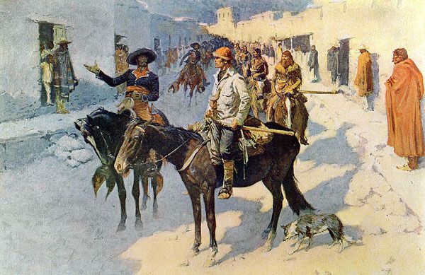
Zebulon Pike entering Santa Fe, New Mexico by Frederic Remington.
Captain Zebulon Montgomery Pike was sent on an exploring expedition of the Arkansas and Red Rivers in 1806. He passed through Colorado, and Pikes Peak is named for him. In his route, he missed his way and found himself on the Rio Grande. On his return, he went to Chihuahua, Mexico, was taken into custody, and sent to Santa Fe, New Mexico. The Spaniards took all his instruments and scientific papers when he was turned back there. He came to Red River, where the bluffs are, where Shreveport now stands, and unfurled the United States flag. There he was taken by Spanish troops and escorted down the River, arriving at Natchitoches July 1, 1807.
Natchitoches was one of the original parishes formed in 1807, encompassing a territory of 10,600 square miles, nearly one-fourth of the state of Louisiana. It was the ecclesiastical parish of St. Francis. It was 70 by 120 miles, bounded on the north by Texas and Arkansas, on the East by the Ouachita and Catahoula Rivers, on the south by Rapides and Opelousas, and on the west by the Sabine River. At that time, the population of Natchitoches was 3,000.

Fort St. Jean Baptiste, Louisiana, courtesy of Wikipedia.
In 1808, the parish was organized, and Natchitoches was chosen as the site of the courthouse.
By 1810, the parish population grew to over 2,870.
In 1811, Creole Captain Manchac organized a company of 200 riflemen and, in connection with Lieutenant Augustus McGee, a former United States Army soldier, crossed the Sabine River, invaded Texas, and captured Nacogdoches. The expedition was ill-fated. Commander Correro of the Spanish forces attempted to attack Fort Claiborne at Natchitoches, and preparations were made to meet and repel him. A deserter from his forces was the informant. This threat caused some anxiety.
Judge Jostah S. Johnson opened the first Court held there on July 19, 1813.
Captain Henry Miller Shreve brought the first steamboat into Red River, the Enterprise, in April 1815. On his next trip to Natchitoches, he went to the head of navigation on the Red River. The Enterprise was built at Bridgeport on the Monongahela River in 1814 and had a burden of 45 tons. Her first cargo down the Mississippi River was arms, ammunition, and supplies for General Jackson at New Orleans.
The federal fur trade factory was removed to Sulphur Fork, Arkansas, in 1818.
The City of Natchitoches was incorporated on February 5, 1819.

Natchitoches, Louisiana, Steamboat.
Captain Isaac Wright began steamboating from Natchitoches to Natchez in 1824.
In the 1820s and early 1830s, Natchitoches also served as a freight transfer point for cotton shipped from parts of East Texas. Cotton shippers used a land route crossing the Sabine River to Natchitoches, where the freight was transferred to boats and floated down the Red River to New Orleans.
During the high water of 1832, the waters of the Red River cut through and flowed down the new channel. Captain Jackson of the John B. Laclede, coming to the mouth, ordered the pilot to go through. The pilot hesitated, but Captain Jackson was well up in his cups and ordered him to go on. The Pioneer was right behind. A steady rain was falling, but no mishap occurred.
The introduction of cotton agriculture led to the establishment of large plantations along the Cane River. However, in the 1830s, the river jumped its main channel and shifted its course about five miles east of town. That action left Natchitoches without a direct outlet to the sea except during high water. What remains today is the picturesque 33-mile oxbow lake left by the river’s former course, which became known as Cane River Lake.
In 1836, David Crockett came down the river from Arkansas on a steamboat on his way to join the revolutionary forces in Texas. At Natchitoches, he was joined by a party consisting of John H. Featherstone, Doc Vennett, Ephraim Tally, Matt Despalie, and “Happy” Johnson, the Bee Hunter. They joined the immortal band of patriot heroes who perished at the Alamo on March 6, 1836. That is all except Matt Despalier, who came back and was killed by Governor J. Madison Wells in Alexandria.

Cane River Lake in Natchitoches, Louisiana, courtesy Wikipedia.
On May 6, 1840, the Natchez hurricane swept over the southern part of Natchitoches Parish, originating from the southwest and coming from the Gulf of Mexico. The following day, another arrived on the identical path of the first. For miles, the view was unobstructed, the timber was destroyed, and at Pierre La Butte Bluffs, the topsoil had been blown off in places for several feet. The timber had stunted, diminutive growth.
Several boats were running to Natchitoches in 1844, including the Cote Joyeuse, Captain Peter Dalman’s Beeswing, Captain Hiram Wilson’s Frontier, Captain M. Ludwick’s DeSoto, and others.
On March 22, 1844, a cold wave struck, killing the newly sprouted timber trees, and calves and fowl died from the cold.
During the Mexican-American War in 1846, Governor Johnson called for volunteers, and Natchitoches was among the first to respond. S.M. Hyams raised a company for the 5th Louisiana Volunteers and was commissioned as Captain.
A considerable amount of trade was conducted up to 1850, overland to Mexico via mule caravans.
The ten-month drought came in 1855. Lakes, bayous, and springs dried up, and corn sold in Natchitoches at $5.00 a bushel in gold.

Cane River Expedition in Louisiana during the Civil War in 1864.
When the Civil War began, 12 companies from Natchitoches Parish left to join the Confederate army.
During the war, Natchitoches was set on fire by Union soldiers who retreated through the town after their failed attempt to capture Shreveport. The Confederate cavalry pursued the fleeing soldiers and arrived in time to help extinguish the flames before the town was destroyed. Alexandria was destroyed by Union troops in 1864, but both Union and Confederate troops were responsible for severely damaging plantations along the river during the war, including Magnolia and Oakland.
After the conflict, when the soldiers returned home, it seemed gloom had settled over the land, but it did not last long. The adjustment to changed conditions was not easy. W.J. Robbins, who had been a staff officer of General Henry Gray, 28th Louisiana Infantry, kept a saloon in Natchitoches. In his back room, gathered the veterans of Texas and Louisiana troops to toast Jefferson Davis.
It took many years to rebuild after the war. During that time, vandals caused much damage, and Smith’s Brigade and Federal troops under General William Sherman’s command played a crucial role in the rebuilding efforts. Sherman had burned all the residences on Cane River, except for a few. They had also burned Alexandria.

Downtown Natchitoches, Louisiana, photo by Kathy Alexander.
As the parish seat, Natchitoches suffered from the decline in agricultural population through the mid-20th century, and grew at a markedly lower rate after 1960. The mechanization of agriculture had reduced the number of workers required, and many moved to cities in search of employment.
Cane River Lake, supplied by nearby Sibley Lake, was dammed in 1962.
Natchitoches was the site of a gas pipeline explosion on March 4, 1965, that killed 17 people.
By the early 1970s, the town’s population was in decline, businesses were closing, and many area farms were abandoned, resulting in a 65% vacancy in the commercial district.
In 1973, singer-songwriter Jim Croce was killed when his plane crashed as it was leaving Natchitoches Regional Airport.
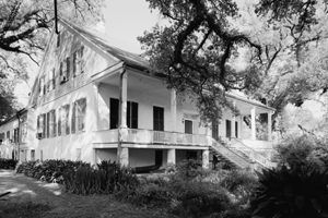
By the mid-1970s, Mayor Bobby DeBlieux and other preservationists believed that attracting tourists to the area, based on its nearly intact historic plantations and numerous historic buildings, could be a key to drawing visitors, reviving the town, and stimulating new businesses. Over the years, he collaborated with various landowners and residents to garner support for designating a historic district in the city. He also supported designating a national park out of the working area of Magnolia Plantation, which had many surviving 19th-century outbuildings, as well as those from Oakland Plantation, both located downriver in the parish.
Magnolia Mansion near Natchitoches, Louisiana.
The plantation country surrounds Cane River Lake. The markedly intact downriver Magnolia and Oakland plantations were designated as National Historic Landmarks, and are part of what has been developed as the Cane River Creole National Historical Park, which was authorized in 1994, with the support of U.S. Senator J. Bennett Johnston. He was a cousin by marriage of Betty Hertzog, the last of the family to live in the great house at Magnolia.
By the end of the 20th century, the mile-long French colonial district in downtown was designated a National Historic District. Many buildings were adapted as antique shops, restaurants, souvenir emporiums, and bed-and-breakfast inns.
Natchitoches received numerous evacuees from New Orleans following Hurricane Katrina in 2005. Many college students from New Orleans were transferred to Northwestern State University to continue their education.
Natchitoches’ population peaked at 18,323 in 2010.
Tours and interpretive programs at both sites continue to attract visitors, especially as they grapple with telling the problematic history of slavery and its aftermath at the plantations. They also highlight the contributions of Black and Creole individuals of color to the community. In April 2022, the city council added Juneteenth as an official city holiday.

Rouge House in Natchitoches, Louisiana, by the Historic American Buildings Survey.
The City’s Historic Landmark District, which fronts Cane River Lake and encompasses a 33-block area, is renowned for its historic landscapes, Creole architecture, and multicultural legacy. The 116,000-acre area includes many sites such as Oakland Plantation, Melrose Plantation, Badin-Roque House, Magnolia Plantation, Kate Chopin House, Cherokee Plantation, Cane River Heritage Scenic Byway, Fort St. Jean Baptiste State Historic Site, the National Historic Landmark District which features the Old Courthouse Museum, the Bishop Martin Museum, and the Landmarks in Time Exhibit, and Los Adaes State Historic Site. The area displays a blend of cultures, including French, Spanish, African, American Indian, Creole, and American.
The city’s tourism center is the downtown river walk. This includes Front Street, which becomes Jefferson at the Texas Street light. Front Street is the jewel of the city. It overlooks the riverwalk and is bordered by a variety of shops and boutiques. The Historical Society maintains the area through regulations on changes and restorations.
Cane River Lake is a 35-mile oxbow lake created after the Red River shifted course in 1836. It runs through the Natchitoches historic district to the south and is famous for numerous plantations, particularly Melrose, which is located on or near its banks. Downriver includes the Cane River Federal Heritage Area, historic Melrose on the Cane, the National Cane River Creole Historical Park, and Isle Breville’s St. Augustine Church. The downriver area of Cane River Lake has gained prominence as a center of Creole de couleur culture, and its cultural significance draws visitors from around the world. The lake offers fishing and boating today.
Near Natchitoches are two large lakes, Spanish Lake and Ferre Noir, also known as Sibley’s Lake. The Spanish lake is approximately six miles from its nearest point and is said to be 50 or 60 miles in circumference. Sibley Lake is about one mile from town and is said to be approximately 30 or 40 miles in circumference.
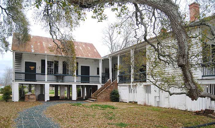
Oakland Plantation Mansion in Natchitoches, Louisiana by Kathy Alexander.
The Port of Natchitoches—a river port on the Red River—is located off the eastbound part of U.S. Route 84, just outside Natchitoches. The port exports lumber from yards onsite, as forestry is a significant industry in the area.
Natchitoches attracts over one million visitors annually.
©Kathy Alexander/Legends of America, updated February 2026.
Also See:
Cane River Creole National Historical Park
Settlement of the Cane River Area of Louisiana
Sources:
Dunn, Milton; History of Natchitoches, The Louisiana Historical Quarterly 3.1 (1920): 26-56.
Louisiana Anthology
Natchitoches.com
Louisiana Anthology
Wikipedia