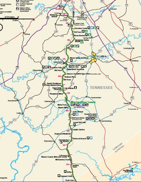
Natchez Trace Parkway from milepost 339-442
| Milepost | Points of Interest: |
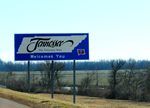
| 341.8 |  Tennessee-Alabama State Line – In 1663, King Charles II of England granted the colony of Carolina all land between 31 and 36 degrees north latitude from the Atlantic Ocean west, in a direct line as far as the South Seas. The separation of North and South Carolina fixed the boundary at 35 degrees in 1735. North Carolina’s release of land claims west of the Appalachian Mountains permitted the establishment of the state of Tennessee with the same southern boundary. John Coffee, one of Andrew Jackson’s generals at the Battle of New Orleans, supervised the line surveys between 1817 and 1822. Tennessee-Alabama State Line – In 1663, King Charles II of England granted the colony of Carolina all land between 31 and 36 degrees north latitude from the Atlantic Ocean west, in a direct line as far as the South Seas. The separation of North and South Carolina fixed the boundary at 35 degrees in 1735. North Carolina’s release of land claims west of the Appalachian Mountains permitted the establishment of the state of Tennessee with the same southern boundary. John Coffee, one of Andrew Jackson’s generals at the Battle of New Orleans, supervised the line surveys between 1817 and 1822. |
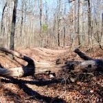
| 350.5 |  Sunken Trace – This early interstate road-building venture produced a snake-infested, mosquito-beset, robber-haunted, Indian-pestered forest path. Lamented by the pious, and cussed by the impious, it tried everyone’s strength and patience. When the trail became so waterlogged that wagons could not be pulled through, travelers cut new paths through the nearby woods. Here you will see three cuts made to avoid mud into which oxcarts and wagons sank, making progress slow, dangerous, and even impossible. Sunken Trace – This early interstate road-building venture produced a snake-infested, mosquito-beset, robber-haunted, Indian-pestered forest path. Lamented by the pious, and cussed by the impious, it tried everyone’s strength and patience. When the trail became so waterlogged that wagons could not be pulled through, travelers cut new paths through the nearby woods. Here you will see three cuts made to avoid mud into which oxcarts and wagons sank, making progress slow, dangerous, and even impossible. |
| 352.9 | McGlamery Stand – A fire tower sits on top of the hill, just off the Trace. In frontier language, a stand was an inn or a trading post, sometimes both. Usually located on a well-traveled route. Such a place was established on the Old Natchez Trace near here in 1849 by John McGlamery. Although the stand did not outlast the Civil War, the name did. The nearest village is known as McGlamery’s Stand. |
| 357.8 | Old Trace Drive – This is one of two locations along the Parkway where travelers can drive on the Old Natchez Trace. This drive is not suitable for travel trailers. |
| 363 | Sweetwater Branch – This small branch receives its name from its water’s clean and fresh or sweet flavor. Thousands of years of erosion and flooding have gradually built up the fertile bottomlands under cultivation nearby. The branch is still carving and shaping the valley. A nature trail here is about a 15-minute walk. |
| 364.5 | Glenrock Branch – From the parking area, it is a short walk down a trail to a natural amphitheater. The creek and limestone bluff bend around the shaded picnic area. |
| 367.3 | Dogwood Mudhole – Located a mile south of the parkway, the Old Natchez Trace crossed a depression in the flat, dogwood-covered ridge. After heavy rains, it became almost impassable for wagons. Its name, Dogwood Mudhole, recalls the ordeals of frontier travel. It also shows how place names from local conditions long ago are carried down through the years. |
| 370 |
Side Trip – Shiloh National Military Park – Besides preserving the site of the bloody April 1862 Battle of Shiloh, this park commemorates the subsequent siege, battle, and occupation of the key railroad junction at nearby Corinth, Mississippi. Shiloh National Cemetery was established in 1866. That year, the War Department removed the Federal bodies from the battlefield and placed them in the cemetery. Today, around 4,000 military veterans lie in the quiet, secluded location on the Tennessee River banks. The park also preserves the Shiloh Indian Mounds, a National Historic Landmark in its own right. Suppose you are traveling south on the Trace, exit at milepost 370 onto U.S. 64, and go west through Waynesboro and Savannah to the park area. If you are traveling north on the Trace, exit at milepost 266 onto Mississippi Highway 145 near Tupelo, go north on U.S. 45, and travel north through Corinth and onto the park area. You can also exit the Trace at milepost 320 onto U.S. 72 and travel west to Corinth and then north to the park area. |
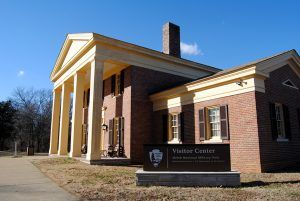
| 385.9 | Meriwether Lewis Monument – Learn more about the life of one of America’s great explorers — Meriwether Lewis. Inside a cabin constructed in the period’s style, you will find interpretive displays about his life and mysterious death of Lewis. In addition to the monument and cabin, the Meriwether Lewis area has a campground, picnic area, and hiking trails. The campsites are available on a first-come, first-served basis. |
| 391.9 | Fall Hallow Trail – If you are interested in waterfalls, you will want to take a short walk on the Fall Hallow Trail. A five-minute walk will take you to a viewing platform to see a small waterfall. Those interested in continuing will be rewarded with numerous small cascades. |
| 401.4 | Tobacco Farm and Old Trace Drive – A great place to get off the main road and get on the Old Trace, the Tobacco Farm provides information about growing and drying tobacco. The Old Trace’s two-mile drive has spectacular forest views and is one of two places you can be on the “Old Trace” without walking. This one-way drive allows visitors to travel south to north and is unsuitable for RVs. |
| 404.7 | Jackson Falls – The short but steep trail takes visitors to views of Jackson Falls, making it one of the most popular walks along the parkway. After dropping 900 feet in elevation on a paved trail, you will find yourself in a small gorge. Your return trip will be more strenuous but well worth the effort. There are picnic tables at the trailhead and a short trail to Baker Bluff Overlook. |
| 407.7 | Gordon House Historic Site – Built in 1818, the Gordon House is one of only two surviving historic buildings on the Natchez Trace Parkway. |
| 423.9 | Valley Divide – When Tennessee joined the Union in 1796, this watershed was the boundary between the United States and the Chickasaw Nation. |
| 427.6 | Garrison Creek – Restrooms, horse and hiking trails, and beautiful fall color highlight this section of the Natchez Trace. |
| 438 | Birdsong Hollow – Provides views of the nation’s first double arch bridge, spans 1,648 feet, and stands 155 feet tall. |
| 442 | Northern Terminus – Your journey ends. |
Compiled by Kathy Alexander/Legends of America, updated November 2022.
Also See:
Legends and Mysteries of the Natchez Trace


