Natchez Trace Parkway from milepost 61 to 108
| Milepost | Points of Interest: |
| 61 | Lower Choctaw Boundary – A line of trees here has been a boundary for 200 years. It was established in 1765 and marked the eastern limits of the old Natchez District. This boundary ran from 12 miles east of Vicksburg southward to the 31st parallel. First surveyed in 1778, Spain reaffirmed it in 1793 and by the United States in 1801. Since 1820, it has been the boundary between Hinds and Claiborne Counties in Mississippi. An inn called Red Bluff Stand once stood here for travelers along the Old Trace. Owned by John Gregg, it was established in 1902. It was the last place a northbound traveler could get provisions for several years. |
| 66.5 | 
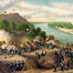
Side Trip – Vicksburg National Military Park – This National Park commemorates the campaign, siege, and defense of Vicksburg, Mississippi. The city’s surrender on July 4, 1863, coupled with the fall of Port Hudson, Louisiana, split the South, giving undisputed control of the Mississippi River to the North. Over 1,330 monuments, a restored Union gunboat, and National Cemetery where 17,000 Union soldiers are buried mark the 16-mile tour road. Open daily, except Thanksgiving Day, Christmas Day, and New Year’s Day. Exit onto Mississippi Highway 27 and left onto Old US-80. About 20 miles. |
| 73.5 | Dean Stand – The Treaty of Doak’s Stand, 1820, opened this land to white settlement. William Dean and his wife, Margaret, settled near here in 1823. The Deans supplemented their farm income by offering to lodge travelers. The clientele was a cross-section of the advancing frontier – the homeward-bound boatmen, the hurrying mail rider, the trader in land and horses, the fugitive, or the itinerant preacher. On the night of May 12, 1863, General U.S. Grant made his headquarters here after the Battle of Raymond. |
| 78.3 | Battle of Raymond – By the Civil War, the Natchez Trace had lost its significance as a national road. One of the sections ran from Port Gibson toward Jackson, but, the route veered from the original Trace to Raymond. In the spring of 1863, General Ulysses S. Grant marched his Union Army over this route after crossing the Mississippi River and taking Port Gibson. On May 12, Grant’s forces drew fire from a Confederate brigade, commanded by Brigadier General John Gregg, located on Raymond’s southern edge three miles to the east. After a day of bitter fighting, the Confederates retreated toward Jackson, leaving their wounded in the county courthouse. This set to convince Grant of the need to take Jackson to ensure the success of his forthcoming siege of Vicksburg. |
| 79 | Side Trip – Raymond Military Park – On May 12, 1863, 10,000 soldiers from Ulysses S. Grant’s Union army encountered 3,000 Confederate soldiers near Raymond, Mississippi. After Raymond’s Battle, 1,000 wounded soldiers from both armies were taken to a local church and the courthouse and cared for. The Friends of Raymond have preserved part of the battlefield. It includes a walking trail that encircles the 23.6-acre tract located at Fourteen mile Creek, west of modern Highway 18. Exit the Trace at milepost 79 onto Mississippi Highway 467 and travel east to the town of Raymond. Continue through Raymond to Mississippi Highway 18. Turn right (west) on highway 18, and Raymond Military Park will be on your right a couple of miles down the road. |
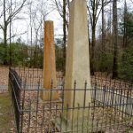
| 88.1 |  Cowles Mead Cemetery – Like many of his generation, Cowles Mead came from the east, seeking opportunity in the Mississippi Territory. He owned a tavern on the Old Trace near Natchez and held several political offices, including an acting governor in 1806. During this time, he ordered the arrest of Aaron Burr for treason, but, the former Vice President was acquitted. Mead followed the growth of the state and moved to the Jackson area. He built his beautifully landscaped home, “Greenwood,” on this site. Nothing remains today of his grand estate that burned after his death during the Civil War, except the family cemetery. Cowles Mead Cemetery – Like many of his generation, Cowles Mead came from the east, seeking opportunity in the Mississippi Territory. He owned a tavern on the Old Trace near Natchez and held several political offices, including an acting governor in 1806. During this time, he ordered the arrest of Aaron Burr for treason, but, the former Vice President was acquitted. Mead followed the growth of the state and moved to the Jackson area. He built his beautifully landscaped home, “Greenwood,” on this site. Nothing remains today of his grand estate that burned after his death during the Civil War, except the family cemetery. |
| 93.1 | Osburn Stand – To improve communication to the Old Southwest, the Natchez Trace was declared a post road in 1800. Afterward, with Choctaw permission, improvements to this section of the Old Trace began. In 1805, the Choctaw allowed inns, known as stands, to be built along the route to provide basic food and shelter to travelers. By 1811, Noble Osburn opened a stand near this spot. He was known to treat his Choctaw neighbors and American travelers equally. In 1821 at LeFleur’s Bluff along the Pearl River, the city of Jackson was founded and, a year later, became the state capitol. As a result, the postal route shifted slightly east from here to go through the new capital leading to the demise of the stands along this section of the Old Trace. |
| 100.7 | 
Choctaw Agency – U.S. agents like Silas Dinsmoor lived among the Choctaw and represented their interests while implementing U.S. policy. His duties included surveying and preventing illegal settlement of Choctaw land. He also encouraged the Choctaw to be more dependent on modern farming practices. He was tasked to collect tribal debts owed to American companies and ensure that the Choctaw were paid for land ceded to the U.S. The agency moved four times to stay within the shrinking boundaries of the Choctaw Nation. It was located here, along the Natchez Trace, from 1807 until just after the Treaty of Doak’s Stand in 1820. |
| 102.4 | Parkway Information Cabin, Ridgeland, Mississippi – Visit a park ranger to help plan your visit and access the Multi-Use Trail. It is open from 9:00 am to 4:30 pm Wednesday through Sunday and closed on Christmas Day. The parking area behind the cabin is also a trailhead for the Ridgeland Multi-Use Path, which parallels the parkway from the Ross Barnett Reservoir area to just south of I-55 with construction and plans to extend the trail to Clinton, Mississippi. When heavy car traffic, cyclists can exit the parkway at the north end at Reservoir Overlook (milepost 105.6) and the south end at the Choctaw Agency (milepost 100.7). |
| 104.5 | Brashear’s Stand and Old Trace – Brashear’s Stand was located here. In 1806 the stand was advertised as “a house of entertainment in the wilderness.” Two portions of the old wilderness road, the Old Natchez Trace, are also preserved here. A short five-minute loop walk allows visitors to see both sections and lets you stroll down a deeply eroded, sunken part of the Old Natchez Trace. |
| 105.6 | Ross Barnett Reservoir – Paralleling the parkway for about eight miles, the reservoir provides spectacular scenery from the roadway. Those interested in spending more time in the area may enjoy starting at the West Florida Boundary walk at milepost 107.9 or taking in the views at the Reservoir Overlook at milepost 105.6. |
| 106.9 | Boyd Mounds – This Native American mound site was constructed during the late Woodland–early Mississippian period, from 800-1100 A.D. Archaeologists tell us that there was a house here sometime around 500 A.D. and that the pottery found in the mounds was made before 700 A.D. Likely, the population was continuous over centuries with customs being handed down from generation to generation. |
| 107.9 | West Florida Boundary – At the end of the French and Indian War in 1763, Great Britain gained control of the territory between the Appalachians and the Mississippi River, except for the New Orleans area. The northern boundary of West Florida was first established at 31 degrees north latitude. It was soon determined that settlement was too restricted. In 1764, Great Britain moved the boundary north to 32 degrees into the Choctaw and Creek Indians’ lands. This Trace stop is also a trailhead to the Ridgeland, Mississippi section of the Natchez Trace National Scenic Trail, a walking and horse trail. |
Continue to mileposts 109-170

