
Carbon County Coal Mining today by Kathy Alexander.

Blue Blaze Mine in Consumers, Utah by Dorthea Lange, 1936.
More Carbon County:
Hiawatha
Kiz
Royal
Scofield

Carbon County, Utah Map
Situated south and east of the Wasatch Plateau and west of the Book Cliffs, Carbon County’s history dates back thousands of years to when the Fremont Indians lived extensively throughout the area, leaving numerous rock art panels behind. Before these ancient natives called it home, the land was roamed by dinosaurs, whose footprints have been found in many of the area’s coal mines.
The first white settlers were the Mormons, who began crossing the Wasatch Plateau, building numerous small communities along the Price River in the late 1870s. The initial roads into the region included paths off the Old Spanish Trail, the Nine Mile Canyon freight road from Price to the Uinta Basin, and a route over Soldier Summit, which early farmers and ranchers used to transport goods and supplies.
The name Carbon County appropriately underscores the importance of carbon products to the area’s economy and history. The first commercial development of coal occurred in this vicinity in the 1870s.

Denver and Rio Grande Western Railroad at Castle Gate, Utah.
However, it was in the early 1880s, when the Denver & Rio Grande Western Railroad began seeking a route from Denver, Colorado, to Salt Lake City, that the area began to be populated. As the railroad opened up the area, they discovered coal. Mining further developed the area as numerous coal companies moved in, often building and running many mining camps. Within no time, the mining camps were populated by immigrants from all over the world, to the point that Helper became known as the town of “57 Varieties” for its ethnic diversity.
Though the new mines brought people and prosperity to the region, they also brought tragedy and violence in mining explosions and significant strikes. However, coal mining continues to play a vital role in the county’s economy.
Particularly during World War II, coal from Carbon County placed Utah among America’s leading coke and coal producers, with vast reserves still to be developed. In addition, oil shale and tar sands offer significant potential as sources of petroleum.
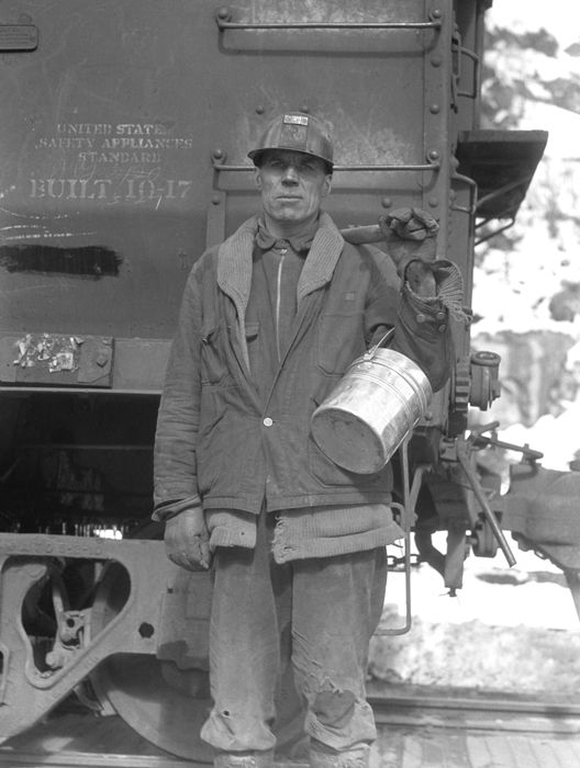
Consumers, Utah Miner, by Dorthea Lange, 1936.
Many of these old towns are located on two roads:
Consumers Road – Just south of Helper, Utah, Consumers Road (UT-290/139) heads west of US-6/191 into the mountains to the old mining campsites of Coal City, National, Consumers, and Sweet. Though a few old buildings can still be seen along this vintage path, active coal mining continues, taking its toll on many of the remains of these once-thriving mining camps. Most of these old towns provide only a view of a few old foundations.
Spring Canyon Road – Due west of Helper, Utah, is Spring Canyon Road, where numerous coal mining camps once stood. This old road still displays many remnants of those more prosperous times, including the ghost towns of Standardville, Rains, Peerless, Mutual, Latuda, and Storrs. Traveling this vintage path, it is difficult to know where one townsite began and another ended, as remnants and crumbling buildings dot the road for miles, and numerous foundations and mining remains poke up from the hills.
©Kathy Alexander/Legends of America, updated November 2025.

Spring Canyon Ghost Town Map
Also See:
See Sources.