Lewis and Clark Trail by the Bureau of Land Management.

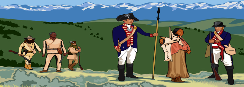
Lewis and Clark with Sacagawea, guiding them.
Corps of Discovery – The Lewis & Clark Expedition
Historic Landmarks Along the Trail
William Clark – Co-Leader of the Corps of Discovery Expedition
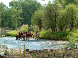
Lewis and Clark National Historic Trail Reenactment on Lemhi River, Idaho by Antonia Hedrick, Bureau of Land Management.
The Lewis and Clark National Historic Trail commemorates the Lewis and Clark Expedition of 1803 to 1806. Part of the National Trails System administered by the National Park Service, it is approximately 4,900 miles long, extending from Pittsburgh, Pennsylvania, to the mouth of the Columbia River, near present-day Astoria, Oregon.
The original expedition began at Wood River, Illinois, before passing through portions of Missouri, Kansas, Iowa, Nebraska, South Dakota, North Dakota, Montana, Idaho, Oregon, and Washington, covering 3,700 miles.
In 1948, the National Park Service proposed a “Lewis and Clark Tourway” along the Missouri River from St. Louis to Three Forks, Montana. Later, Jay “Ding” Darling proposed developing the expedition route into a recreational trail. Following a 1966 report by the Bureau of Outdoor Recreation, the National Trails System Act of 1968 listed the route for study as a possible National Scenic Trail. Finally, in 1978, it was made official.

Beaverhead Rock, Montana, by the National Park Service.
In 2019, the trail was extended by 1,200 miles along the Ohio and Mississippi Rivers from Pittsburgh, Pennsylvania, to Wood River, Illinois, including the introductory section before the official expedition began. As a result, the trail now also runs through Pennsylvania, Ohio, West Virginia, Kentucky, and Indiana.
Along its 4,000-mile meandering path across the West, the Lewis and Clark National Historic Trail crosses some of the most diverse landscapes on the continent. From the vast grasslands of the Great Plains to the imposing peaks of the Rocky Mountains and the lush valley of the Columbia River, the Trail offers visitors an opportunity to experience the breadth of North America’s stunning landscapes.
Though the National Park Service administers the trail, many sites are managed by federal land management agencies and state, local, tribal, and private organizations. Along the way, visitors can enjoy hiking, boating, and horseback riding at many locations. The trail is the second-longest of the 23 National Scenic and Historic Trails.
©Kathy Alexander/Legends of America, updated November 2025.

Lewis & Clark Expedition Map by the National Park Service.
Also See:

Ecola State Park, Cannon Beach, Oregon. Captain William Clark and twelve of his team traveled through here in 1806.
Byways & Historic Trails – Great Drives in America
Corps of Discovery – The Lewis & Clark Expedition
Lewis & Clark Scenic Byway in Nebraska
Sacagawea – Leading Lewis & Clark
Sources: