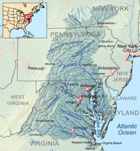
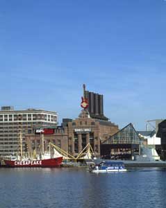
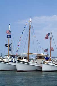
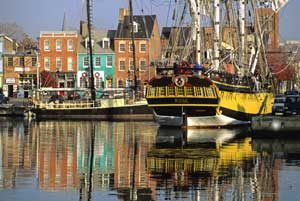
The Chesapeake Bay watershed, stretching from Cooperstown, New York, to Norfolk, Virginia, includes parts of six states — Delaware, Maryland, New York, Pennsylvania, Virginia, West Virginia, and the entire District of Columbia.
The bay is about 200 miles long, and at its narrowest point, it is 2.8 miles wide. At its widest point, just south of the mouth of the Potomac River, it is 30 miles wide. The Chesapeake Bay watershed is about seven times larger than New Hampshire, encompassing approximately 64,000 square miles. The bay and its tributaries contain an astounding 11,684 miles of shoreline.
Today, the Chesapeake Bay is the nation’s largest estuary, where freshwater and saltwater mix. Here, several thousand species of plants and animals can be found, from blue crabs to bald eagles. The bay and its watershed also provide extensive recreational resources, including fishing, hunting, boating, water sports, hiking, bird-watching, and relaxation.
The region is steeped in history, including the legacy of American Indians, the arrival of European settlers, the inspiration of the American Revolution, and the tragedy of the Civil War. Across the watershed are diverse landscapes, from the Shenandoah Mountains to Smith and Tangier Islands. Large cities, colonial towns, farms, and fishing villages are also here.
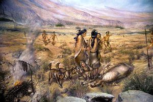
People have occupied the Chesapeake Bay area for at least 12,000 years at the end of the last ice age. As the climate moderated and rivers found their modern-day courses, plants and animals became established, and the once-barren plain was replaced with swamps, lagoons, grasslands, and forests. Most archeologists generally agree that the first inhabitants of the Chesapeake region arrived between 11,500 and 12,000 years ago. However, some suggest an arrival several thousand years earlier.
The first residents, known as “Paleoindians,” probably organized themselves in small groups and moved across the country, living off the land. They established temporary camps, obtaining all they needed from the local environment, and left when the game or other resources became scarce. They fashioned tools and weapons from natural materials like rock and animal bone. The presence of “foreign” rocks and technologies, such as spear throwers and notched projectile points, traced to other parts of the country indicate that early residents of the Chesapeake region traded with other peoples.
From the end of the ice ages to about 3,000 years ago, it is called the Archaic Period. With the warmer conditions that followed the ice ages, narrow river canyons became wide transportation corridors, and the shallow Bay offered access to clams, oysters, fish, and other sea animals.
The Chesapeake region continued to offer abundant resources for the Woodland peoples who populated the area, beginning about 3,000 years ago. Food, tools, and household products came from many sources, including the bay and rivers, birds, plants, forests, and game. These inhabitants began to fire pottery and make pots and jars for cooking, transportation, and food and water storage. As time progressed, tools, pottery, and textile production became more sophisticated. Domestication of animals and cultivation of crops increased as Woodland peoples settled in larger groups. The people then began to clear fields and grow squash, beans, tobacco, and corn using raised beds, hoes, and digging sticks.
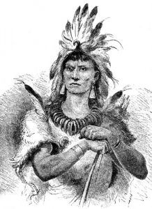
As towns, technology, and agriculture became more complex, so did political systems. Over time, small bands, or tribes, became more extensive, forming chiefdoms, a political unit that included several permanent towns headed by a single influential leader. The Powhatan tribes, headed by a paramount chief known as Powhatan, who lived from about 1545 to 1618, included many Coastal Plain settlements between the York and James Rivers.
Italian explorer Giovanni da Verrazzano was the first European to arrive in this area in 1524. In service of the French crown, he sailed past the Chesapeake but did not enter the Bay. The following year, Spanish explorer Lucas Vazquez de Ayllon sent an expedition from Hispaniola that reached the mouths of the Chesapeake and Delaware Bays. After some exploration, he established a short-lived Spanish mission settlement called San Miguel de Gualdape in 1526 near the future site of Jamestown, Virginia. Another Spanish explorer, Diego Gutiérrez, showed the Chesapeake Bay on his large-scale North and South America map in 1562.
In 1570, Spanish Jesuits established the short-lived Ajacan Mission on one of the Chesapeake tributaries in present-day Virginia. Three years later, in 1573, Pedro Menéndez de Márquez, the governor of Spanish Florida, conducted further exploration of the Chesapeake.
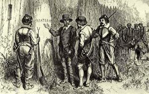
John White, an English explorer and artist, provided the first detailed information about the native people, flora, and fauna of the eastern coast of North America in his paintings and drawings between 1585 and 1593. White sailed with the earliest expedition to the ” Virginia ” area on the present-day North Carolina coast. His drawings of the Algonquian Indians and the region’s plants and animals are the only surviving visual record of England’s first settlement in North America — the famed Lost Colony of Roanoke.
Three decades later, in 1607, Europeans again entered the Bay. At this time, the Virginia Company of London organized an expedition to the “Bay of Chespioc” in search of gold, silver, and a water route through North America to the riches of the Far East — the famed “Northwest Passage.” Over nearly five months, three ships carried 140 men from England to the West Indies and Chesapeake Bay. They landed on April 26, 1607, near present-day Cape Henry, Virginia.
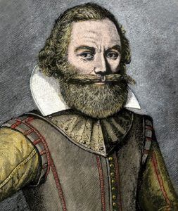
“Heaven and earth have never agreed better to frame a place for man’s habitation.”
— Captain John Smith
The English moved their ships up the James River looking for a place for a new colony when, on May 14, 1607, the leaders selected an island near the north shore, which they named “Jamestown” in honor of King James. As the colonists built the new town, they began exploring neighboring lands for riches and food. One of the expedition’s leaders, Captain John Smith, made two voyages that explored nearly 3,000 miles of the Chesapeake Bay, its tributaries, and nearby lands. Smith also mapped the Bay between 1607 and 1609, resulting in the publication in 1612 in the British Isles of “A Map of Virginia.”
The English foothold at Jamestown began waves of immigration and settlement that forever transformed the Bay and its people. Although many colonists did not survive the disease, starvation, and conflicts that challenged the new settlements, Europeans continued to found new colonies across the region. They were motivated by reports of the region’s abundant resources, the desire to escape unpleasant European conditions, or simply the search for a new life.
In 1634, English Catholics under Leonard Calvert (Lord Baltimore) established the Maryland colony and Saint Mary’s City. In 1681, William Penn received a charter to establish the Pennsylvania colony. Settlers cleared land for farms and harvested timber for fuel and the growing shipbuilding industry with each new colony. As they moved to the interior for farmland, they met increasing resistance from the native population. At first, the Indians were willing to trade and form alliances, but conflicts escalated as they saw their land consumed.
Diseases introduced by the colonists accelerated the decline of the Indians. By 1650, the Indian population was down to 2,400, about one-tenth of the estimated pre-contact population. Decimated by epidemics and forced from the fertile land and productive waters of the Chesapeake, Indians moved to other parts of the country or adapted to non-native lifestyles.
By 1650, Europeans dominated the landscape with a population of 13,000. With growing numbers and more efficient land-clearing tools, they moved into the Piedmont and higher elevations, where they cleared the majestic virgin forests for wood products and farmland.
Soon, the rivers became energy sources for mills, roads crisscrossed the countryside, and several cities emerged, including Baltimore, Maryland, Richmond, Petersburg, and Alexandria in present-day Virginia.
By the mid-1700s, Europeans settled almost the entire Chesapeake Bay region, and the Chesapeake region was perceived as the land of opportunity with its seemingly limitless resources. An armed conflict was inevitable as European nations competed to control these resources. During this time, a group of Virginia investors set their eyes on the land beyond the mountains in the Ohio River watershed with visions of linking the Ohio Valley with the Chesapeake to open the way for harvesting western resources for southern and European markets. However, French possessions stood in the way, leading to the French and Indian War between Great Britain and France in 1754. During this time, the Chesapeake Bay and its tributaries transported troops and supplies, becoming targets of opposing forces to block trade. The war lasted until 1763, when England became the victor, forcing France to abandon almost all its land in North America.
Following the French and Indian War, anger among the colonists grew as they began to think of themselves as American, especially when England decided to tax the colonies to pay for the war.
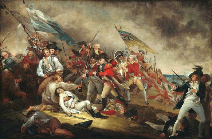
This resentment soon grew into the American Revolution, which began in 1775. Like the rest of the colonies, the residents of the Chesapeake Bay region had divided opinions on breaking away from England. Some supported the rebellion, while others remained loyal to the British king. The Chesapeake Bay and several key rivers figured prominently in the Revolutionary War. British warships blockaded American ports, American merchant ships ran goods to cities along the East Coast, Loyalist boats plied their trade to British-held ports, and rebel privateers preyed on English shipping.
The Treaty of Paris in 1783 officially ended the Revolutionary War and marked the birth of a new nation. In 1790, the Residence Act established a new national capital (replacing Philadelphia) on the Potomac River. Establishing the District of Columbia as the capital of the new United States of America brought added attention and influence to the Chesapeake Bay region.
Following the Treaty of Paris, Great Britain and the United States were officially at peace, and trade was strong for a time. However, tensions grew again when the war between England and France impacted the United States. England restricted supplies from entering France, which Americans saw as the interference of free trade. Americans also objected to the impressment of American sailors forced to serve on British warships. Closer to home, the United States objected to Great Britain arming Indians in America’s frontier areas, seeing this as interfering with the settlement of newly acquired western lands. Although the idea of war was controversial, the U.S. Congress, by a slim margin, declared war on Great Britain in June 1812.
The War of 1812 brought new devastation to the region. The Bay was the economic and political hub of the young nation, and Baltimore was an important port. The British conducted coastal raids in 1813, and the British Navy used the Bay to disrupt trade. In 1814, Maryland was hard hit when the British attacked several towns, defeated an American army at Bladensburg, burned public buildings in Washington, D.C., and defeated the Americans again at North Point. Finally, the two sides signed the Treaty of Ghent on December 24, 1814, ending America’s Second War for Independence.
The war’s aftermath was a significant change for the Chesapeake Bay region. Wealthy families in the Coastal Plain concentrated on expanding the plantation system based on the labor of enslaved Africans. Though the Chesapeake Bay and its rivers retained importance for travel and trade, a new road system connected plantations to rural towns, larger cities and ports, and interior communities. Baltimore and Richmond became urban centers. In July 1828, construction began on two competing transportation routes: the Baltimore and Ohio Railroad and the Chesapeake and Ohio Canal.
Located between two increasingly diverse sections of the country, the Chesapeake Bay became a microcosm of a divided nation in the years leading up to the Civil War. The differences between the primarily industrial North and the rural South led to political tensions that were particularly hard-felt in the Chesapeake region. Conflicting opinions divided states, communities, and even families.
The issue of slavery in the United States was incredibly divisive. For many years leading up to the war, the Chesapeake Bay was vital to the Underground Railroad. This was not an actual railroad but a series of routes and hiding places that led from slave states to free states and Canada.
The tributaries and waterways of the Chesapeake region were often used as safe passages along the Underground Railroad. Routes from Baltimore led west to southern Pennsylvania and northeast towards eastern Pennsylvania and New Jersey. Another route went northwards through the eastern shore of Maryland to Pennsylvania and New Jersey. An ocean route left Norfolk, Virginia, and headed toward the New England states. Harriet Tubman, born into slavery on the Eastern Shore of the Chesapeake, became one of the Underground Railroad’s most famous “conductors.” She guided some 300 people to freedom through the Chesapeake portion of the railroad.
The Chesapeake Bay’s strategic location between the northern and southern states meant its lands and waters were essential to both sides during the Civil War. The Confederacy and the United States capitals were on Bay tributaries: Richmond, Virginia, on the James River, and Washington, D.C., on the Potomac River. The short distance between the two capitals saw frequent combat. Both sides wanted to control the Chesapeake Bay and its rivers for the ability to receive supplies, quickly transport troops, and penetrate enemy territory.
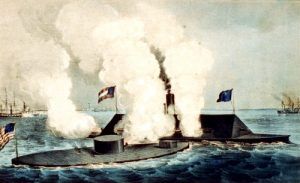
While most of the action occurred on land, the Chesapeake Bay was a player on the stage of the Civil War. The famous clash of the ironclads in the waters off Hampton Roads, Virginia, is one example of how the war played out on the Bay. The clash of the first ironclad vessels on March 9, 1862, was one of history’s most important naval battles. The Confederates converted a captured warship, the USS Merrimac, into an ironclad ram designed to sink wooden Union warships. The Union also converted a battleship, the USS Monitor, into an ironclad, with the added feature of an iron turret that could rotate with two large guns. The bloody battle ended in a draw but significantly changed naval history.
The Civil War raged until 1865, devastating the Chesapeake landscape as opposing armies trampled the fields, pillaged the land for food and fuel, and tore families and communities apart. It was a defining time for the Chesapeake region and the nation. Recovery would take many years. The impacts of the war years and the Reconstruction period were harsh on the Chesapeake Bay as industrialization and urbanization increased and economies changed.
However, the pace of development quickened through the latter 19th century as commodities and immigrants flowed into Chesapeake Bay cities, particularly the deepwater ports of Baltimore and Norfolk. Foreign trade and the manufacture of oceangoing vessels linked the Chesapeake Bay to worldwide ports. Markets for Chesapeake Bay goods grew, and entrepreneurs rushed to improve transportation, communication, and production to meet foreign and domestic demands.
World War I fueled prosperity in the region into the 1920s when Baltimore, Richmond, and Norfolk grew as shipbuilding and industrialization increased. With prosperity came more leisure time, and soon, amusement parks, Bay-side resorts, and water-based recreation developed on the Chesapeake.
The stock market crash of 1929 plunged the Chesapeake region into the Great Depression as it did the nation as a whole. Recovery began with the New Deal and could be seen in the region’s bridges, dams, road repairs, and other public works. Again, the nation’s involvement in a world war spurred economic recovery. Laborers moved into Baltimore and other Bay cities to work in plants that manufactured arms and munitions during World War II. The shipyards of Newport News and Norfolk bustled, and both Norfolk and Baltimore were significant ports for the departure of troops. Textile mills in Richmond and Petersburg flourished, making fabric for uniforms. Washington, D.C., boomed as agencies expanded to support the war effort.
The region continued to prosper after the war. Federal agencies expanded beyond Washington. Cities spread out over the landscape, as affordable automobiles and better roads made traveling easier for work and leisure. Businesses and residents left the cities to escape the congestion.
Today’s Chesapeake Bay is a product of its history. While it has changed dramatically due to human and natural forces, it remains a place of extraordinary ecological, cultural, economic, historical, and recreational value. The Chesapeake Bay remains one of the nation’s most economically important maritime corridors. Each year, ports on the Bay handle 10,000 oceangoing vessels carrying 200 billion pounds of cargo. Some 17,000 men and women working on Bay waters catch and process one-quarter of all oysters and one-half of all clams consumed in America. Although annual harvests are only a fraction of their historic levels, the yearly haul of blue crabs is the largest in the world.
The Chesapeake Bay region continues to be a desirable place to live, as it has been for centuries. Nearly 18 million people now call the watershed home.
Visitors to the Bay enjoy parks, wildlife refuges, museums, historic sites, and water trails. The colony of Jamestown Island can be seen, the paths of Civil War soldiers and the Underground Railroad can be followed, and hundreds enjoy the many outdoor activities.
More Information:
Chesapeake Bay National Park
410 Severn Avenue
Suite 314
Annapolis, MD 21403
410-260-2470
©Kathy Alexander/Legends of America, updated March 2024.
Also See:
Sources:


