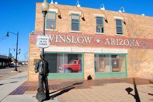
“Standin on a corner in Winslow, Arizona, such a fine sight to see – It’s a girl my Lord in a flatbed Ford slowin’ down to take a look at me …”
— The Eagles, 1972
Winslow, Arizona, is a Route 66 city located in Navajo County that features several historic sites and photo opportunities for travelers.
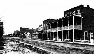
Two miles west of the Little Colorado River, Winslow became a division point for the Santa Fe Railway in 1880 and a regular railroad terminal in 1881. The settlement reportedly started when a settler named “Doc” F.C. Demerest operated a business from a tent. Later, another settler named J.H. Breed built the first stone building, and a post office was established on January 10, 1882. The new town was named after General Edward F. Winslow, president of the railroad.
In the late 1800s, a man named John Lorenzo Hubbell began building Navajo trading posts all over Arizona and New Mexico. These were just part of a trading empire that included freight and mail lines and curio shops in California, bean farms near Gallup, New Mexico, and apple farms near Farmington, New Mexico. Hubbell was instrumental in bridging the gap between the white settlers and the Navajo people. In Winslow, the building still stands that once housed the Hubbell Wholesale Store, which operated from 1924 to 1948.
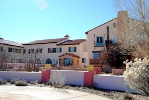
On May 15, 1930, the famous La Posada Harvey House Hotel opened its doors for business. The last one, built in the famous Harvey Hotel and restaurant chain Winslow, was chosen for the site as it was the headquarters of the Santa Fe Railway. Winslow grew so fast during those days that the railroad anticipated the town would soon become another Santa Fe, New Mexico. Designed by Mary Colter, the famed Grand Canyon architect, she carefully blended the aspects of the area’s Native American and Spanish cultures into the hotel.
The La Posada opened just after the 1929 Stock Market crash but still managed to survive. When the nation recovered from the depression, the hotel catered to railroad passengers and the many travelers of the Mother Road. Now, dozens of other businesses sprouted up in the city, initially catering to the many Dust Bowl escapees and later to leisure travelers after World War II.
However, by 1957, railroad travel had all but stopped, and the beautiful La Posada Hotel was closed. Two years later, all of its museum-quality furnishings were auctioned off. In the early 1960s, much of the building was gutted and transformed into the Santa Fe Railroad offices. The La Posada wasn’t the only business that suffered during these years. Until the 1960s, Winslow was the largest town in northern Arizona. But life began to slow down in Winslow, and when I-40 bypassed the town in the 1970s, tourism died, and businesses began to close their doors.
When the Eagles released their first hit single, “Take it Easy,” in 1972, the verse “standing on a corner in Winslow, Arizona,” put the town on the national map of consciousness, but Winslow’s downtown was frozen in time.
However, when the railroad announced plans to move out of Winslow for good in 1994 and the La Pasada was scheduled for demolition, the town gathered up and went to work. First on the list of items was to save the old hotel, which they did. The second was the restoration of Winslow’s downtown historic district, which continues today.
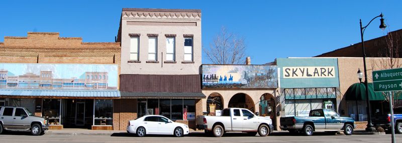
Today, the La Posada has been fully restored and stands as an oasis in the desert, catering to a new generation of Route 66 adventurers. The Old Trails Museum provides a collection of artifacts and memorabilia documenting the history of Winslow and northern Arizona. Make sure to capture a photograph or two at the “Standin’ on the Corner” Park. You’ll catch glimpses of vintage Route 66 throughout your cruise in Winslow. As of December 2024, you can also catch a live view of “Standin’ on the Corner” Park via Winslow’s Live YouTube stream. The town’s population is about 9,425 today.
You can enjoy fishing and water sports at Clear Creek Reservoir, just five miles southeast of Winslow. Apache-Sitgreaves National Forest, some 30 miles south of the city, will also satisfy the water sports enthusiast and provide camping opportunities. On the vast Navajo Reservation, there are many prehistoric ruins and cliff dwellings north of Winslow, and on the Hopi Reservation are ancient pueblo villages. The Homolovi Ruins State Park is only five miles northeast of Winslow.
Between Winslow and Winona, the original Route 66 is patchy, sometimes following the frontage road and suddenly dead-ending. Most of this stretch has been buried by I-40 or reverted to private property. While you can exit to see pieces of the old road, the interstate is your only choice in getting to Winona. However, along the way, be sure to exit the superhighway to see the sights of Meteor City, Twin Arrows, and the ghost towns of Two Guns and Canyon Diablo.
© Kathy Alexander/Legends of America, updated December 2024.
Also See:

