
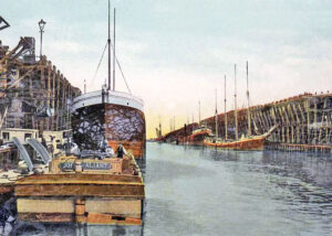
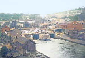
Industrial canal side scene in Buffalo, New York. Buffalo was the western terminus of the fabled Erie Canal and several smaller canals that fed it in the 1800s. Photo by Carol Highsmith.
The Erie Canal is a historic canal located in upstate New York, running east-west between the Hudson River and Lake Erie. The construction of the Erie Canal was a landmark achievement in civil engineering during the early years of the United States’ history. When built, the 363-mile canal was the second-longest in the world after the Grand Canal in China.
The Erie Canal played a pivotal role in the history of commerce in the United States. Its creation helped to make New York City the chief port in the county and opened the western part of the state and other western territories to increased settlement and trade. Many of New York state’s largest cities – Albany, Utica, Syracuse, Buffalo – lie along its banks.
A canal from the Hudson River to the Great Lakes was first proposed in the 1780s. Shipping goods west from Albany was a costly and tedious affair, as there was no railroad yet, and to cover the distance from Buffalo to New York City by stagecoach took two weeks.
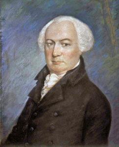
Gouverneur Morris.
Gouverneur Morris and Elkanah Watson were early advocates for a canal along the Mohawk River. Their efforts culminated in the establishment of the “Western and Northern Inland Lock Navigation Companies” in 1792, marking the first initiative to improve navigation on the Mohawk River and to construct a canal connecting it to Lake Ontario. However, it quickly became evident that private financing alone was insufficient for the project.
Christopher Colles, familiar with the Bridgewater Canal, surveyed the Mohawk Valley and presented his findings to the New York state legislature in 1784. He proposed a more direct canal route from Lake Ontario. While this proposal garnered attention and some initial responses, it ultimately was never realized.
The problem was that the land rose about 600 feet from the Hudson River to Lake Erie. Locks at the time could handle up to 12 feet of lift, so 50 locks would be required along the 360-mile canal, even with the heftiest cuttings and viaducts.
Such a canal would be expensive to build even with modern technology; in 1800, the expense was barely imaginable. President Thomas Jefferson called it “little short of madness” and rejected it.
It would be several decades before New York legislators became interested in building a canal in the early 19th century. At that time, New York Governor DeWitt Clinton proposed a canal connecting the Hudson River to Lake Erie and relentlessly promoted its construction. Skeptics just as forcefully derided it as “Clinton’s Big Ditch” or “Clinton’s Folly.” It also had other big-name supporters, including Gideon Granger, Stephen Van Rensselaer, and founding father Gouverneur Morris. Ultimately, Governor Clinton would be vindicated.
A formal survey was conducted by James Geddes in 1808.
The New York State Legislature authorized the construction of the Erie Canal in 1817. That year, construction began on the canal in the middle of the state, near Rome.

Erie Canal Map courtesy of Encyclopedia Britannica.
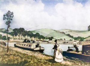
1822 The Western section was underway, but when the surveyors reached Oak Orchard Creek, bypassing a deep ravine, now known as Medina Falls, was necessary. They swung southward, creating a U-shaped section that formed a natural docking area.
It took 2,000 to 3,000 men and 700 horses to build the canal. Laborers earned 50¢ per day, and engineers earned $1,500 to $2,000 per year.
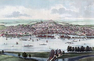
Hudson River at Albany, New York.
The canal began on the west side of the Hudson River in Albany and extended north to Watervliet, where it branched off into the Champlain Canal. At Cohoes, the canal ascended the west bank of the Hudson River, featuring 16 locks that raised it 140 feet. It then turned west along the southern shore of the Mohawk River, crossing to the north side at Crescent and back to the south at Rexford. Continuing west near the southern shore of the Mohawk River, the canal reached Rome, where the Mohawk River turned north.
From Rome, the canal continued west, paralleling Wood Creek, which flows into Oneida Lake. It then turned southwest and crossed overland to avoid the lake. West of Canastota, the canal followed the lower edge of the Onondaga Escarpment, passing through Syracuse, Onondaga Lake, and Rochester. Just before reaching Rochester, the canal used a series of natural ridges to cross the deep Irondequoit Creek valley. At Lockport, the canal turned southwest to ascend to the top of the Niagara Escarpment, utilizing the ravine of Eighteen Mile Creek.
The canal continued south-southwest to Pendleton, where it turned west and southwest, primarily following the path of Tonawanda Creek. From Tonawanda, it ran south toward Buffalo, just east of the Niagara River, and reached its “Western Terminus” at Little Buffalo Creek (later known as the Commercial Slip). This creek flows into the Buffalo River just above its confluence with Lake Erie. Following the re-excavation of the Commercial Slip by Buffalo, completed in 2008, the canal’s original terminus is now re-watered and accessible to boats. However, several miles of the canal, located inland from this site, remain buried under 20th-century fill and urban development. As a result, the effective western navigable terminus of the Erie Canal is now at Tonawanda.
After eight years of construction, the 363-mile-long Erie Canal opened on October 26, 1825, at a cost of $7.143 million (equivalent to approximately $192 million in 2023). The canal measured 40 feet wide and 4 feet deep, cutting through fields, forests, rocky cliffs, and swamps. It crossed rivers using 18 aqueducts and navigated hills with 83 stone-walled lift locks. To ascend from the deep Hudson Valley past Cohoes Falls near the mouth of the Mohawk River, 16 locks were necessary. The Erie Canal became North America’s most successful and influential public works project.
The Erie Canal in 1825.
The event was celebrated with a statewide “Grand Celebration,” culminating in a salute of cannon fire along the canal and the Hudson River. A flotilla of boats, led by Governor Dewitt Clinton aboard the Seneca Chief, sailed from Buffalo to New York City over a span of ten days. During the celebration, Clinton ceremonially poured water from Lake Erie into New York Harbor to mark the “Wedding of the Waters.” On the return trip, the Seneca Chief brought back a keg of Atlantic Ocean water that had been poured into Lake Erie by Buffalo’s Judge Samuel Wilkeson, who would later become the mayor.
The Erie Canal was acclaimed as an engineering marvel, as it provided the first all-water link between the Atlantic seaboard and the Great Lakes. This connection significantly reduced transportation costs for people and goods across the Appalachian Mountains. It also united the country, giving New York City a substantial advantage over other U.S. ports in becoming an international trade center. Soon, New York City emerged as the nation’s busiest port, most populous city, and leading hub for commerce and finance. This shift took business away from other ports such as Philadelphia and Baltimore. In the years that followed, these cities and their states initiated projects to compete with the Erie Canal.
The canal also significantly increased the populations of cities along it, such as Albany, Utica, Syracuse, Rochester, and Buffalo.
The canal opened the American interior to settlement, bringing a flow of people and new ideas, and infusing the nation with diverse languages, customs, practices, and religions. The Erie Canal carried more westbound immigrants than any other trans-Appalachian canal.
Erie Canal in Buffalo, New York.
The original design anticipated an annual tonnage of 1.5 million, a goal that was surpassed almost immediately. The toll revenue generated during the first year of operation was enough to cover the state’s construction debt. That year, over 40,000 passengers took advantage of the convenience and beauty of canal travel. The steady flow of tourists, businessmen, and settlers brought uses to the canal that its initial sponsors had never imagined. Evangelical preachers traveled their circuits throughout the upstate region, and the canal served as the final leg of the Underground Railroad, transporting those seeking freedom to Buffalo, near the Canada-U.S. border. Aspiring merchants discovered that tourists were reliable customers. Vendors moved from boat to boat, selling items such as books, watches, and fruit, while less scrupulous “confidence men” sold dubious medical remedies or passed off counterfeit bills. Tourists enjoyed the “northern tour,” which led to the popular honeymoon destination of Niagara Falls, just north of Buffalo.
The Erie Canal accelerated the settlement of the Great Lakes region, the United States’ westward expansion, and New York State’s economic ascendancy. Along the transportation line, a wide range of products, including timber, agricultural goods, merchandise, and manufactured goods, were shipped. The canal has been called “The Nation’s First Superhighway.”
The canal advanced Euro-American settlement of the Northeast, Midwest, and Great Plains, sometimes at the expense of Native American populations.
An ambitious program to improve the canal began in 1834. During this massive series of construction projects, known as the First Enlargement, the canal was widened from 40 to 70 feet and deepened from four to seven feet. Locks were widened or rebuilt in new locations, and many new navigable aqueducts were constructed. The canal was straightened and slightly re-routed in some stretches, abandoning short segments of the original 1825 canal.
To compete with the Erie Canal, the Main Line of Public Works, a combined canal and railroad running west from Philadelphia to Pittsburgh, Pennsylvania, on the Ohio River, opened in 1834.

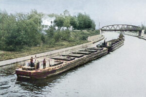
Men and horses working on the Erie Canal.
Fueled by its Erie Canal success, New York State built the Oswego, Cayuga–Seneca, Chemung, Crooked Lake, and Chenango canals between 1826 and 1836.
In 1836, the Chenango Canal was completed, connecting the Erie Canal at Utica to Binghamton, which led to a significant business boom in the Chenango River Valley. The Chenango and Chemung canals linked the Erie with the Susquehanna River system. The Black River Canal connected the Black River to the Erie Canal at Rome and remained in operation until the 1920s. The Genesee Valley Canal ran along the Genesee River to connect with the Allegheny River at Olean. Still, the Allegheny section, which would have connected to the Ohio and Mississippi Rivers, was never built.
The Mohawk and Hudson Railroad opened in 1837, bypassing the canal’s slowest part between Albany and Schenectady. Other railroads were soon chartered and built to continue the line west to Buffalo. The tonnage of property moved that year was 667,151.

Mohawk & Hudson Railroad.
The 1839 Annual Report of the Commissioners of the Canal Fund showed that revenue received from the tolls on the Erie Canal alone was over $1,000,000.
In 1842, a continuous railroad line, later to become the New York Central Railroad, was opened, extending to Auburn. The line was further extended to Buffalo in 1853.
Over one million properties were moved in 1845.
The population along the canal route in Syracuse, Rochester, and Buffalo quadrupled from 1830 to 1850.
Erie Canal Locks at Little Falls, New York.
The canal’s success spurred the expansion and enlargement of New York’s canal system to handle more and bigger boats. It triggered a surge in canal building across the eastern United States and Canada in the mid-1800s, before railroads became the primary means of hauling freight and passengers.
The canal’s peak year was 1855, with more than 33,000 commercial shipments.
The first enlargement of the canal was completed in 1862, with further minor enlargements in later decades.
By the late 1870s, the Chemung, Chenango, Crooked Lake, Oneida Lake, and Genesee Valley canals had been abandoned.
In 1880, the tonnage of property moved peaked at over four million. Overland, the cost was $100.00 per ton; the canal reduced the cost to $10.00 per ton, and freight rates fell by 90%. The only other New York canal that came close was the Champlain, which often had less than half of that amount.
Canal tolls ended in 1882.
In 1895, the second canal enlargement changed the depth to nine feet.
By 1896, lengthened chambers had allowed most Erie Canal locks to pass two boats in tandem.
The canal remained competitive with railroads until about 1902, when tolls were abolished.
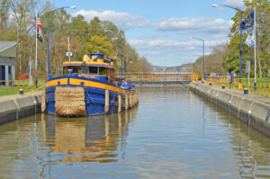
Barge Canal.
Initially 40 feet wide and four feet deep, the canal was expanded several times, most notably from 1905 to 1918, when the “Barge Canal” was built, a robust grandchild of the Erie, Champlain, Oswego, and Cayuga-Seneca Canals. The third Canal enlargement was made 120-200 feet wide and 12-23 feet deep. The cost was $155 million. This new canal replaced much of the original route, leaving many abandoned sections, mostly between Syracuse and Rome. In sections that did not consist of canalized rivers, particularly between Rochester and Buffalo, the original Erie Canal channel was enlarged to 120 feet wide and 12 feet deep. The expansion allowed barges up to 2,000 short tons to use the Canal.
Built for self-propelled vessels, it uses canalized rivers, lakes, and land-cut sections with a minimum depth of 12 feet. Electrically powered locks allow boats 300 feet long to pass.
Freight traffic reached a total of 5.2 million short tons by 1951.
Commercial traffic declined heavily in the latter half of the 20th century due to competition from trucking.
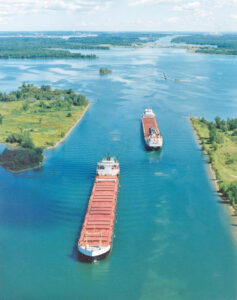
St. Lawrence Seaway, courtesy Wikipedia.
In 1959, the larger St. Lawrence Seaway was opened, allowing ships to travel directly from the Great Lakes to the Atlantic Ocean. Afterward, commercial traffic on the New York canals declined. However, New York’s Canal System is still in service, and the active and retired canals are now vibrant places to enjoy water and land-based recreation.
The canal’s last regularly scheduled hauler, the Day Peckinpaugh, ended service in 1994.
Since the 1990s, the canal system has been used primarily by recreational traffic.
In 1992, the New York State Barge Canal was renamed the New York State Canal System and placed under the newly created New York State Canal Corporation, a subsidiary of the New York State Thruway Authority.
Congress established the Erie Canalway National Heritage Corridor in 2000. The Corridor spans 524 miles of navigable waterway across upstate New York, encompassing 4,834 square miles. It includes the Erie, Cayuga–Seneca, Oswego, and Champlain canals, along with their historic alignments, and the 234 cities, towns, and villages connected to the canal system.
A New Kind of National Park, the Erie Canalway National Heritage Corridor, is one of nearly 30 federally designated national heritage areas. Its purpose is to help preserve and interpret the historical, natural, scenic, and recreational resources that reflect its national significance, and to revitalize canal-side communities.
The Federal Government does not own or manage national heritage area lands as it does with traditional national parks. Instead, people, businesses, non-profit historical and environmental organizations, towns, cities, counties, and the State of New York cooperate to protect the Canalway Corridor and prepare for its future. This partnership helps ensure that canals, towpaths, structures, and other historical and natural features remain preserved and accessible to thousands of visitors annually.
Erie Canal in Rochester, New York, courtesy National Park Service.
Today, the Erie Canal is mainly used by recreational watercraft. The New York State Canalway Trail is a popular cycling path that follows the canal across the state. The canal has also become a tourist attraction in its own right, with several parks and museums dedicated to its history.
More information: Erie Canalway National Heritage Corridor
©Kathy Alexander/Legends of America, updated November 2025.
Also See:
Sources:
Library of Congress
National Park Brochures
National Park Service
Orleans County, New York
Wikipedia