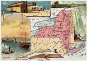
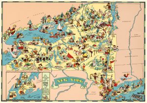
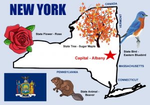
New York, located in the Northeastern United States, was one of the original Thirteen Colonies that formed the United States. Known as the “Empire State,” it was named after the English Duke of York.
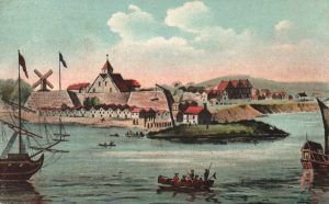
The Dutch West India Company established the first settlement at Fort Orange near present-day Albany in 1624 and another in New Amsterdam on the site of present-day Manhattan a year later. After the English took over in the 1660s, the colony was renamed New York. The state includes everything from skyscrapers in Manhattan to rivers, mountains, and lakes in upstate New York.
Today, New York has the fourth-largest population, and its economy ranks third in size behind the larger states of California and Texas and remains the country’s financial center. With an estimated 20 million residents in 2019, two-thirds of the state’s population lives in the New York metropolitan area.
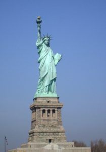
New York’s diverse geography includes many well-known landmarks, including several most-visited attractions such as Times Square, Central Park, Niagara Falls, and Grand Central Terminal. New York is also home to the Statue of Liberty, a symbol of the United States and its ideals of freedom, democracy, and opportunity.
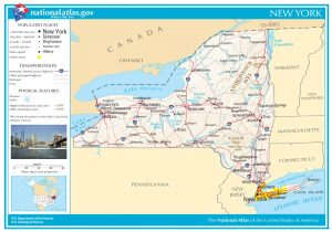
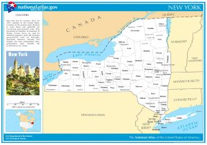
The state borders New Jersey and Pennsylvania to the south and Connecticut, Massachusetts, and Vermont to the east. The international border with the Canadian provinces meets Quebec to the north and Ontario to the northwest.
New York has numerous mountain ranges, the principal one being the Catskills. In the northeastern comer of the state is a wild, mountainous tract of land called the ” Adirondacks,” which consists of heavily timbered mountains and numerous beautiful lakes, which is a great summer resort.
Capital:
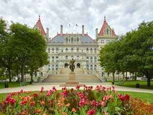
Albany, the state’s capital, is located on the west bank of the Hudson River, about 145 miles from the Atlantic Ocean. The area that later became Albany was settled by Dutch colonists who, in 1614, built Fort Nassau for fur trading and, in 1624, built Fort Orange. This continued to be its name until the English took possession when it was changed to Albany. It became the capital of New York in 1797 following the formation of the United States. Known for its rich history, commerce, culture, architecture, and higher education institutions, Albany is also the seat and largest city of Albany County.
Landmarks:
Lakes Champlain and George – Along the northeastern boundary of New York and between it and Vermont, Lake Champlain lies stretched for about 100 miles. It derives its name from a French navigator who, in 1609, first entered the State from Canada by way of that lake. Stretching south of and tributary to it, there is another beautiful sheet of water 35 miles long by two or three miles broad, known as Lake George. Its water is noted for its excellent clearness. The lake contains numerous small islands available as campgrounds for tourists. Many summer resorts are situated at various places on these lakes.
Hudson River – Named after Henry Hudson, a navigator in the employ of the Dutch East India Company, who discovered it in 1609 while searching for a passage to the East Indies. Supposing he had discovered that passage, he sailed up the river as far as Albany. Some 300 miles in length, this river flows through a fine farming country and is celebrated for its incredible beauty. In New York City, it unites with the East River to form New York Bay and, through that, empties into the Atlantic Ocean.

West Point Military Acadamy, New York, courtesy Britannica.com
West Point – Situated on the west bank of the Hudson River, West Point was an important American fortification during the American Revolution. An attempt was made by Benedict Arnold, the American officer in command, to surrender the place to the British and Major Andre, an English officer, who was found within the American lines and was hanged as a spy. It is the oldest continuously operating Army post in the United States and has long served as the United States Military Academy, where officers are educated for the army. The academy traces its roots to 1801 when President Thomas Jefferson directed that plans be set in motion to establish the United States Military Academy at West Point.
Syracuse – One of the most beautiful of New York’s interior cities, Syracuse is situated at the head of Onondaga Lake amid a beautiful and fertile farming region and has an extensive and valuable trade. Formerly a manufacturing center, Syracuse’s economy has changed over the past decades as industrial jobs have left the area. Today, its top employers are primarily in higher education, research, health care, and services, with some high-tech manufacturing remaining. It has a population of about 143,000.
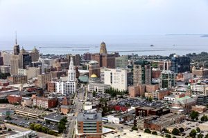
Buffalo – The second largest city in the State, Buffalo is on the eastern shore of Lake Erie, at the head of the Niagara River, 16 miles south of Niagara Falls. With a population of about 256,000, it is the county seat of Erie County and serves as a major gateway for commerce and travel across the Canadian border. Its early embrace of electric power led to the nickname “The City of Light.”
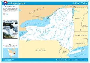
Lake Erie – One of the great inland seas,” Lake Erie is 290 miles long, and its widest point measures 57 miles from shore to shore. It is about 560 feet above the level of the ocean. There are but few islands in the lake and almost no bays. Its average depth is about 200 feet. Due to its comparative shallowness, it freezes more than any of the other lakes. It receives at its western end the waters from Lake Huron and empties into Lake Ontario by the Niagara River.
Long Island – Reaching off from New York in an easterly direction, Long Island stretches along the entire Connecticut front. On its north is the Long Island Sound, while the Atlantic Ocean washes its southern shores. It has many flourishing cities, most occupied by persons engaged in business in New York City. The island comprises four counties and the New York City boroughs of Brooklyn and Queens. With a population of nearly 8,000,000 people, its residents constitute nearly 40% of New York State’s population.
New York City – When the Dutch possessed this section of the country, the city was known as New Amsterdam and was a quiet, steady-going Dutch town. When the English took possession, it was called New York, after the Duke of York, and has ever since been so known. It is built on Manhattan Island and a part of the mainland north of that island. The waters of the Hudson River, the East and Harlem Rivers, and the Spuyten Duyvil Creek surround it. The junction of the North and East Rivers forms the upper bay, and the Narrows afford a passage to the lower bay. The upper bay and the two rivers form an unsurpassed anchorage ground for vessels of all kinds. The commerce of New York is extensive and connected with all parts of the world. The city is handsomely built, and along the principal business street, Broadway, stretches for miles of fine business buildings, while on the streets running parallel with it or crossing it, there are many other equally fine. In the upper portion of the city are the residences, which cannot be surpassed for beauty and elegance. In the upper portion of the city are residences, which, for beauty and elegance, cannot be anywhere. New York’s hotels are celebrated for their elegance and comfort, and its theaters and amusement places are the best to be found. In the upper part of the city is the celebrated Central Park, which, for beauty and taste, is unequaled. Comprised of five boroughs — Brooklyn, Queens, Manhattan, the Bronx, and Staten Island, it is the most populous city in the United States, with more than eight million residents.
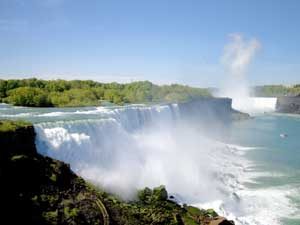
Niagara Falls – This great natural wonder is situated between Lakes Erie and Ontario in the Niagara River. The rapids commence about a mile above the falls, which are two in number, including American Falls and Horseshoe Falls. Niagara Falls has been known as one of America’s great natural wonders since the early days of European exploration. Over Niagara Falls courses the outflow of four of the Great Lakes. The river is here 4,750 feet wide. In the deep gorge below the falls, the current is carried through a narrow channel in violent eddies and whirlpools toward Lake Ontario. The falls are part of the Niagra Falls National Heritage Area that stretches from the western boundary of Wheatfield, New York, to the mouth of the Niagara River on Lake Ontario, which includes the communities of Niagara Falls, Youngstown, and Lewiston. The region is home to natural wonders, rich cultural traditions, and nationally significant historical sites.
National Historic Sites & Parks:
Appalachian Trail – This 2,180-mile-long public footpath traverses the scenic, wooded, pastoral, wild, and culturally resonant lands of the Appalachian Mountains through several states. Conceived in 1921, it was built by private citizens and completed in 1937. Today, the trail is managed by the National Park Service, US Forest Service, Appalachian Trail Conservancy, numerous state agencies, and thousands of volunteers.
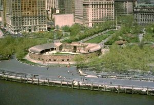
Castle Clinton – Located at the southern tip of Manhattan Island, Castle Clinton stands where New York City began and represents the city’s growth and the nation’s growth. Initially intended to prevent a British invasion in 1812, the fortification has transformed over the years to welcome theatergoers, immigrants, sightseers, and now, millions of visitors to New York Harbor.
Chesapeake Bay and the Captain John Smith Chesapeake National Historic Trail – Both the bay and the trail stretch from Cooperstown, New York to Norfolk, Virginia, and includes parts of six states, including Delaware, Maryland, New York, Pennsylvania, Virginia, and West Virginia, as well a the entire District of Columbia. Four hundred years ago, Englishman John Smith and a small crew of adventurers set out in an open boat to explore the Chesapeake Bay. Between 1607 and 1609, Smith and his crew mapped nearly 3,000 miles of the Bay and rivers and documented American Indian communities. Here, you can visit major league cities, colonial towns, American Indian landscapes, farms, and fishing villages. You can learn to kayak, pick crabs, go fishing, tour a lighthouse, slurp oysters, and slow down to enjoy the natural beauty of the Chesapeake Bay.
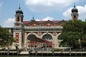
Ellis Island – Part of the Statue of Liberty National Monument, Ellis Island is a federally owned island in New York Harbor with a museum and former immigration inspection station. As the United States’ busiest immigrant inspection station from 1892 to 1954, approximately 12 million immigrants arriving at the Port of New York and New Jersey were processed there under federal law. Accessible to the public only by ferry, visitors can see the main building and support structures that once served as the headquarters of the U.S. Bureau of Immigration and a museum. On the island’s south side, the Immigrant Hospital is only open to the public through guided tours.
Erie Canalway – In upstate New York, visitors can explore the Erie Canal and discover America’s most famous and influential man-made waterway. Nowhere else will you find the distinctive locks and low bridges of the New York State Canal System or discover towns and cities whose watery front doors still give way to lively Main Streets. More than 500 miles of historic waterways and trails are here to explore.
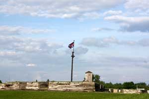
Fort Stanwix National Monument – For centuries, the Oneida Carrying Place, a six-mile portage connecting the Mohawk River and Wood Creek, was a vital link for those traveling by water from the ocean to the Great Lakes. When Europeans arrived, nations fought for control of the carry, the homelands of the Six Nations Confederacy, and the rich resources of North America. In this struggle, Fort Stanwix would play a vital role. The monument is located in Rome, New York.
Governors Island National Monument – From 1794 to 1966, the U.S. Army on Governors Island was part of the social, political, and economic tapestry of New York City. Today, the island is a vibrant summer seasonal venue of art, culture, and performance against the backdrop of two centuries of military heritage and the skyline of one of the world’s great cities. The island is open to the public from May 1st through October 31st.
Harriet Tubman National Historic Park – Harriet Tubman was guided by a deep faith and devotion to family, freedom, and community. After emancipating herself and her family members, she moved them from Ontario, Canada, to Fleming and Auburn, New York, in 1859. Central New York was a center for progressive thought, abolition, and women’s suffrage, where Tubman continued to fight for human rights and dignity until she died in 1913. The park is located in Auburn, New York.
Hudson River Valley National Heritage Area – This National Heritage Area stretches from New York City to Albany. The area’s resources exhibit the roles of freedom and dignity in the valley’s history and commerce’s historical and contemporary role. Revolutionary War stories, famous residences, scenic parks and gardens, and landscapes contribute to the Hudson Valley’s beauty and significance.
Statue Of Liberty National Monument – “The Statue of Liberty Enlightening the World” was a gift of friendship from the people of France to the United States and is recognized as a universal symbol of freedom and democracy. The Statue of Liberty was dedicated on October 28, 1886. It was designated as a National Monument in 1924. Employees of the National Park Service have been caring for the colossal copper statue since 1933. The statue is situated in Upper New York Bay on Liberty Island, south of Ellis Island, which comprises the Statue of Liberty National Monument. No charge is made for the entrance to the national monument, but there is a cost for the ferry service that all visitors must use.
State Symbols:
State Song – I Love New York
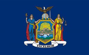
State Motto – Excelsior, Latin for “Ever Upward”
State Maps:
© Kathy Alexander/Legends of America, updated January 2024.
Also See:

