
Osage County, Kansas Map, 1899
After leaving Douglas County, Santa Fe Trail travelers moved into north Osage County, past the present-day towns of Overbrook, Scranton, and Burlingame. Along this westerly course of 25 miles, the trail dropped only one mile to the south, closely following Highway 56 today.
Rock Creek Springs-Walton
Many people’s first stop was Rock Creek Springs #1, about 1.5 miles east of Overbrook. This campground and watering stop once boasted a blacksmith shop, general store, inn, and post office.
Daniel Walters first settled on land here, which later belonged to V.C. Bryson and is still called the “Old Bryson Farm.” Walters erected a large stone store and hotel building that housed the post office, established in October 1858. He also built himself a two-story house with a basement. Though he called his “settlement” and post office “Walton,” it continued to be known by Santa Fe Trail travelers as Rock Spring No. 1.
Dan Walters was a sort of “Jack of all Trades” — a shoemaker, a stonemason, and a farmer. Though known as a hard worker, he fell behind on his labor and material bills. Making matters worse was an ongoing dispute with Walters’ neighbors, two pro-slavery men, Lee and William Daughterty. Rock Springs, the old and noted watering place, was about 300 yards west of Walters’ store and hotel. Its location was close to his boundary line, and his neighbors, endeavoring to have the line surveyed, hoped the spring was on their land rather than on Walters. The dispute continued until Lee Daughterty had Walters arrested for passing a counterfeit half dollar on him — even accusing Walters of manufacturing the spurious coin. Walters was taken off to the Olathe, Kansas jail, where he was held for several weeks. There was no evidence against him when the trial date came, and he was discharged. In the meantime, Walter Jennerson was deputized as assistant postmaster instead of Dan Walters. When Mr. Walters was released from jail, he packed up his household effects, took his family, and removed them to Colorado, thoroughly disgusted with Kansas.
Missouri Border Ruffians are also called Bushwhackers.
In May 1863, a Confederate guerrilla named left Missouri on the Santa Fe Trail, crossed into Kansas, and on May 4, encamped near Council Grove. That night, he raided the tiny village of Diamond Springs, where he killed one man and wounded a woman. On the return trip, he stopped at Rock Springs, where he met and killed George N. Savin, a soldier of Company K, Eleventh Kansas, who had been at his home in Pottawatomie County on leave and was on his way to rejoin his regiment. Seven miles farther on, Yeager’s men shot and seriously wounded David Hubbard at his Stage Station in Globe, Kansas, then passed through Baldwin and Black Jack, where they robbed the stage, before returning to Missouri via Gardner. The Walton post office continued until June 1864, when it closed its doors forever. Nothing is left of this historic spot on the Santa Fe Trail today.
Overbrook
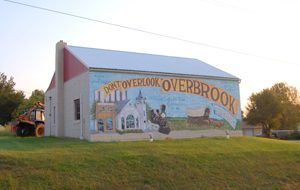
Overbrook, Kansas Mural
The Santa Fe Trail continued west from Rock Creek Springs to where the Overbrook Cemetery stands today. Faint outlines of ruts can be seen going toward the school building. Near the 200 block of Ash, in Overbrook, was a spring used for a watering stop. The Trail ran west through Overbrook down the present Santa Fe Trail Street. At Sycamore Street, it veered to the north a bit and continued through what is now the Brookside Manor Nursing Home. The Santa Fe Trail then turned north, where the old railroad bridge is on Highway 56, west of Overbrook. A windmill can be seen just west of the bridge, north of the highway. The spring located here was called Flag Spring or Santa Fe Spring.
About four miles west of Overbrook was a place called Boneyard. Here, a wagon train of traders was caught in a blizzard. They were trying to return to Westport (Kansas City), Missouri. The men could walk to the safety of the 110-mile Crossing, but the oxen perished. For years, wagons going and coming on the trail used the bleached bones as a marker.
Another DAR marker is located just south of the intersection of Highways 56 and 75. About 1⁄2 mile west of the marker was the 110 Mile Crossing. It was so named because, according to the survey of 1825, it was 110 miles from the start of the Trail in Missouri.
110 Mile Creek/Crossing
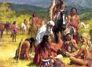
Shawnee Indians.
Originally called Jones Creek, the creek was renamed for its distance from Fort Osage, Missouri, as measured by the expedition dispatched to survey the Santa Fe Trail in 1825-1827. In July 1854, all that portion of the Shawnee Reserve down to the Sac and Fox Reserve had been declared open to settlement. Fry P. McGee stopped at 110 Mile Creek on a return trip from Oregon that summer. There, he found three families of mixed-blood Shawnee Indians engaged in farming. On August 2, McGee and his brother Mobillion purchased the crossing site from the two white men who had married Shawnee Indian women.
Soon after he acquired the land, Fry McGee’s wife, Martha Booth McGee, and two daughters joined him at the Crossing, where they occupied the crossings that the original owners constructed. Here, McGee provided bed and board for Santa Fe Trail travelers. Additional income came from a toll bridge built over the creek. Records show that the crossing charge was 25 cents per wagon and that, on some days, as much as $30.00 was collected. Here intersected the Santa Fe Trail going west, the Fort Scott Road from the southeast, the 110-mile road going north, and a segment of the Mormon Trail that ran northwest to Fort Riley.
The McGees, very influential Southerners who had previously lived in Westport (Kansas City), Missouri, immediately began to induce more Southerners to settle on the headwaters of the Osage River. However, the settlement was relatively isolated from other pro-slavery settlements. Fry McGee became the local headquarters for pro-slavery sentiment and was its outspoken advocate. His “station” also became a local voting place.
In the meantime, Fry’s brother Mobillion also claimed the mouth of Switzler Creek, though he continued to make his home in Westport. Another pro-slavery man named C.M. Linkenauger also made a claim nearby. The wealthy and well-connected McGees persuaded more Missourians to make claims in the area in a move to hold the new Kansas Territory for slavery. Fry McGee’s girls had slave servants in their home, and a neighbor kept some 20 or more slaves working a farm nearby, even though Council City (Burlingame), just 8 miles away, was known as a strong Free State colony.
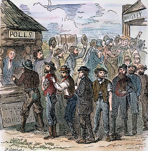
Kansas Voting.
In November 1854, McGee’s Tavern was one of only 16 voting places for the whole Territory. The one chosen by the Missourians as a good point to gather and cast an excellent, significant vote on the proposition regarding whether Kansas should be a Free or Slave Territory. Horace Greeley spoke of it in his New York Tribune afterward as the worst point in the whole Territory, with 597 of the 607 votes cast there found by the congressional investigating committee to be fraudulent. The following year, the voting place was removed from McGee and moved to Council City. That, however, would not change McGee’s influence in the area.
On March 30, 1855, the first election was held to elect a delegate to the first Territorial legislature. On the day before the election, a large body of Missourians, armed with rifles and a large quantity of whiskey, arrived at Council City and camped in the woods. They spent the night drinking whiskey, yelling, cursing the Free-State cause, and firing their guns.
On the morning of March 30, the regularly appointed Election Board met at the unfinished log cabin of I.B. Titus. No sooner were the polls declared open than the Missourians appeared on the scene, tore a window out of the cabin, drove away the judges, and appointed others of their group. They then took possession of the polls and drove the few Free-State men away. They spent the day drinking, swaggering about, and making threats of violence toward the Council City people. All voted, some of them several times. That night, they closed the polls and moved back as far as 110 Mile Creek, where they camped, continued their drunken orgies, and went through the form of counting the votes, declaring Mobillon McGee to be elected by a unanimous vote (about 250). Though he had located a claim the fall before, McGee was then a resident of Westport, Missouri. The following day, the ruffians resumed their march to Missouri.
Governor Andrew Reeder was then at Muncie, Kansas. He was at once apprised of the violent measures used at Council City when he ordered a new election, at which Hollam Rice was elected, receiving 28 votes from everyone in the district. Governor Reeder issued a certificate of election to Rice, but upon meeting the legislature, they excluded him and admitted McGee.
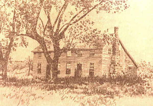
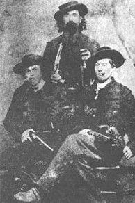
McGee’s Tavern on 110 Mile Creek, Osage County, Kansas.
On January 9, 1855, 110 Mile Creek gained a post office named Richardson for the original owners. James McClure was appointed census taker for the Territory’s 7th and 8th voting districts early that same year. Governor Andrew Reeder had forewarned McClure of McGee’s radical attitude, which, unfortunately, McClure would find out about firsthand. Upon his arrival at the Fry McGee Tavern and Hotel, McGee engaged McClure in an argument, leading the census taker to spend the night in a log building with no furniture or heat. A few years later, McGee would pay for that mistake in Kansas Territory. In 1857, the raiders looted the 110 Mile Station, and McGee was robbed of all his personal property.
A table of distances published in 18Crossingcrossing provided mail service for crossing travelers, water, wood, grass, coal, and entertainment. Entertainment might have been defined as simply liquor and card playing, but it could also have meant prostitution.
At about the same time, McGee’s daughter married a man named William Harris, and the two settled on the opposite side of the road. McGee and his new son-in-law organized a town company named Washington at the station, but the town never developed. However, Harris remained in the partnership until McGee died in 1861. Subsequently, he built a store that he operated through 1866, when the Union Pacific Railroad closed Santa Fe Trail traffic east of Walnut Creek. However, a post office remained here until September 1874, when it closed its doors forever.
Unfortunately, despite its rich history, nothing remains of the McGee-Harris Stage Station at the 110-Mile Creek Crossing. It was about a mile southwest of U.S. 56 (West 157th Street) and Old Highway 75 (South Topeka Avenue).
From 110 Mile Creek, the trail ran southwest through the southern edge of present-day Scranton, Kansas. A DAR marker is located in the northeast corner of Jones Park, two blocks east of Highway 56 on Boone Street.
Burlingame
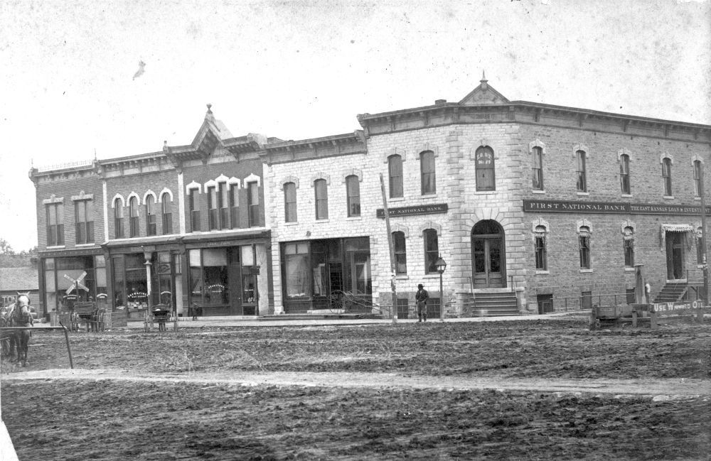
Historic Burlingame, Kansas.
Before arriving in Burlingame’s old Santa Fe Trail town, travelers crossed Switzler Creek, sometimes called Bridge Creek, on the eastern edge of town. Here, John Switzler constructed a toll bridge over the waterway in 1847. It continued to operate into the 1860s.
The trail enters Burlingame at the east end of the present Santa Fe Street and proceeds downtown. The original trail is now and has always been the town’s principal street, and several businesses are named after this famous highway across Kansas. Burlingame is the oldest town in Osage County, having been built around a nucleus and founded as Council City in 1855. In 1857, the site was surveyed to include a larger area, and the name was changed to Burlingame in honor of Anson Burlingame, who later served as minister to China.
During these early years, Burlingame was second only to Council Grove in importance for getting supplies and blacksmith work done before heading west on the Santa Fe Trail. In the center of the town was a fine well, the watering place for miles around in the dry seasons. Improvement in the town was rapid from 1857 until the outbreak of the Civil War. This well was walled around to protect it from attack and ruin during the Civil War. Additionally, a large round fort was built in 1862, and several armed men were stationed to protect the town from destruction threatened by Bill Anderson, one of Quantrill’s guerrilla bands. As soon as peace was restored, business activity was renewed. A bridge was put across Switzler Creek, sawmills and grist mills were built, and durable buildings, some of them of stone, were put up. The Atchison, Topeka & Santa Fe Railroad reached Burlingame in 1869, signaling the end of Santa Fe Trail traffic through the community.
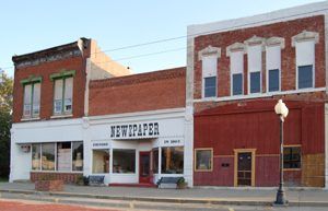
Downtown Burlingame, Kansas, today by Kathy Alexander.
Today, Burlingame’s Santa Fe Street offers not only a nostalgic panorama with its classic red-brick streets, antique-style streetlights, and historic brick-and-stone buildings but also a unique reminder of those early Trail days. The vast expanse between the store buildings is reminiscent of the Trail days, when the trail was wide enough for ox-drawn freight wagons to circle as wagon trains camped to restock supplies and make repairs before heading west. Today, residents park their cars in the middle of the street and at the curb.
The Santa Fe Trail then headed west over the hill and out of town, roughly paralleling Highway 31.
Dragoon Creek & Havana Stage Station
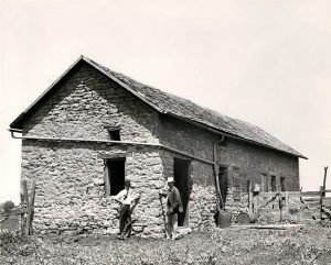
Havana Stage Station near Burlingame, Kansas.
About three miles northwest of Burlingame and north of Kansas Highway 31 is the Dragoon Creek Crossing, a natural rock crossing point that still appears much as it did in the Trail days. The creek is reportedly named after a troop of dragoons who traveled the Santa Fe Trail in the 1850s, or possibly after a dragoon, Samuel Hunt, whose grave is just west.
The old Havana Stage Station site is about one mile west of Dragoon Creek and just south of Kansas Highway 31. Reportedly built in 1858, a store and a hotel complemented the station. The site was home to about 50 German and French families in its earliest days. The townsite included six small buildings in addition to the stage station, store, and hotel. The stage station operated as a stop on the main stage line, offering meals and lodging until around 1869 when the Atchison, Topeka, and Santa Fe Railroad arrived in nearby Burlingame. The town was abandoned in the early 1870s. Many Germans moved to Alma, and the property was sold for taxes.
Today, only the remains of the stage station are discernible. However, the trail’s ruts or swales can still be seen in the field south of the roadside marker as it continues southwest from the Havana Station.
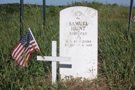
Samuel Hunt Grave
Samuel Hunt Grave
The Samuel Hunt Grave is located just north of Kansas Highway 31 and about ½ mile west of the Havana Stage Station site. Private Samuel Hunt, US Army Dragoons, served with Colonel Henry Dodge’s Rocky Mountain Expedition in 1835 and died at this location on the return march to Fort Leavenworth, Kansas. This is the earliest known gravesite of a soldier on the Santa Fe Trail.
Soldier Creek Crossing
Southwest of Samuel Hunt’s Grave, Santa Fe Trail ruts lead to the Soldier Creek Crossing. The creek is reportedly named after an army unit that suffered heavy losses from cholera at this location in 1851.
The trail then continues, crossing just a short corner of Wabaunsee County and the northern edge of Lyon County.
©Kathy Alexander/Legends of America, updated February 2026.


West to Wabaunsee County
Also See:
Santa Fe Trail – Pathway to the Southwest
See Sources.