
Santa Fe Trail Map, Johnson County, Kansas.
The different Missouri River branches of the Santa Fe Trail, whether from old Franklin, Fort Osage, Independence, Westport, or Kansas City, Missouri, came together in Johnson County, Kansas. Near its southwest corner, they passed out of the county by one common course.
Initially, Santa Fe traders traveled across the county and southwest for commerce. In the 1840s, westbound emigrants heading to Oregon and California shared parts of the route through the area. In the spring, the vast emigrant migration to the west and the movement of traders to and from Santa Fe created traffic jams along the roads in Johnson County as freight haulers, wagons filled with passengers and possessions, mules, and oxen jockeyed for a position along the rutted paths.
An early course of the road entered the county and state just nine miles due south of the mouth of the Kansas River and east of the now-extinct village of Glenn.
Though Johnson County is today filled with homes, businesses, people, and several cities collectively known as Shawnee Mission, and urban development has long overtaken the rural landscape, traces of its trail history still endure.
Nine-Mile Point, Prairie Village

Johnson County, Kansas, 1899 Map
While many things have changed in the Kansas City area since the early days of the Santa Fe Trail, the Missouri border remains the same. In 1823, surveyor Joseph Brown and his crew worked south using 66-foot surveying chains from the center of the mouth of the Kansas River. They marked each mile point by raising a large dirt and rock mound, charting the Missouri state line.
When the surveyors reached the nine-mile point south of the mouth of the Kansas River, Brown raised a dirt mound as he had on the previous eight-mile points. Then they continued surveying southward to this place that Brown characterized in his field notes as “to a trace leading from Fort Osage toward Santa Fe.”
This citation in Brown’s field notes represents the earliest official government documentation of any location on the Santa Fe Trail. The trace Brown found here was created by the three wagons of William Becknell’s second trip to Santa Fe in 1822, the first wagons ever taken over the trail. By the 1840s, Santa Fe traders abandoned this earliest trail route in the Kansas City area, favoring a new route out of Westport that crossed the state line about a mile north of here.
Today, the site is documented with wayside exhibits explaining the history of Joseph Brown’s first survey of the western boundary of Missouri in 1823 and George Sibley’s party’s first federal survey of the new Santa Fe Trail in 1825 along the same wagon traces. Weltner Park is at 77th Street and State Line Road in Prairie Village, Kansas.
Shawnee Methodist Mission, Fairway

Shawnee Indian Mission, Fairway, Kansas
The line from Westport passed near the old Shawnee Methodist Mission just west of the present-day State Line Road in present-day Fairway, Kansas. The buildings, which served as a mission and Indian school from 1839 to 1862, also served as the second capital of Kansas.
The missions were often used as meeting places for travelers beginning their westward journey. In 1843, John C. Fremont, a noted westward explorer, camped near the Methodist mission before heading west. Dr. Marcus Whitman, a missionary physician, stayed at the Methodist Mission before joining Fremont’s party.
The remains of three original brick mission buildings are now a Kansas State Historic Site and open as a museum. Trail ruts are still visible to the north of these buildings. The blacksmith shop of the mission was reportedly used by trail travelers, many of whom mentioned both the mission and the Shawnee Indians it served. The mission is located at 3403 West 53rd in Fairway, Kansas.

John Charles Fremont.
Harmon Park, Prairie Village
A bit further west is Harmon Park in present-day Prairie Village, Kansas. Situated on the southern branch of the trail from Westport, Missouri, it is one of the few confirmed places in Johnson County where physical evidence of the trail can still be seen today. Rounded depressions in the ground, called swales, are visible diagonally across the park. These swales were once sharply defined ruts worn into the ground by thousands of cattle, oxen, and wagons. Slight shifts in the wagon path and years of weathering smoothed these ruts to their current gently sloping indentations. A partnership of federal and local governments and private citizens created Harmon Park in the early 1990s to preserve physical evidence for future generations. The four-acre city park at 7727 Delmar in Prairie Village displays an exhibit that interprets the visible trail ruts.
Boone’s Fork, Merriam
Located approximately six miles from Westport was a site known as Boone’s Fork. In 1845, John C. Fremont, a noted westward explorer, camped here with his party for approximately two weeks to wait out a period of heavy rainfall. Located along what is today known as the Turkey Creek Streamway Trail, it is in the vicinity of I-35 between 74th Street and Shawnee Mission Parkway in Merriam, Kansas.
Sapling Grove Park, Overland Park

Sapling Grove Park, Overland Park, Kansas
Located on the headwaters of Turkey Creek, Sapling Grove served as a campground for travelers from the earliest days of the Santa Fe Trail in the 1820s. Noted for its excellent spring, this location provided wood, water, and grass — critical requirements for a trail caravan on the move.
An Indian agent commissioned to survey the trail in 1825-27, George Sibley included Sapling Grove on his list of campsites and noted it as having “an excellent fountain spring, a very good place to camp.”
William M. Anderson mentioned it in 1834, a member of William L. Sublette’s pack train to the Rocky Mountains.
The site served as the rendezvous point for the Bidwell-Bartleson group, the first caravan of families to head west on the trail in 1841. Thousands of immigrants passed through here during the 1840s and 1850s. John Fremont, guided by mountain man Thomas Fitzpatrick, came through Sapling Grove in 1843. Overnight travelers camped on the hill where Comanche Elementary School now stands. It is located at 8210 Grant Street in Overland Park, Kansas.
Today, we have left the settlements. After a twenty-mile horse walk, we have reached and made our camp in Sapling Grove. We are a mighty band to meet and contend with a whole village of red skins. We count thirty-seven, in all, with ninety-five horses and mules. I presume I am [now] out of the United States and in the territory of our good Uncle Sam. But does his law, or power, still protect me? Shall I say to the red man, “Take care what you do! If you strike me, I will sue you for assault and battery; if you steal my horse, I will send you to the penitentiary.”
— William Anderson, 1834
Flat Rock Creek Park, Lenexa

George C. Sibley.
The Santa Fe Trail forked into two routes south of Westport, Missouri. Along the routes were campgrounds for trail travelers — to the northeast of the junction was Sapling Grove, and to the southwest was a campground called Flat Rock or Indian Creek.
Until the 1860s, these two routes out of Westport saw traffic from Santa Fe traders, Oregon and California-bound emigrants, mountain men, missionaries, gold seekers, and the frontier military. Even the frontier stagecoach of the early 1860s rumbled through this trail junction heading southwest.
An early surveyor, George Sibley named the Flat Rock Creek campsite for the large rocks that lined the creek bed. The campsite was later known as Indian Creek. Because of the low banks and solid limestone bottom, emigrants could easily cross the creek.
Like Sapling Grove, Flat Rock Creek was a popular rendezvous point where overland travelers would often meet a day or two out from their starting point to organize their caravans, select officers, train their new oxen and mules, and get their bearings. Those traveling to Oregon and California drafted resolutions and laws to govern the group on the long, tough journey ahead. Flat Rock Creek and Sapling Grove were a short day’s travel from Westport.
Today, the site is at 10-acre Flat Creek Park, 13120 West 103rd Street in Lenexa, Kansas. One large oak tree at the site is estimated to be over 100 years old, indicating it would have been there when the Santa Fe Trail was used.
“Our party, which left Kansas City today, Friday, September 17, 1858, consists of fifty-seven men and one woman. Our traps packed in fourteen wagons hauled by oxen, and one of the party has a mule. We drive to Indian Creek, where we make our first camp.”
From Lenexa, the trails passed over one route southwest through Olathe, where three old sites can still be seen.

Mahaffie Farmstead is in Olathe, Kansas, by Kathy Alexander.
Mahaffie Farmstead, Olathe
Located on the north edge of Olathe, the Mahaffie Farmstead and Stagecoach Stop were on the Oregon, California, and Santa Fe Trails. The original farm was founded by James Beatty Mahaffie and his wife Lucinda in 1858. The two-story native limestone house was constructed in 1865. The Mahaffie family ran the farm until 1870 and resided there until 1886. The house’s heyday came with many westbound travelers of the 1860s when dinners were served in the basement. Operating as a museum today, the farmstead on almost 40 acres of land is the only known Santa Fe Trail station open to the public. Exhibits include a Visitor Center and museum, the farmhouse, several outbuildings, the grounds, farm animals, and frequent events connected to Bleeding Kansas and bushwhackers, Old West Trail days, and more. There is an in-house blacksmith and other various era-specific artisans and outdoor exhibits.
The farmstead is open between May and December. It is located at 1200 E. Kansas City Road, adjacent to Kansas City Road Park, in Olathe, Kansas.
“The pounding of hammers, creaking of wagons, and the bellowing of oxen echoed down Olathe’s streets of dirt and mud. Settlers and travelers could feel the excitement of a new town, country, and state in the making. As America turned her attention to the Great Plains in the 1850s, entrepreneurs like James Beatty Mahaffie intended to be part of its bright future.”
— Mahaffie Farmstead Exhibit
Lone Elm Park, Olathe

Lone Elm Park, Olathe, Kansas
Beginning in 1821, this site served as a campground and rendezvous point for travelers along the Santa Fe, Oregon, and California Trails for several decades. This was the site of a spring (now enclosed in a small well) and excellent grazing for livestock.
“A Rapidly Growing Place … “Olathe is a brisk and rapidly growing place … It was started only two years ago, and now has the appearance of a young metropolis… on the great Santa Fe thoroughfare…”
— Border Star, Westport [Kansas City], Missouri; August 12, 1859
The spring was a major campsite for Trail travelers. Oliver Trowbridge and William Millen, Pioneer Line passengers, died of cholera on May 17, 1849, two miles east of Lone Elm. As time progressed, the “Elm Grove” was cut down by the travelers for firewood, resulting in the name “Lone Elm.” Eventually, the last tree was also cut down, but the name endured. Several artifacts dated to pioneer travelers were discovered during the construction of the park’s ball fields (after 2004). Today, visitors can use their imaginations to journey back and trod where thousands of pioneers had come before. A wagon swale can still be seen at one point along the trail where it crossed the creek. The park offers four historical interpretative waysides and a large interpretive sculpture. In addition, a quiet walking trail winds through forests and prairie lands and past three original water wells. The site is in Lone Elm Park, a 160-acre community park at the southeast corner of S. Lone Elm Road and W. 167th Street. A DAR marker is at the site. The trail then continued through present-day Gardner, Kansas.
Trail Junction and Bull Creek Campground, Gardner

Trail Junction, Gardner, Kansas.
The historic junction of three great western frontier trails, the Santa Fe Trail, the Oregon Trail, and the California Trail, is approximately one-half mile to the north in Gardner, Kansas. To the southwest lay the Santa Fe Trail, and to the northwest was the road to Oregon and California Trails. By 1827, freight wagons loaded with goods and commodities traveled between the Missouri River frontier and Mexico’s provincial capital in Santa Fe. A single event that year determined the location of this historic junction and foreshadowed the creation of the Oregon and California Trails. Fur trappers William Sublette and Moses “Black” Harris, returning from a 1500-mile journey to the northern Rocky Mountains, came down the Kansas River Valley, encountered the Santa Fe Trail near here, and followed it east to the settlements at Independence and St. Louis, Missouri.
Between the late 1830s and the early 1850s, as many as 200,000 emigrants may have passed through this gateway to start a new life in the Oregon Territory or take a chance seeking their fortune in the goldfields of California. During this same period, thousands of freighters loaded with commodities were also rumbling through this junction, heading to and from the markets at Santa Fe.
When William Sublette turned south from the Kansas River toward the path of the Santa Fe Trail, he did more than establish an immigrant path to the west; he created a “landmark.” The junction of the Santa Fe Trail and the Oregon/California Trails is approximately two miles west of the town of Gardner on US Highway 56, and 0.25 mile to the north is the point where the Santa Fe and Oregon/California Trails separated after following the same route from Independence, Missouri. An informational Kiosk is located here describing the various trails, sites to the east and the west, and stories of the times. Native prairie grasses and plants have been planted here to allow visitors to visualize what the Trail travelers would have witnessed.
Lanesfield School, Edgerton

Lanesfield School, Edgerton, Kansas.
When Kansas was opened for settlement In 1854, the new settlers would vote to decide if Kansas would enter the union as a slave or free state. There was a great deal of fighting between people on opposite sides of the issue, and the territory came to be called “Bleeding Kansas.” Near the schoolhouse, a skirmish known as the Battle of Bull Creek was fought in 1856. There were no casualties. James Henry Lane led the free-staters in this skirmish, after whom the town of Lanesfield was named when it was established in 1858. It gained a post office three years later, in July 1861. The first students were taught in a log cabin in 1867. In 1869, the stone schoolhouse was built, which still stands today. At its peak, the settlement boasted a population of about 100 people, two churches, and a two-story hotel. However, when the Atchison, Topeka & Santa Fe Railroad was built through the area in 1870, it bypassed the town of Lanesfield. That same year, the nearby town of Edgerton was created to service the railroad, and people immediately began to move.
Lanesfield’s post office closed in September 1870, and almost all the people and buildings had been removed to Edgerton within five years. The one exception was the stone schoolhouse, which continued to serve farm families in the area until 1963, when it finally closed its doors. Today, the only building left in this old Santa Fe Trail settlement is the school, which now serves as a museum and is listed as a National Historic Site. Adjacent to the school is a short nature trail. An observation tower provides a birds-eye view of the skirmish site between the Free-State Kansans and the Missouri Border Ruffians. It is located at 18745 Dillie Road, Edgerton, Kansas. The trail then crossed and continued into Douglas County.
©Kathy Alexander/Legends of America, updated January 2025.


Go West to Douglas County
“We took the Oregon road instead of that to Santa Fe and went twelve miles before we discovered our error. In returning, two of our wagons broke down, by which we were detained two days until July 4. We, at last, got fairly on the Santa Fe route.”
— Lucian Eastin, 1846
Also See:

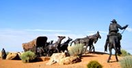
Covered wagon in Johnson County, Kansas
Santa Fe Trail – Pathway to the Southwest
Sources: See Santa Fe Trail Site Map & Writing Credits