
Washington Map – Click for 8×11 printable version.
Washington, in the extreme northwestern corner of the United States, is named for George Washington, the first U.S. President. Washington Territory was formed from part of the Oregon Territory in 1853 and became the 42nd state to join the Union in 1889.
The state is bordered on the west by the Pacific Ocean, Oregon to the south, Idaho to the east, and British Columbia, Canada, to the north. Washington is the 18th largest state, with an area of 71,362 square miles, larger than the combined areas of New York and West Virginia. It is the 13th most populous state, with a population exceeding 7.6 million, and its most significant metropolitan areas include Seattle-Everett and Tacoma.
The state has two major mountain ranges: the 7,000-foot Olympic Mountains, surrounded by temperate rainforest on the peninsula west of Puget Sound, and the more majestic Cascade Range, which boasts the 14,410-foot Mount Rainier and the volcanic Mount St. Helens, which erupted twice in the 1980s.
Capital:

The Washington State Capitol Building in Olympia by Carol Highsmith.
Olympia is the capital of the state of Washington. It is also the county seat and largest city of Thurston County, with a population of over 52,000. Located at the southern end of Puget Sound, the first recorded Europeans came to the Olympia area in 1792. European settlers claimed the area in 1846 with the Treaty of Medicine Creek in 1854. The town was platted by Edmund Sylvester in 1850 and became Washington’s first territorial Capital in 1855, retaining the title upon statehood. Today, the city thrives with activities ranging from government work to tourism and a vibrant small business scene. The Puget Sound offers fantastic views, boating opportunities, and excellent seafood.
Landmarks:
The Columbia Plateau – Also known as the Columbia Basin, is the site of one of the largest outpourings of lava the world has ever seen. Between 15 and 6 million years ago, basaltic lava flooded approximately 63,000 square miles, covering large parts of Washington, Oregon, and Idaho. The thickness of the lava flows reached 6000 feet, burying almost all the older rock in the area. Within this area are also the Great Plains of the Columbia east of the Cascade Mountains. These plains constitute an immense grazing ground, approximately 150 miles in width, covered with the finest grass in the world, and are well-watered. The soil is exceedingly fertile, and grain and fruits of all kinds are grown here in abundance.
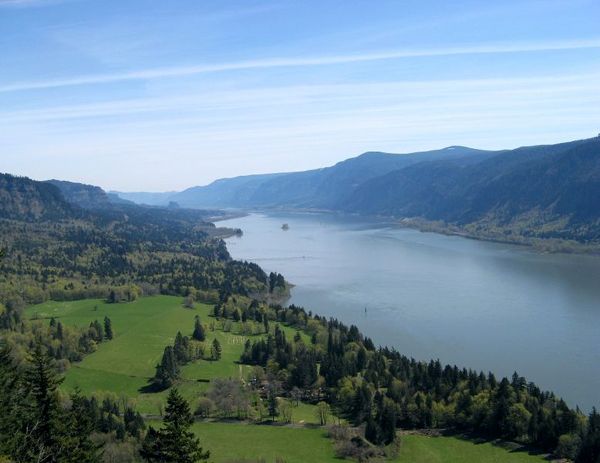
Columbia River in Washington state
The Columbia River – The great waterway of the Pacific Northwest, the river rises in the Rocky Mountains of British Columbia, Canada, before it flows south into Washington, then turns west to form most of the border between Washington and Oregon before emptying into the Pacific Ocean. The 1,243-mile-long river has long been a principal means of transportation for products and is also famous for its excellent salmon quality. Its great branches are the Snake and the Willamette Rivers.
Pacific Slope – Describing the geographic region west of the Rocky Mountains, this area slopes down to the Pacific Ocean and forms the principal part of the boundary between Washington and Oregon. During the days of westward expansion, the term was often used to describe the Northwest region, including the territories and the states that emerged from them, such as California, Oregon, Washington, Nevada, Idaho, and Utah.

Seattle Skyline along Alki Beach across Puget Sound by Carol Highsmith.
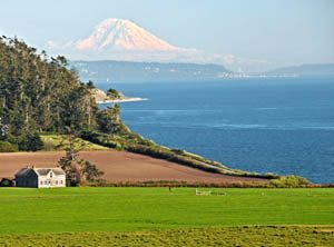
Puget Sound – An inlet of the Pacific Ocean, and part of the Salish Sea, Puget Sound is located along the northwestern coast of Washington. The term “Puget Sound” is used not just for the body of water but also for the Puget Sound region, which includes several major cities, including Seattle, Tacoma, Olympia, and Everett. One of the loveliest bodies of water in the Western Hemisphere, Hundreds of islands dot its shining surface. It is a complication of arms, straits, and inlets and has 1,400 miles of navigation, affording Washington more harbors than are formed by any other region of equal area in the world.
National Historic Sites & Parks:
Ferry House at Ebey’s Landing with Mt. Rainier in the background by the National Park Service.
Ebey’s Landing – Located in Coupeville, Washington, this stunning landscape at the gateway to Puget Sound, with its rich farmland and promising seaport, lured the earliest American pioneers north of the Columbia River to this part of the state. Today, Ebey’s Landing National Historical Reserve preserves the historical, agricultural, and cultural traditions of both Native Americans and Euro-Americans, while also offering spectacular recreational opportunities.
Fort Vancouver – located on the north bank of the Columbia River in present-day Vancouver, Washington- was a 19th-century fur trading post that served as the headquarters of the Hudson’s Bay Company’s Columbia Department. This park has a rich cultural past. History is shared at four unique sites, from a frontier fur-trading post to a powerful military legacy, the magic of flight, and the origin of the American Pacific Northwest.
Klondike Gold Rush – Seattle Unit – After surviving a devastating fire and an economic depression, Seattle flourished with the Klondike Gold Rush. As a key port city, merchants supplied would-be Klondike Kings and Queens on their way to Alaska. This cemented Seattle as an anchor of the Pacific Northwest. Today, the park serves as your gateway to learning about the gold rush, exploring Seattle-area parks, and engaging with the local community.
Lake Roosevelt National Recreation Area – This National Recreation Area, under the supervision of the National Park Service, encompasses the 130-mile-long Franklin D. Roosevelt Lake between Grand Coulee Dam and Northport, Washington, in the eastern part of the state. The Grand Coulee Dam was built on the Columbia River in 1941, and the first recreational area, the Coulee Dam Recreational Area, was established in 1947. It was renamed for President Franklin D. Roosevelt in 1997. The area provides opportunities for fishing, swimming, canoeing, boating, hunting, camping, and visiting historic Fort Spokane and St. Paul’s Mission. Another significant body of water in Washington is Lake Washington.

Stehekin at Lake Chelan, North Cascades National Park by Deby Dixon, National Park Service.
North Cascades National Park – Just 100 miles northeast of Seattle, the alpine landscape of the North Cascade Mountains beckons hikers, backpackers, and mountaineers. The national park encompasses more than 500,000 acres and is bisected by the Skagit River, which flows through the Ross Lake National Recreation Area. Long known as the North American Alps, the park is characterized by ruggedly beautiful jagged peaks, deep valleys, cascading waterfalls, and glaciers. The most expansive glacial system in the contiguous United States, it also includes the headwaters of numerous waterways and vast forests. This rugged wilderness was established as a national park in 1968.
Mount Rainier National Park – Mount Rainier, also known as Tahoma or Tacoma, is a large active volcano in the Cascade mountain range located 59 miles south-southeast of Seattle in Mount Rainier National Park. With a summit elevation of 14,411 feet, it is the highest mountain in Washington and is the most topographically prominent mountain in the contiguous United States. Spawning five significant rivers, subalpine wildflower meadows ring the icy volcano while ancient forest cloaks Mount Rainier’s lower slopes. Wildlife abounds in the park’s ecosystems.
Olympic National Park – Located in northwestern Washington in the north-central part of the Olympic Peninsula, this wilderness park also includes a narrow 63-mile strip along the peninsula’s Pacific Coast. Encompassing nearly a million acres, the park offers a fog-shrouded coast with booming surf and waves, manicured beaches, spectacular alpine country dotted with sparkling lakes, lush meadows, glaciers, and North America’s finest temperate rainforest. It was designated as a national park in 1938.

San Juan Island National Historic Park by the National Park Service.
San Juan Island National Historic Park – Located at Friday Harbor, Washington, San Juan Island is well known for splendid vistas, saltwater shore, quiet woodlands, orca whales, and one of the last remaining native prairies in the Puget Sound/Northern Straits region. It was also here in 1859 that the United States and Great Britain nearly went to war over possession of the island — a crisis ignited by the death of a pig.
Lewis & Clark National Historic Trail & Park – The 4,900-mile-long Lewis & Clark Trail, extending from Pittsburgh, Pennsylvania, to the mouth of the Columbia River, near present-day Astoria, Oregon, follows the historic outbound and inbound routes of the Lewis and Clark Expedition as well as the preparatory section from Pittsburgh, Pennsylvania, to Wood River, Illinois. The Lewis and Clark National Historic Park, near the mouth of the Columbia River, commemorates the Lewis and Clark Expedition at multiple sites in Oregon and Washington. Here, visitors can follow in the footsteps of explorers and discover the rich heritage of the native people in timeless rainforests, while enjoying majestic coastal vistas.
Oregon National Historic Trail – Spanning several states, including Missouri, Kansas, Nebraska, Wyoming, Idaho, Washington, and Oregon, this trail was one of the key migration routes that pioneers used on their way to the vast West. Spanning over half the continent, the trail proceeded over 2,170 miles west through endless plains, rolling hills, and mountain passes. The trail began in Independence, Missouri, and ended at the Columbia River in Oregon. Along this historic path, trail ruts and traces can still be seen, serving as reminders of the sacrifices, struggles, and triumphs of early American settlers.
Whitman Mission National Historic Site – Located just west of Walla Walla, Washington, Dr. Marcus Whitman, his wife Narcissa Whitman, and 11 others were slain by Cayuse Indians on November 29, 1847. The site commemorates the Whitmans, their role in establishing the Oregon Trail, and the challenges encountered when two cultures meet. The attack on the Whitmans horrified Americans and impacted the lives of the people of the Columbia Plateau for decades afterward.
Symbols:

Nickname – The Evergreen State

Washington State Flag

State Flower – Coast Rhododendron

State Tree – Western Hemlock

State Bird – Willow Goldfinch

State Animal – Olympic Marmot
State Song – “Washington, My Home”
State Motto – Into the Future
Washington Maps:
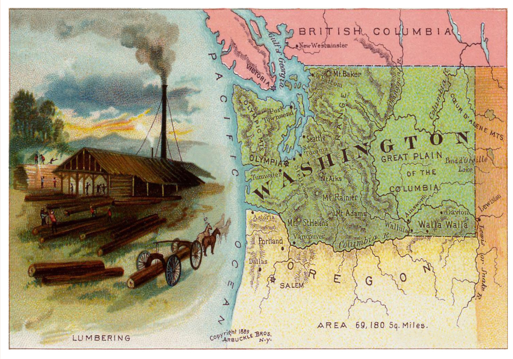
Washington Postcard, 1889. Click to print 8×11.
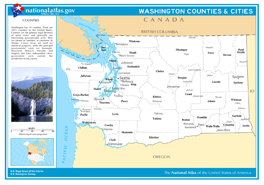
Washington Counties & Cities. Click to print 8×11.
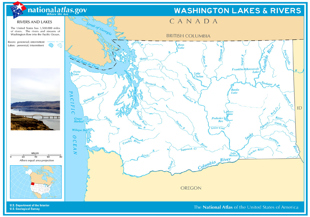
Washington Rivers & Lakes. Click to print 8×11.
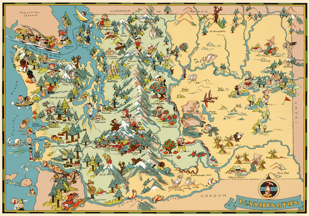
Historic Washington Pictorial Map. Click to print 8×11.

Washington Map – Click to print on 8.5×11 inches.
© Kathy Alexander/Legends of America, updated September 2025
Also See:
Washington – The Evergreen State
Westward Expansion & Manifest Destiny
See Sources.