You must live in the present, launch yourself on every wave, find your eternity in each moment.
— Henry David Thoreau
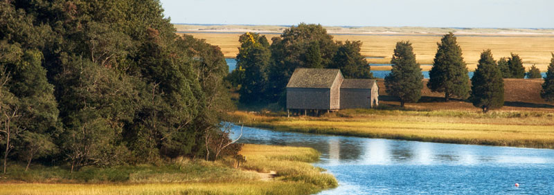
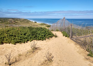
Cape Cod is a peninsula extending into the Atlantic Ocean from the southeastern corner of mainland Massachusetts. The name Cape Cod, coined in 1602 by Bartholomew Gosnold, is the ninth oldest English place name in the United States. Cape Cod National Seashore has long inspired wonder among those who value nature. From the striking heights of the coastal bluffs to the serenity of a forested pond, it’s easy to understand why so many become enamored with the natural beauty of this place.
Cape Cod extends from Provincetown in the northeast to Woods Hole in the southwest and is bordered by Plymouth to the northwest. The Cape is divided into 15 towns, several of which are made up of multiple named villages. Cape Cod forms the Gulf of Maine’s southern boundary, extending north-eastward to Nova Scotia.
The Cape is a glacial deposit constantly undergoing natural changes as winds and water move sand along the shorelines, tearing away one place and building up another. Visitors can get a good sense of how quickly the land diminishes at the Marconi Station Site at Wellfleet, where the peninsula is only a mile wide. Much of the high cliff has eroded since Guglielmo Marconi first built his towers there in 1901.
The history of the Cape Cod National Seashore region, during most of the period of white settlement, has been one of dependence on the sea for a livelihood. Protection of maritime activity off the Cape shore, through the development of lighthouses and the Life Saving Service, also played a role in the Cape’s history. Disruption of marine activities, from wars and the financial inability to adopt new fishing methods, brought depressions. Even during prosperity, the isolated Cape region took a backseat to the commercially prominent Boston area. After the Civil War, as fishing declined, the Cape residents turned to raising cranberries and promoting tourism. Finally, since the mid-1950s, it has succumbed to suburbanization.
American Indians began living on the Outer Cape about 10,000 years ago. Native American settlements were primarily concentrated around coastal areas and on the shores of ponds and other waterways. This pattern suggests that the area around the Salt Pond, unlike adjacent inland areas in the vicinity of present-day Eastham, may have had more use by early inhabitants. These people enjoyed a relatively stable cultural adaptation to an environment rich in subsistence resources. This included various food types, some of which varied seasonally.
They lived in locations like those surrounding Nauset Marsh and Wellfleet Harbor, allowing easy access to environments ranging from tidal flats and salt marshes to freshwater wetlands and wooded uplands. Their lifestyle did not require the movement of the principal residences. The plans of the villages were more dispersed than those known commonly among the Iroquois and Huron.
The Nauset Indians, a branch of the Algonquian Family, inhabited all of Cape Cod except for the extreme western end in which the Wampanoag tribe lived. They had a loose affiliation with the Wampanoag. Those Nauset villages on the upper Cape were dominated by the Wampanoag, while the ones more distant on the lower Cape enjoyed relative independence. Six Nauset villages were located in the proximity of what is now Cape Cod National Seashore. These villages included: Manamoyik, close to Chatham; Potanumaquut on Pleasant Bay near Harwich, Meeshawn in Truro township (Pilgrim Springs area); the main village called Nauset near Eastham, Pamet, near Truro; and Punonakanit by Wellfleet. In 1621 their population was estimated at 500.
For the most part, the Cape Cod Indians lived sedentary lives with agriculture as their main livelihood. They lived in small villages along the creek banks and the bays. Houses consisted of domed huts separated by their fields. These huts were constructed with a frame of green saplings bent into a semi-circle. Additional saplings were tied in horizontal circles around the frame. Strips of bark were sometimes placed over this skeletal structure, but most huts were covered with grass and reeds. A smoke hole was left at the top. Inside the huts, at the center, they made a stone-lined pit for the fire.
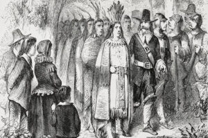
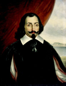
French explorer and navigator Samuel Champlain visited the Nauset and Monomoy bands during his two visits to Cape Cod in the early 1600s. He provided the best early description of their lifestyle. The Nauset that Champlain observed at Nauset Harbor in 1605 went naked except for covering appropriate areas of their bodies. Occasionally, they wore a robe made of grass and hemp, which came to their thighs. Both men and women painted their faces red, black, and yellow. In addition, the men cut the hair from the tops of their heads. Wild turkey feathers were placed in the hair for decoration. They lived in circular huts which were covered with a reed thatch. One-and-a-half-foot openings in the tops permitted the smoke to leave. These huts were not clustered together but were separated by cultivated fields that grew corn, beans, squash, tobacco, and a root that Champlain said tasted like artichoke. The Nauset practiced crop rotation, but the effectiveness was diminished because weeds covered the fields left fallow. Before planting, the vegetation was burned off the field, and the soil was turned with wooden spades.
Champlain noted that the Indians used two methods to prepare their corn for consumption. It was either boiled in an earthen pot or ground in wooden mortars. The flour from the latter process was used to make cakes. Shellfish formed part of the diet, although the abundant crabs were not consumed but used for fertilizer. The sharp point of the crab tails served as arrowheads, as did flint. The most common shells identified were clam, quahoag, conch, periwinkle, and oyster. A Smithsonian Institution survey in 1882-83 identified eight Indian village sites on the lower Cape by the shell heap remains.
In 1606, Champlain visited the Monomoy band at Stage Harbor. He found them living in a style similar to those at Nauset Harbor. Each hut contained one or two beds which were a foot off the ground. They were constructed of little pieces of wood over which was laid a mat two to three fingers thick. Again, the huts were separated by cultivated fields that were grown the same crops as those the Nauset band raised. Champlain noted that the Monomoy stored their corn in grass sacks buried five to six feet deep in the sand.
The Monomoy had bows, arrows, and clubs for weapons, but Champlain felt they were better fishermen and farmers than hunters. For fishing, the Indians used harpoons with bone heads and fishhooks.? Large rocks were used as whetstones to sharpen these implements and stone axes. One such rock can be found on Skiff Hill in Eastham. The Cape Indians preferred using snares to catch wild animals rather than shooting them with arrows. On the Pilgrim’s first exploration of the Cape, William Bradford, Jr. was caught in one such snare.
Thomas Morton, who lived in the Plymouth Colony area during the early 1620s, observed the Indians’ marriage and childbearing customs. Girls, who became of marriageable age, wore a flat, red-leather cap for 12 months to advertise their availability. After marriage, most girls were soon pregnant and continued to work until the birth of their child. The women, attended by midwives, delivered quickly and, within a day or two, returned to their toil. Infants were carried in cradles on their mothers’ backs. The cradle consisted of a board forked at both ends. The child, wrapped in furs, was bound to the board with its knees thrust upward.
Each Indian band lived within a political boundary on the Cape, with only a loose connection among the bands. In these areas, the concept of individuals owning parcels of land did not exist. The entire band held the land in common. Leadership in each band fell to a sachem or chief who retained the title within his family. As a result, the position of sachem occasionally fell to a woman when a chief had no sons. The elders of a band acted as advisors. The medicine man was another person of influence within the band. This individual performed a religious function since he called upon Hobbamock, the god of curable disease, to heal the sick. Religion included many other deities whose roles allowed the Indians to explain the natural phenomena which occurred. Chief among these gods was the creator, Kiehtan.
Explorers
Cape Cod was a landmark for early explorers. It may have been the “Promontory of Vinland” mentioned by the Norse voyagers (985–1025). Some claim the Manomet River area to have been visited by Leif Eiriksson. A stone wall discovered in Provincetown in 1805 is also claimed to have been built by his younger brother Thorvald Eiriksson around 1007 AD, when the keel of his ship was repaired in the harbor, according to Norse sagas. He was killed later in the same journey and is said to have been returned to this spot for burial. However, there is no tangible support for the presence of Norse voyagers in Cape Cod, and archaeologists or historians do not generally accept the view.
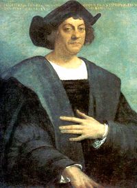
Christopher Columbus
Almost immediately after Christopher Columbus’ initial voyage, Europeans began to traverse the Atlantic to explore and map the coast of North America. Cartographers, in turn, used these men’s accounts and charts as the basis for additional maps. Three areas of the North American coast — Sandy Hook, Cape Cod, and the Bay of Fundy — made a strong impression on these early voyagers as most maps contained references to at least two of these locations.
Giovanni da Verrazzano approached it from the south in 1524. He named Martha’s Vineyard Claudia, after Claude of France, the wife of King Francis I of France. In 1525, Portuguese explorer Estevao Gomes called it Cabo de la Arenas while sailing under the Spanish crown.
As a result of the 1583 voyage of Stephen Bellinger, a Frenchman from Rouen, the Basques of St. John de tuz petitioned the French king for permission to plant a colony in the New England region. Some of these men did come to the region, for when the Bartholomew Gosnold expedition arrived in 1602, they found Indians using a Basque shallop with mast and sail. John Brereton, a member of the Gosnold group, felt these natives must have obtained it from the St. John de Luz Basques.
In 1602, Bartholomew Gosnold encountered Cape Cod while exploring the New England coast, looking for a colonization area and a passage to China. In his ship, the Concord, he sailed into Cape Cod Bay on May 15, 1602. Soon Gosnold was opposite Barnstable harbor. Since it appeared promising, he floated a half-shallop and rowed into the harbor with Brereton and three others. Finding the harbor too shallow for the Concord, they landed and explored. Returning to the Concord, he found that those on board had caught such a large quantity of cod fish that some had to be thrown overboard. This abundance of fish prompted him to name the place Cape Cod.
In 1605, French explorer Samuel de Champlain explored the cape and narrated his observations of Nauset Harbor, describing contact with the native population. His writings include crops planted, housing types, food storage methods, and dress styles. He also prepared a map showing the general location of several Native American villages surrounding Nauset Harbor. Some of these appear to be located in the vicinity of Salt Pond. The Nauset Archeological District, established as a National Historic Landmark in 1993, comprises six sites, three located adjacent to Salt Pond. These sites all contain evidence of native occupation from the Late Archaic to Late Woodland periods.
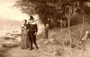
Henry Hudson landed at Cape Cod in 1609. Captain John Smith, of Jamestown, Virginia fame, arrived in 1614 and mapped the Cape coast as far as the Isle of Nauset on the ocean side. Although not published for several years, the Dutch “Figurative Map” of 1614 also charted the Cape, which they called Staten Hoeck. On November 11, 1620, the Pilgrims entered the “Cape Harbor” and made their first landing near present-day Provincetown. They stayed briefly before sailing across the bay to Plymouth. In 1624 William Alexander published the first map of the Cape with the name Cape Cod printed on it.
European Settlement
Cape Cod was among the first places settled by Puritan colonists in North America. The Cape’s 15 towns developed slowly, aside from Barnstable (1639), Sandwich (1637), and Yarmouth (1639). The final town to be established on the Cape was Bourne in 1884, breaking off from Sandwich. Provincetown was a group of huts until the 18th century. A channel from Massachusetts Bay to Buzzards Bay is shown on Southack’s map of 1717. The present Cape Cod Canal slowly developed from 1870 to 1914. The federal government purchased it in 1928.
When the Pilgrims landed in 1620, it was estimated that the Cape was about 97% covered with woods. The Indians had cleared small patches of land to grow their crops. These areas were usually near the bays or streams because the lower elevations were closer to the water table and the fish and crabs used for fertilizer. In addition, the Indians fired the woods twice a year, each spring and fall. This practice cleared the underbrush and provided tender new growth for deer. About 61% of the upper elevations of the Cape woods were touched by burning. As a result, the higher elevations had a park-like appearance. Trees growing below an altitude of seventy-five feet were protected from fire by a moister forest floor and by the ponds, swamps, and streams.
The Pilgrim farmers employed more intensive burning and cutting of trees than the Indians. This practice provided pasture for cattle and sheep, supplying wool for clothing. These animals destroyed the growth of young trees. Without a tree cover, the land dried. Huckleberries, blueberries, scrub oak, and sheep laurel spread over the treeless areas and created the condition to promote uncontrolled fires. These fires, in turn, killed more trees. So great was the destruction that the land became denuded. By the mid-18th century, areas of shifting sand dotted the Cape east of Yarmouth where woods had once been, and no large timber remained of the original Cape woods.
As the soil fertility decreased, farmers of the Cape sought to augment their income from other sources or slowly turned to other professions. The first non-agricultural supplement to their income occurred by accident. A whale called blackfish was so abundant in the area that they frequently became stranded on the beaches. Settlers would strip them of blubber and reduce it to oil. Soon individuals began to watch for the blackfish. Lookout towers were constructed in appropriate areas to observe their approach. When they were sighted, men would enter boats and drive them ashore. This activity led Cape residents to sail the local waters in search of whales. By 1650 whaling had come into its own as a vocation. Whaling increased the destruction of the woods. Large areas of trees were cut to furnish fuel to reduce blubber to oil. Coopers also needed trees to provide barrels to hold the whale oil.
By 1643, the colony at Plymouth was running out of arable land to support its growing population. One option that was considered involved splitting the colony and relocating part of the population to an inland site, but the land there was rocky and deemed unsuitable for cultivation. Another solution was to relocate the entire colony to a new location closer to the coast. The colonists were familiar with Nauset (later called Eastham) from earlier excursions into the area when they were initially establishing the colony. The land there was considered fertile and able to support agriculture, as evidenced by the natives’ agricultural subsistence practices. Two groups were sent out to explore the area. After determining that there was not enough arable land to “be competent to receive the whole body, much less be capable of any addition or increase,” it was decided that only a portion of the Plymouth colony would relocate.
In 1644, a group led by Thomas Prence (or Prince), Jr., John Doane, Edward Bangs, and others returned to Nauset and settled in the Town Cove area on the Lower Cape. This land was part of a parcel that members of the Plymouth colony had purchased from George and Mattaquason, the sachems of the Sauset and Monomoyick tribes, respectively. This parcel extended from Pleasant Bay in the south to Truro in the north, approximately 15 miles. The Nauset grant included the present towns of Eastham, Orleans, and Wellfleet. In 1646, Nauset was incorporated as a town by the General Court of Plymouth, and in 1651, the colonists changed its name to Eastham.
Surviving records indicate that most land grants to early Eastham residents were relatively small, with the average parcel at five acres or less. This followed the predominant colonial settlement pattern of the time, combining clusters of family farms into a unified settlement. The geography of Eastham supported this arrangement by providing a variety of land types to each family. Each grant included a salt marsh, typically called a meadow, upland usually already cleared by Native Americans, and a woodland plot. Together, these provided adequately for each family’s subsistence needs. By 1656, there was a population of 115 in the settlement. Families cultivated wheat, com, and English hay; planted apple and pear orchards; and kept cattle, pigs, sheep, horses, oxen, and fowl. Additional subsistence was
provided by fishing the locally abundant waters.
Thomas Prence, the leader of the new settlers, was an influential member of the Plymouth colony before he relocated. He continued to remain so after helping to establish the new settlement. Having served as colony governor for two years and as assistant governor for several more before leaving Plymouth, Prence was again chosen as governor of the colony in 1657. Instead of moving back to Plymouth, he was allowed to remain in Eastham. With the governor of the colony located there and the fact that it was the only organized town at the time beyond Yarmouth, Eastham became the center of political and religious life for the Lower Cape for several years.
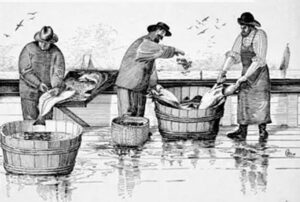
By 1660 the first Cape Codders began to sail the bay to fish. This industry encouraged related ventures, which in turn reduced the woods. Small fishing vessels constructed on the Cape required white pine for masts. Pitch pine provided resin, while other trees were severely damaged during tapping to obtain turpentine and tar. Salt was obtained by boiling sea water in open pans to preserve the fish. By 1670 salt production received serious attention and continued to grow as an industry. Fuel to boil the seawater, of course, came from the woods.
Lacking adequate roads, the Cape people depended upon small packet ships for transportation. These small coastal vessels carried produce to Boston, the main port of the neighboring Puritan colony. Local products included fish, pork, beef, mutton, hides, tallow, timber, oysters, and whale oil. In addition to the incipient fishing industry, these small commercial ventures fostered shipbuilding. Cape Cod, however, failed to develop economically. Geography played a part in limiting general prosperity, for the Cape lacked good ports. Provincetown was the only area with a port of any consequence; however, it was not well located to promote commerce. Capital, too, was scarce, and the Cape men did not have the contact with English merchants that the Puritans of Massachusetts Bay had. As a result, the Cape, like the rest of Plymouth Colony, relied upon Boston merchants who acted as middlemen for their imports and market for their products. The situation did not change after Plymouth became a part of Massachusetts in 1691.
By 1800, much of Cape Cod’s firewood had to be transported by boat from Maine. The scarcity of vegetation was worsened by raising merino sheep, which peaked in New England around 1840. The early industrial revolution occurred through much of Massachusetts and Rhode Island, but it mostly bypassed Cape Cod due to a lack of significant water power in the area. As a result, the Cape developed as a large fishing and whaling center.
Due to early colonial settlement and intensive land use, the Cape’s vegetation was thin, and trees were scarce when Henry Thoreau saw Cape Cod during his four visits from 1849 to 1857. Fires heated the settlers, and it took 10 to 20 cords of wood to heat a home, so they cleared most of Cape Cod of timber early on. They planted familiar crops unsuited to Cape Cod’s thin, glacially derived soils. For instance, much of Eastham was planted with wheat. The settlers practiced the burning of woodlands to release nutrients into the soil. Improper and intensive farming led to erosion and the loss of topsoil. Farmers grazed their cattle on the grassy dunes of coastal Massachusetts, only to watch “in horror as the denuded sands ‘walked’ over richer lands, burying cultivated fields and fences.” Dunes on the outer Cape became more common, and many harbors filled in with eroded soils.
After 1860 and the opening of the American West, farmers abandoned agriculture on the Cape.
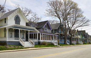
Cape Cod became a summer haven for city dwellers at the end of the 19th century. Improved rail transportation made the towns of the Upper Cape, such as Bourne and Falmouth, accessible to Bostonians. At the beginning of the 20th century, the Northeastern mercantile elite built many large, shingled “cottages” along Buzzards Bay.
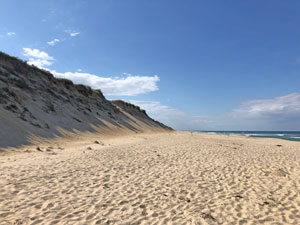
Guglielmo Marconi made the first transatlantic wireless transmission originating in the United States from Cape Cod at Wellfleet. The beach below the bluffs where his station was located is now called Marconi Beach. In 1914, he began constructing a new transatlantic wireless receiver station in Chatham and a companion transmitter station in Marion. In 1920, the stations were acquired by RCA, and in 1921, Chatham began operations as a maritime radio station communicating to ships at sea using the callsign WCC. The station supported the communications of Amelia Earhart, Howard Hughes, Admiral Byrd, and the Hindenburg. Marconi chose Chatham due to its vantage point on the Atlantic Ocean, surrounded on three sides by water. Much of the east-facing Atlantic seacoast of Cape Cod consists of wide, sandy beaches.
The Cape Cod National Seashore was created on August 7, 1961, by President John F. Kennedy. This protected the area from private development and preserved it for public use. Encompassing 43,607 acres, it includes ponds, woods, and the beachfront of the Atlantic coastal pine barrens ecoregion. The National Seashore includes nearly 40 miles along the Atlantic-facing eastern shore of Cape Cod, in Provincetown, Truro, Wellfleet, Eastham, Orleans, and Chatham. Large portions are open to the public, including the Marconi Site in Wellfleet. This park encompasses the site of the first two-way transoceanic radio transmission from the United States. The National Park Service administers it.
Recreation and Relaxation
Cape Cod visitors enjoy multiple opportunities for recreation and relaxation, including bicycle and hiking trails, swimming and surfing at several beaches, hunting, camping, fishing and whaling, and more. There are also several historic sites and buildings that can be seen and toured. Activity schedules are available at the visitor centers. Visitor Centers also provide publications, information, exhibits, audiovisual programs, and spectacular seashore views. These sites and activities are all part of the ambiance and charm that attract thousands of visitors to the Cape each year. Its historic maritime character and ample beaches attract heavy tourism during the summer months.
Beaches:
Marconi Beach, Wellfeet – Located at the end of Marconi Beach Road. This beach is situated in front of a steep glacial scarp and has stair access only. It is popular with surfers. The historic Marconi Station Site and the Atlantic White Cedar Swamp Trail are nearby.
Coast Guard Beach, Eastham – Located at the end of Doane Road. Summer access via shuttle from the Little Creek parking area. Coast Guard Beach is popular with families. Access is relatively gentle, and beach wheelchairs and Mobi-Mat are available in summer. Nauset Marsh and the historic Coast Guard station (not open to the public) are located nearby. The Nauset Bicycle Trail terminates at Coast Guard Beach.
Nauset Light Beach, Eastham – Located 1 mile north of Coast Guard Beach on Ocean View Drive at the intersection of Cable Road. This broad, sandy beach is in front of a steep glacial scarp. A hard-packed path leads from the parking lot down to the beach. Nauset Light and the Three Sisters Lighthouses are located nearby.
Head of the Meadow Beach, Truro – Located at the end of Head of Meadow Road. Access to this broad, sandy beach is over a tall dune. Waves are typically gentler here than at Marconi and Nauset Light beaches. This beach often has seaweed and large populations of seals nearby. The Head of the Meadow Bicycle Trail runs between this beach and High Head.
Race Point Beach, Provincetown – Located at the end of Race Point Road. Access to this beach is over a tall dune. Mobi-Mat is provided. This is a popular destination for whale watching from shore and for sunset viewing. Old Harbor Life-Saving Station and Province Lands Visitor Center are located nearby. The Province Lands Bicycle Trail has a spur to Race Point Beach.
Herring Cove Beach, Provincetown – Located on Province Lands Road by the end of Route 6. This beach has easy access and fully accessible facilities. Beach wheelchairs and Mobi-Mat are available in summer. Gentle surf makes this beach popular with families. It’s known for its views of Race Point Light, sunsets, and spring whale watching. There is a seasonal snack bar, and free concerts are held during the summer. The Province Lands Bike Trail has a spur to Herring Cove Beach.
Historic Buildings
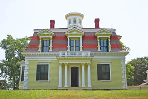
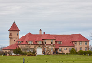
Penniman House, 70 Fort Hill Road, Eastham – The Penniman House, completed in 1868, was styled after the French Second-Empire period. It included every known comfort of the day and many innovative ideas. The Captain Edward Penniman family enjoyed this fine home for nearly 100 years. Seasonal tours. Limited parking.
Pamet Cranberry Bog House, 86 North Pamet Road, Truro – Originally constructed around 1830, the Bog House is located among former cranberry bogs in the Pamet Valley. It supported cranberry harvesting that occurred there until the 1960s. Views of the house can be seen from atop Bearberry Hill. Limited parking.
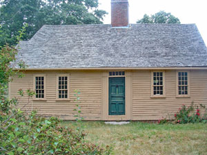
Atwood-Higgins House, 269 Bound Brook Island Road, Wellfleet – The Atwood-Higgins House is a fine example of a properly framed Cape Cod cottage, which grew from a half-house in the early 1700s to a full-Cape with eight rooms by the 19th century. The oldest house owned by the national seashore, it is ranked by an eclectic collection of later-vintage buildings. Seasonal tours. Limited parking.
Old Harbor Life-Saving Station, 191 Race Point Road, Provincetown – At Old Harbor, the National Park Service interprets the dramatic story of shipwrecks and the role of the U.S. Life-Saving Service in preventing shipwrecks and performing rescues. Seasonal open houses. A beach fee may apply.
Highland House, 27 Highland Light Road, Truro – The Highland House Museum occupies the Highland House, originally a hotel built in 1907. A visit provides insight into the people of Truro dating back to early European settlers and the native people who preceded them. 508-487-3397. Open seasonally and operated by the Truro Historical Society.
Area Lighthouses
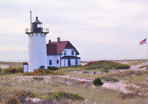
Race Point Light, Provincetown – The first Race Point Light was erected in 1816. The current lighthouse and keeper’s house date from 1876. Grounds are accessible by hiking from Race Point Beach or Hatches Harbor. No road access. From Route 6: turn right at the lights onto Race Point Road to its end. Park at Race Point Beach. Walk left for two miles. Beach fees may apply.
Long Point Light, Provincetown – This light at the entrance to Provincetown Harbor was first lit in 1827. The lighthouse and keeper’s cottage were rebuilt in 1875. Not open for tours. Caution: Hazardous conditions are possible along the breakwater. Summer boat service from MacMillan Wharf.
Monomoy Point Light, Chatham – The first Monomoy Light was erected in 1823 and rebuilt in 1849 with castiron plates lined with brick. Monomoy is now part of the Monomoy National Wildlife Refuge of the U.S. Fish & Wildlife Service. The island is accessible only by boat at the end of the five-mile-long South Monomoy Island.
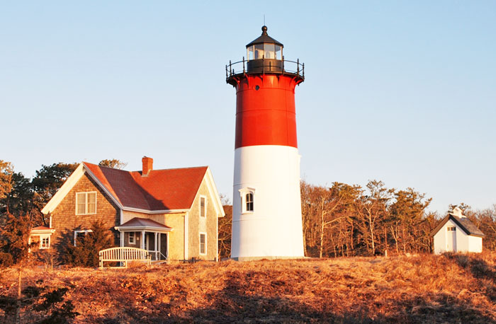
Nauset Light, Eastham – Nauset Light was built as one of the Chatham Twin Lights in 1877 and was relocated to Eastham in 1923. The tower and keeper’s house were moved back from the eroding shoreline to this site in 1996. Open seasonally and operated by the Nauset Light Preservation Society.
Chatham Light, Chatham – Chatham Light was built in 1808 as two brick towers with a keeper’s house. Two lights were used to distinguish it from the single light at Truro’s Highland Light. The United States Coast Guard maintains it.
Wood End Light, Provincetown – A twin to Long Point Light guarding the entrance to Provincetown Harbor, Wood End Light is located toward the end of the breakwater. Not open for tours. Caution: Hazardous conditions are possible along the breakwater. Summer boat service from MacMillan Wharf.
Three Sisters, Eastham – The original brick Three Sisters were built in 1838 to differentiate the location from Chatham and Highland. The brick towers were threatened by erosion, and these wooden ones replaced them in 1892 and were eventually relocated here in the 1980s. Located on Cable Road, a short walk from Nauset Light Beach. Limited parking at Three Sisters. Seasonal tours.
Highland Light, North Truro – Also known as Cape Cod Light, Highland Light was the first light seen on a voyage from Europe to Boston. In 1798, Highland was the first Cape Cod lighthouse built. The tower is closed for rehabilitation until 2021. The Keeper’s House store and exhibits are open seasonally and operated by Eastern National, Inc.
U.S. 6 is the main route to and through the national seashore. Buses run from Hyannis to Chatham and Provincetown. Airlines operate between Hyannis and Boston, Providence and New York, and between Boston and Provincetown. Amtrak provides limited service to Hyannis on weekends in the summer. There is a seasonal ferry service between Boston and Provincetown.
© Kathy Alexander/Legends of America, January 2023.
Also See:
National Parks, Monuments & Historic Sites
Ship Wrecks of Cape Cod, Massachusetts
Sources:
National Park Service Brochure
National Park Service – Cape Cod National Seashore
National Park Service Publications
National Park Service Publications – 2
National Park Service Publications – 3
Wikipedia – Cape Cod
Wikipedia – Cape Cod National Seashore

