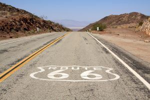
The stretch of Route 66 that passes through California extends from the Colorado River near Needles to, the Pacific Ocean at Santa Monica. Traveling through deserts, mountains, ghost towns, metropolitan areas, and beach communities, California’s 320 miles of the Mother Road provide various geography, cultures, architecture, and photographic opportunities.
Long before Route 66 was built in 1926, California had attracted adventurers, explorers, gold seekers, and other hardy pioneers to this land of abundant resources. Only those very hardy crossed the Mojave Desert to reach this Promised Land, which was isolated by its mountains and deserts.
However, Route 66 finally made the Golden State accessible to thousands of travelers seeking the dream that California provided. Before Route 66, California had long become independent, relying only on itself for many of the new inventions of the early 1900s, supplying its manufacturing of automobiles, appliances, and other materials due to the high transportation costs of moving items from the East.
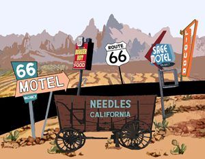
Needles, California Custom Postcard. Click to see all our Route 66 Postcards at Legends’ General Store.
At the time, only one railroad line, with a single track, entered the southern portion of California. When Route 66 came through, this all changed as thousands of people poured into the state and cargo loaded upon trucks traveling the new road.
After crossing the dreaded Mojave Desert, travelers breathed a sigh of relief as they approached the fertile San Bernardino Valley. The tourist industry flourished in these early years as it sprouted services, cafes, and motels that many travelers had been without while traveling the long stretch of the desert.
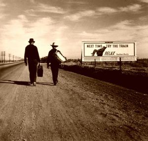
In the 1930s, during the dust bowl days of the Midwest, thousands fled to the “Paradise” of California to such a degree that California got scared. An independent state that had long been isolated, the “powers that be” worried about all the people flooding California and instituted highway inspection stations to weed out the “non-worthy.” Disguised as agricultural stations, many people were disappointed when they were turned away by the lack of money required to pay the bribe to enter the state. According to the legend, some of these “would-be” Californians, without money or means to move forward, walked out into the desert, never to be seen again.
Ultimately, it took federal authorities to break up this illegal ring of inspection stations; however, to this day, agricultural checkpoints still exist before entering California.
Like other states, many vintage icons along the old Mother Road have been obliterated by the bustling population’s desire to build “new and shiny,”, especially in the cities, where you will need to search harder to find the Route 66-era views.
However, you will still find several vintage icons in the lonely ghost towns of the Mojave Desert, peeks of old buildings tucked between strip centers in the suburbs, and numerous historic landmarks on the Route 66 corridor in Los Angeles County.
In the Mojave Desert, where I-40 bypassed the towns, the few remaining remnants are quickly eroding, so be sure to take lots of pictures now.
95% of the original road is still drivable through California, and the California Route 66 Preservation Foundation is working hard to preserve those remaining icons of the past. Some of the fascinating points of interest along old Route 66 are near the western end of the old route, where Los Angeles County has 34 National Registered Historic Places on or within one block of the Mother Road.
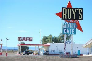
In any event, you will begin your trek across California at Needles, which provides a peek of several vintage motels before you move into the Mojave Desert and the lonely ghost towns of Goff, Essex, Chambless, Amboy, and Ludlow before rejoining I-40.
Take a side trip to the historic ghost town of Calico on your way into Barstow. In Barstow, you can still see many vintage icons, including the El Rancho motel, constructed from railroad ties, and the restored Harvey House Hotel and depot, which houses the Route 66 Museum.
The road continues along the path of the Old Trails Highway to Victorville, where you can take a peek at the California Route 66 Museum.
As you continue your journey into the San Bernardino Valley, you will quickly know that you are entering the sprawling Los Angeles proper; however, San Bernardino provides a view of several vintage businesses and the world’s first McDonalds, which is now a museum.
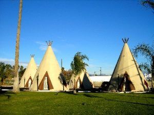
And don’t miss the infamous Wigwam Motel on the border between San Bernardino and its suburb Rialto, which once rented its rooms by the hour with its sign displaying “Do It In a Teepee.”
Continuing through Fontana to Rancho Cucamonga, don’t miss the old 1920s gas station and the Route 66 Visitors Center and Museum. As you pass through Upland, grab a buffalo burger at the landmark Buffalo Inn before making your way to Pasadena.
From here, the original road survives for 80 miles through Los Angeles and its suburbs, known variously as Foothill Boulevard, Colorado Boulevard, Huntington Drive, Sunset Boulevard, and Santa Monica Boulevard, until you reach the western end of the Mother Road at the Santa Monica Pier.
Check out the historic 1913 Colorado Street Bridge in Pasadena, continue to downtown Los Angeles, where you can see dozens of historic buildings, and move on through Hollywood and Beverly Hills for a peek at the “stars” before finally reaching Santa Monica.

