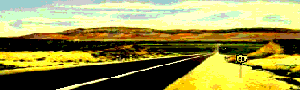
San Gabriel Valley, 1900.
Lying at the base of the San Gabriel Mountains in California, the 200-square-mile valley that was once primarily agricultural is today highly developed into a diverse urban area. Steeped in history, the drive through the valley provides an abundance of museums, historical landmarks, roadside peeks, and entertainment for a new generation of Route 66 travelers. To the north of the valley, in the San Gabriel Mountains, adventurous travelers can find hiking trails, camping, water sports, and old mining towns among the forests and canyons.
San Dimas – A Slice of the Old West
Straddling the San Gabriel and Pomona Valleys, San Dimas was first called Mud Springs when settlers arrived in the early 1800s. Part of the Rancho San Jose, the last Spanish land grant, the area was swampy, hence its nickname.
The San Jose Ranch Company officially formed the town when the railroad came through in 1887, and the community’s name was changed to San Dimas to reflect the San Dimas Canyon to the north. E.M. Marshall opened the first business – a hardware store near Bonita and Depot Streets.
A hotel was built for the expected rush of settlers in each of the townsites along the railroad. However, the land boom lasted only two short years before collapsing in 1889, without the San Dimas Hotel ever having had a single visitor. This historic building is the only one of the many hotels from San Bernardino to Los Angeles that has survived into modern times. When the hotel failed, it was purchased by the J.W. Walker family, which occupied the home for six generations from 1889 to 1978. After a stint as a restaurant, the old hotel was listed on the National Register of Historic Places and is now owned by the City of San Dimas. Also known as the Walker House, Carruthers Home, and the San Dimas Mansion, the historic landmark is located just north of Bonita Avenue and San Dimas Avenue.
San Dimas developed as an agricultural center like the many other small towns along the railroad. After trying several crops, area farmers recognized that oranges, lemons, and avocados performed best. The city once boasted four citrus packing houses and a marmalade factory. It was here that the Sunkist name, spelled initially “Sunkissed,” originated. The San Dimas Feed Company, established in 1897, continues to operate today and is the city’s oldest business. Unfortunately, by the 1950s, the citrus trees were affected by a disease, and the quiet agricultural life ended as groves were cleared for housing tracts.
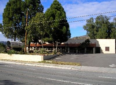
Pinnacle Peak’s Steakhouse has served Route 66 travelers in San Dimas, California, for decades, by Kathy Alexander.
San Dimas today prides itself on its heritage, especially its Old West heritage. In the 1970s, a “Western Village” concept was developed for the downtown core, complete with wooden sidewalks and false wood storefronts for a frontier look. In the fall each year, San Dimas hosts a rodeo at Horsethief Canyon Park along with Western days, and a myriad of equestrian paths exist throughout the city.
Other historical peeks can be seen at the San Dimas Train Depot, which now serves as a museum, located on Bonita Avenue at the west end of Old Town; the old hotel, called the Walker House today, is just north of the intersection of Bonita and San Dimas Avenues; and the Chamber of Commerce located in the historic Martin House at 246 East Bonita Avenue.
While in San Dimas, a “must stop” if you’re hungry is the Pinnacle Peak Steakhouse at 269 W. Foothill Boulevard. You will find great mesquite-broiled steaks in an Old West saloon-type atmosphere here.
Boasting a wagon train in its parking lot, Pinnacle Peak has been serving great food to travelers of the Mother Road for decades. But, know going in that this is no “fancy” place. If you wear a tie in here, you’ll soon find it dangling from the ceiling with hundreds of other ties “donated” by the many other patrons who made the same mistake.
Glendora – Route 66 Proud
Within just a few blinks, you will know you have entered Glendora, very easily the proudest Route 66 town along this stretch of the vintage highway. Dotted with signs and businesses named after the famous road, Glendora was the first city in California to change the name of its main street, Alosta Avenue, back to Route 66.
The Glendora area was first settled by former Confederate soldiers John Bender and Bryant Cullen in 1874, when both were homesteading 160 acres. Soon, more families moved into the area, and when the railroad came through in 1887, the town was laid out and named “Glendora” by a large landowner, George Whitcomb. The name was coined from the glen behind his home and his wife’s name, “Ledora.”
The new settlers began to plant castor beans, wheat, potatoes, and the ever-present citrus groves. By the turn of the century, Glendora had become the center of the citrus industry, shipping products worldwide. Over the years, the city continued to grow, and orchards were replaced with new homes and businesses.
In addition to Glendora’s new signs and businesses along the Mother Road, the city continues to sport several vintage views of an earlier time along the path.

Golden Spur Sign, Glendora, California, by Kathy Alexander.
At 1223 E. Route 66 once stood the Golden Spur Restaurant, which had a history dating back some 100 years. Though its stucco exterior belies its long history, the Golden Spur began as a ride-up hamburger stand for the equestrian crowd. For decades, the old restaurant offered a full steak-and-seafood menu, but its vintage neon sign, complete with a cowboy boot, remains a reminder of its colorful past. Unfortunately, The Golden Spur closed in October 2018.
On the southwest corner of the intersection of Route 66 and Loraine hides a 1940s gas station. You’ll never see this wonderful relic, camouflaged by a tall evergreen hedge and a chain-link fence, unless you stop and look for it. A bit further down the road at 437 E Route 66, look for the old Alta-Dena Dairy painted in a myriad of vibrant colors, and at 619 W. Route 66, you will see the Palm Tropics, one of the best-maintained old motels along the route.
Glendora also sports a quaint downtown district where several buildings haven’t changed for over a century. In addition, Glendora hosts several annual festivities celebrating its rich heritage, including Flashback to the ’50s, the Great Glendora Festival, and the Route 66 Mile Run.
Azusa – The Canyon City

Azusa, California Sign
Nestled at the foot of the San Gabriel Mountains, Shoshonean Indians, known locally as the Gabrielino, were roaming the area when homesteaders began to settle the land. Known to the Indians as Asuksagna, meaning either “a place of water” or “skunk,” depending upon who you talk to, it was from this Indian word that the city would take its name.
The land was granted to Luis Arena in 1841, who sold his holdings three years later to Henry Dalton, a wealthy merchant from Los Angeles. Dalton called his holding the Azusa Rancho de Dalton. He soon planted vineyards and built a winery, a distillery, a vinegar house, a meat smokehouse, and a flour mill. When floods destroyed many of the mills in the canyons between Dalton’s property and San Bernardino, the Azusa mill prospered.
Gold was discovered in nearby San Gabriel Canyon in 1854, which brought a flood of miners to the new boomtown of El Doradoville, built at the fork of the San Gabriel River. Over the next 20 years, some twelve million dollars in gold was taken from the El Doradoville mines. However, the entire town was destroyed during the floods of 1861 and 1862.
In 1860, Dalton’s ranch was resurveyed by the United States Land Office, resulting in 1.5 miles being removed from its southern and eastern boundaries. The land was then opened for homesteading, bringing another influx of people into the area.
In 1881, Dalton lost the title to all but 55 acres of the land to a Los Angeles banker named Jonathan Slauson. Over the next several years, the rancho was divided, providing more land for newcomers, and in 1868, the first school was built. In 1887, when the railroad barreled through, Slauson formed the official townsite of Azusa.
Though modern in all its amenities today, Azusa still offers several glimpses into the past. The old Azusa railroad depot still stands, and the historic bank building housing Wells Fargo is at the intersection of Route 66 and Azusa Avenue.

Azusa, California Drive-In Theater by Kathy Alexander.
Azusa’s most famous icon is its classic red neon sign featuring the Foothill Drive-In. In operation not so long ago, the single-screen drive-in closed in 2001 after being purchased by the neighboring Azusa Pacific University. Stalling plans for classrooms and dorms on the site, the California Route 66 Preservation Foundation secured the drive-in as a California State Historic landmark. However, in October 2005, the theater’s screen came tumbling down to make way for a college parking lot. However, the historic sign has been preserved for future Route 66’ers.
Just west of the theater marquee, look for two vintage motels with signage at the Colonial Motel at 534 E Foothill Boulevard and the Stardust Motel at 666 E Foothill Boulevard.
Just two more blocks west will bring you to Azusa’s elegant 1932 City Hall, Auditorium, and Library complex, which looks much the same as when Mel Blanc popularized the city on the Jack Benny radio show in the 1930s and ’40s.
Outside of town in San Gabriel Canyon, another rich view of the past can be found on large boulders covered with Indian markings. This also will lead the adventurous traveler along a treasure-seeking side trip of abandoned gold mines that dot the San Gabriel River as it winds its way north from Azusa.
Irwindale and Duarte – Leaving the Past Behind

Route 66 Products.
As you continue to drive the “burbs” of Los Angeles, you will soon arrive in the Cities of Irwindale and Duarte, settled initially as yet another land grant. Here too, the Gabrielino Indians lived before the governor of Alta, California, granted the land to an ex-Mexican Corporal, Andres Duarte, in 1841. The 7,000-acre parcel was named the Rancho Azusa de Duarte.
However, by the 1850s, Duarte found himself in financial trouble and sold most of the land to Dr. Nehemiah Beardslee, who soon divided the land into 40-acre plots, started the first school, and laid out water lines for new residents.
Early pioneer families began buying property for its fertile soil and pleasant climate, and the area soon thrived as an agricultural community. Duarte remained primarily an agricultural area until after World War II, when it was essentially converted into a residential community. Irwindale has since developed into an industrial community with numerous plants, including a Miller brewery and Health Valley Foods.
Of Route 66, a couple of glimpses of the vintage past can be seen at the old motor courts of the Capri Motel at 2435 Huntington Drive and the Evergreen Motel at 1648 Huntington Drive in Duarte. Two more fun and informative stops include the Justice Brothers Racing Museum at 2734 E. Huntington Dr. and the Duarte Historical Museum at 777 Encanto Parkway.
Monrovia – Gem City of the Foothills
Monrovia is part of what were once two large ranchos: Azusa de Duarte and Santa Anita. Over the years, the ranchos were subdivided, and in 1884, William N. Monroe, a railroad builder, purchased 240 acres, which soon became known as the Monroe Ranch. Gracious hosts, the Monroes frequently entertained friends from Los Angeles, and by the end of 1885, three of these friends also purchased acreage in the area, and the group decided to establish a town. In honor of W.N. Monroe, the new 60-acre townsite was named Monrovia. Lots were first offered for sale on May 17, 1886, and the Gem City of the Foothills was born.

Monrovia, California, 1949.
The very next year, the town was incorporated under the leadership of prohibitionists who wished to control the arrival of an unwelcome saloon. One of the first orders of business for the newly formed government was to pass a tippler’s law prohibiting the sale of alcohol.
Shortly after the turn of the century, the Pacific Electric was opened, providing transportation to and from Los Angeles, making it possible for Monrovians to commute to work, and the town began to grow.
Today, Monrovia is primarily a residential community of nearly 40,000 people, but it still offers glimpses of its past. One block north of Colorado Boulevard on Shamrock, a vintage gas station stands on an older alignment of Route 66.
On West Foothill Boulevard are several vintage motor courts, including Harding Court, a 1921 property of 15 bungalows now designated as a historic landmark. Today, the property has been completely restored.

The Aztec Hotel in Monrovia, California, by Jim Hinckley
Further down the road is the historic Aztec Hotel at the corner of Foothill and Magnolia. One of the unique Route 66 structures in California, the hotel was designed in 1925 by architect Robert Stacy-Judd, whose creations were inspired by Mayan and Aztec buildings. A local showplace during these early days, the Mayan murals, Native-American-themed lobby, brass railings, stained glass, and numerous antiques awed its guests. The historic hotel once boasted the city’s most prominent beauty salon, barbershop, and pharmacy. Restored today, the hotel continues to entertain Route 66 travelers in its casual atmosphere, where you can stay the night or drop into the hotel’s exotic Elephant Bar and Restaurant.
On the post-1933 alignment of Route 66, at Huntington and Drive and Mayflower Avenue, sits the Pottery Ranch, which has been doing business for decades, providing everything from replacement plates to outdoor water fountains.
If you’re looking for some shopping, Old Town Monrovia provides ten square blocks of quaint Main Street America, providing shops, clubs, cafes, boutiques, and more. Between March and December, the streets shut down for the weekly farmer’s market on Friday nights, where you will also find California-grown produce, crafts, and various other items.
As you near Arcadia, look for the life-size cow marking Mike’s Diary Drive-thru on the southeast corner of Mayflower.
Arcadia – Racing Into the Future
Once a 13,000-acre land grant was established in 1845, the area was called the Rancho Santa Anita. Over the next three decades, Rancho Santa Anita changed ownership five times until, in 1875, Elias J. “Lucky” Baldwin purchased approximately 8,000 acres of the original ranch.
Having grown rich from investments in gold and silver mines, Baldwin’s initial purchase price of $200,000 would pay him vast returns when he split up the acreage into the Santa Anita tract that would become Arcadia.
Baldwin began to develop the enormous estate, which at its height encompassed the cities of Sierra Madre, Arcadia, Monrovia, El Monte, and Baldwin Park. The rancho grew oranges, lemons, grapes, and walnuts; supported large herds of cattle, sheep, and horses; and produced wine and brandy. Among the horses that roamed the large ranch, some were bred as fine racehorses, and Baldwin began to run his thoroughbreds nationwide during the last two decades of the 19th century.
Baldwin became its first mayor when the town was officially incorporated in 1903. But the following year would fulfill Baldwin’s dream – building the Santa Anita Race Track.

Santa Anita Racetrack, Arcadia, California, 1908.
Located at the present site of Arcadia County Park, the grandstand presented a beautiful view of the San Gabriel Mountains behind the running thoroughbreds. But for Baldwin, his dream was not to last. In 1909, California banned horse racing, forcing the race track to close. Baldwin died the same year.
In 1912, the grandstand burned, and the property went unused until 1917, when Anita Baldwin sold the land to Los Angeles County, which deeded it to the War Department, which utilized it as an Army balloon school during World War I.
As Los Angeles grew in the post-war period, Arcadia grew along with it, as more and more homes and businesses were built. When Route 66 was completed through the area in 1931, it barreled through Baldwin’s old rancho.
In 1933, the Army returned the land on which the original racetrack stood to Los Angeles County, which developed it into Arcadia County Park.
After horse-racing bans had been lifted in California, the present Santa Anita Race Track was opened to the public on Christmas Day, 1934. As prosperity returned after the depression and travelers began to travel the “new” Route 66, Arcadia responded by building numerous motels and restaurants.
During World War II, the racetrack closed and was utilized as one of the largest Japanese American concentration camps. The government forced over 100,000 American citizens to abandon their homes and businesses, which were often never recovered. Initially planned for 15,000 people, the camp housed over 20,000 Japanese Americans, living in crowded conditions in barracks and sometimes in horse stables.
When the war was over, the racetrack opened up again in May 1945, and within the next two decades, several of the horses from Santa Anita went on to win the Kentucky Derby.
Today, just some 20 miles from downtown Los Angeles, Arcadia’s approximately 55,000 residents enjoy quiet neighborhoods, numerous parks, and tree-lined streets.
In addition to the race track, visitors can enjoy the Los Angeles State and County Arboretum, established in 1947 at 301 North Baldwin Avenue. Situated on the original Rancho Santa Anita, the Arboretum includes 127 acres of gardens, waterfalls, and wildlife, an 1840 adobe house, the original Santa Anita Railroad Depot, and original buildings from the Baldwin family.

Denny’s Windmill in Arcadia, California.
Check out Denny’s restaurant at the corner of Santa Anita and Huntington Streets for a vintage view of Arcadia’s past. Originally the site of a Van de Kamp’s coffee shop, the site now features a large Dutch-style windmill on its roof. More history can also be found at The Derby, a restaurant dating back to 1938. Opened by George Woolf, the jockey who rode Seabiscuit to victory, the restaurant soon became a gathering place for jockeys and race fans. Here you will find a wide variety of menu items, including steaks, seafood, and race track memorabilia dating back to 1875. The Derby is located at 233 East Huntington Drive.
For the more adventurous traveler, Angeles National Forest, just north of Arcadia, provides camping, picnicking, recreation trails, and more.
In Irwindale, Foothill Boulevard (and Route 66) turns into Huntington Drive, continuing through Duarte and Arcadia, connecting with Colorado Place at the Santa Anita Racetrack. Follow Colorado Place northeast to Colorado Boulevard and continue your Route 66 journey westward to Pasadena.
©Kathy Alexander/Legends of America, updated November 2025.
Also See:
See Sources.