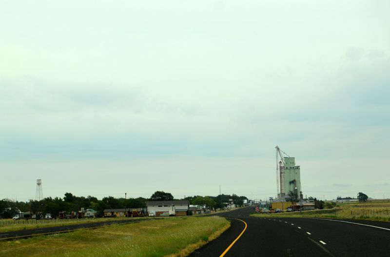
Route 66 Eastbound into Groom, Texas.
Long before Groom, Texas, became a town, Captain Randolph Barnes Marcy explored and charted the area in 1849 as he traveled from Fort Smith, Arkansas, to Santa Fe, New Mexico, along the Canadian River. Ten years later, he published his findings, including maps and illustrations, in a book entitled The Prairie Traveler: A Handbook for Overland Expeditions.
In 1882, Colonel B. B. Groom, an experienced cattleman from Lexington, Kentucky, leased from the New York and Texas Land Company nearly 600,000 acres of land in Hutchinson, Carson, Gray, and Roberts Counties in the Texas Panhandle and organized the Francklyn Land and Cattle Company. Unfortunately, Groom’s vision of the best and most desirable cattle ranch in the United States did not materialize, and the company went bankrupt four years later. However, the Colonel was not forgotten, as the site was chosen in 1902 as a station along the Chicago, Rock Island, and Gulf Railway route, and it was named after him.
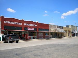
Groom, Texas Downtown.
In 1903, a general store, post office, and mercantile store were established. By 1906, the town boasted a barbershop, a bank, a hotel, a lumberyard, a school, and several more new businesses. The town was incorporated in 1911 with more than 250 residents. While it benefited from the oil boom of the 1920s and traffic along Route 66, it never grew beyond about 800 people.
Old service stations and local farmers and ranchers once made a big business pulling stranded cars out of the infamous Jericho Gap, a stretch of muddy road East of Groom. Travelers who weren’t stranded breathed a deep sigh of relief as they entered the small town without falling prey to the treacherous road.
Today, Groom’s sleepy little village is home to only about 575 people, and many of the services that once catered to Route 66 travelers have closed.
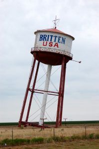
Britten Water Tower, in Groom, Texas, by Dave Alexander.
On the East side of Groom at exit #114 of I-40, Route 66 travelers will pass by the old Britten Truck Stop. This once-busy stop, with its leaning water tower, once had a garage and a restaurant. Though the business is long gone, the tall sign’s vestige remains standing next to the water tower. Many people have wondered how this water tower came to stand this way, some thinking one leg is shorter than the others. Not true, and the tower wasn’t swept to one side by a raging Texas tornado. Quite simply, it was planned that way, making for a good gimmick and lots of traffic at the Tower Restaurant when travelers stopped to inquire.
The water tower once served as a functioning water tower. Still, it was slated for demolition until Ralph Britten bought it and moved it to its current location to draw attention to his truck stop and tourist information center.
After taking advantage of the photo opportunities at “Britten, USA,” travel under I-40 to follow Route 66 into Groom. Follow this route to Western Street (Ranch Road 295) and turn right (North) onto County Road BB, then turn left (West) to see the Groom Cross.
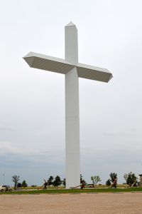
Groom, Texas Cross by Kathy Alexander.
Steve Thomas of Pampa, Texas, built the 19-story cross, standing 190 feet tall, in 1995. Mr. Thomas, disgusted with the huge billboards advertising XXX pornography locations along I-40, wanted to make a public profession of faith along the Interstate. Inspired by a cross built by a rancher in Ballinger, Texas, the Cross was built on Chris Britten’s private property.
More than 100 welders built the cross frame in two shops in Pampa, Texas, and erected it in July 1995. The freestanding cross is visible from 20 miles away. Life-sized statues of the Stations of the Cross surround its base. Today, ten million people pass by the Cross each year, and about 1,000 stop each day for a closer look. The Cross is located just West of Groom, South of I-40.
Route 66 follows the South frontage road of I-40, where it joins Texas Highway 207 to Conway, Texas, about 16 miles West of Groom. Highway 207 turns North in Conway, where it joins I-40. Several newer Route 66 buildings include the old Longhorn Trading Post, two closed restaurants, a gas station, and two motels.
However, the original Route 66 continues West from Conway’s old townsite, where the grain elevators stand, following FM 2161 for 7.2 miles before rejoining I-40. This short stretch of highway is listed on the National Register of Historic Places.
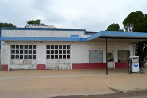
1949 Chevron Station in Groom, Texas by Kathy Alexander.
©Kathy Alexander/Legends of America, updated September 2026.
Also See:
About Texas Route 66 – Info & History
See Sources.