
Santa Fe Trail through Barton County, Kansas
Beyond Plum Buttes in Rice County, the Santa Fe Trail continues west into Barton County, Kansas. At a distance of about five miles, the Santa Fe Trail comes to the Big Bend of the Arkansas River in southwest Ellinwood, Kansas. Here, once, sat a large campsite and a burial ground for many of those who had died along the journey. Unfortunately, their graves were never marked.
Following the river, the trail reached Walnut Creek Crossing, about two miles east of Great Bend. The crossing once included a trading ranch, a toll bridge, and a military post. The trading post, a large log building, was established by William Allison and Francis Boothe in the summer of 1855. The Walnut Creek Ranch was the first non-military building erected west of Council Grove.

Arkansas River at Great Bend, Kansas
In the years that followed, the trading post had several owners. In September 1857, a Mexican murdered Francis Boothe, and two years later, in April 1859, Allison traveled to Missouri and, while there, died of heart failure. George Peacock of Independence, Missouri, was the next to own it. He was killed in September 1860 by a Kiowa Chief named Satank. Shortly after Peacock’s death, the post was taken over by Charles Rath, a well-known buffalo hunter, who operated it until 1867. It was then taken over by a man named Joseph W. Douglas until the store was burned down on May 19, 1868, by Arapaho and Cheyenne Indians.

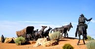
Fort Zarah site, Barton County, Kansas, by Kathy Alexander.
When the creek flooded, wagon trains would camp on its banks for days waiting to cross. It was one of the first streams in the region to have a toll bridge.
The Walnut Creek Crossing is about two miles east of Great Bend and south of US Highway 56. The trading post was about 100 yards from the crossing of Walnut Creek, on the east side of the creek and north of the Santa Fe Trail. Today, only the foundations remain.
The trail then passed by the site of Fort Zarah, which comprised a large stone building with quarters for officers and troops, kitchens, mess halls, storerooms, and other functions. This post was abandoned in 1869 when it was felt that the Indian threat was insufficient to warrant a second post so close to Fort Larned. The site is located in a roadside park on the north side of US Highway 56, just east of Great Bend.

Pawnee Rock, Kansas
From here, the trail rounded the north, or great, bend of the Arkansas River, turning southwest near the present-day town of Great Bend and passing out of the county close to the famous “Rock Point,” later known as “Pawnee Rock.”
One of the best-known natural features along the Santa Fe Trail in Kansas, Pawnee Rock, is an outcropping of Dakota sandstone named for a battle with the Pawnee Indians. During the trail days, the rock was nearly 30 feet higher than today, and many travelers carved their names into the sandstone. Over the years, however, large amounts of rock were removed for the railroad and home construction. However, visitors can still enjoy this relatively high landmark’s panoramic views across the prairie. Today, it is a Kansas State Historic Site located ½ north of US Highway 56 on the north edge of Pawnee Rock, Kansas.
“After leaving Pawnee Rock, the fear of the Indians was with us day and night…and when we reached Fort Mackey (Fort Atkinson) on the Arkansas River, we breathed a sigh of relief.”
— Marian Russell, near what would become Fort Dodge, 1852
©Kathy Alexander/Legends of America, updated March 2026.


West to Pawnee County
Also See:
Santa Fe Trail – Pathway to the Southwest
See Sources.
See Sources.