
Delaware Water Gap, from Winona Cliff, Pennsylvania, by William H. Jackson, about 1900.
The Delaware Water Gap National Recreation Area runs 40 miles along the Middle Delaware River through New Jersey and Pennsylvania.
The famed “Water Gap” in Pennsylvania, a distinct notch cut into the Kittatinny Ridge, is formed by the Middle Delaware River’s passage between low forested mountains and rocky mountain ridges. The park’s best-known feature was that it was once touted as a scenic Wonder of the World. The Gap is about a quarter-mile wide at river level and nearly a mile wide from the top of one mountain to the top of the other.
The natural beauty of the Delaware Water Gap attracted travelers through the area. As early as 1820, visitors began staying in the village of Delaware Gap, where they roomed with local families to enjoy the scenery.

Kittatinny House, Delaware Water Gap, Pennsylvania.
A local man, Antoine Dutot, began constructing a small hotel overlooking the Delaware River in 1829. However, by 1832, he had run out of money and sold the incomplete building to Samuel Snyder, who enlarged and completed the hotel, which he named the Kittatinny. Over the years, the hotel was enlarged, becoming the biggest hotel in the area. The success of the hotel soon led to the establishment of more lodging establishments. Local railroads helped to boost the popularity and number of visitors to the region. The Delaware, Lackawanna, and Western Railway first arrived at the Delaware River on May 13, 1856, with a train to New York City.
Soon, the Delaware Water Gap’s popularity as a resort area became well known throughout the northeastern United States. The Civil War led to a decline in the burgeoning resort industry. Still, afterward it recovered, and additional accommodation facilities were built, including the Water Gap House, which opened in June 1872 and rivalled the Kittatinny in size and splendor. With the railroads promoting the Gap as a destination, 16 more hotels sprang up in the village of Delaware Water Gap by the century’s end. Additional rail lines, such as the New York, Susquehanna, and Western, served the New Jersey side of the Gap.

Railroad Tracks through the Delaware Water Gap, Pennsylvania.
From 1901 to 1938, the Delaware Valley Railroad ran a spur from East Stroudsburg station to Bushkill, Pennsylvania, carrying passengers and freight. Resort-based agriculture, such as dairy farming, began to replace subsistence farming in remote areas between Scranton and Stroudsburg, Pennsylvania, which were characterized by numerous villages and farms. Churches, scouts, and trade groups lined the banks of the river with rustic summer camps.
By 1900, the resorts of the Water Gap in Pennsylvania had reached their peak, while western New Jersey’s landscape mainly consisted of farms and villages, with a handful of hotels, such as the Karamac, and several farmhouses converted into guesthouses. In 1909, a guide to summer resorts in the area said:
“Its quota of hotels is second to none in the United States. They compare favorably with those in any other section of the country in size and attractiveness and are comparable only to the very finest in the matter of cuisine.”
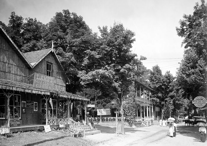
Street view, Delaware Water Gap, Pennsylvania, by Detroit Publishing, about 1910
But the resort era wouldn’t last. The arrival of the automobile changed how Americans took their vacations, and the staid old wooden hotels of the Water Gap declined. The Depression further decreased passenger traffic. The two largest hotels—the Water Gap House and the Kittatinny—burned down in 1915 and 1931, respectively. The large hotels were in an ideal location to benefit from the easy access provided by the rail lines and trolleys, but the railroads weren’t needed. In 1940, the New York, Susquehanna, and Western Railroad gave up its bridge at the Gap. In 1952, the Delaware, Lackawanna, and Western Railway discontinued passenger service to the Delaware Water Gap and instead used East Stroudsburg. The completion of the Interstate 80 bridge in December of 1953 then cut Water Gap station off from the town it had once served.
Over the years, the Poconos remained a central resort region, but the village of Delaware Water Gap steadily declined as a resort community. Many of the small boarding houses were converted into private residences. At the same time, most of the old hotels fell into ruins, were destroyed by fire, were closed, or continued to operate as best they could under changed conditions. Today, most of these landmarks are no longer extant, but the hills continue to host visitors.

Dingmans Creek Waterfall, Pennsylvania by the National Park Service.
In the 1950s, the Army Corps of Engineers began to survey the Delaware River Valley in hopes of building a dam. While the dam would provide clean water for the cities of New York and Philadelphia, it would also cover the valley with up to 140 feet of water, obscuring thousands of years of cultural and natural history. However, the engineers discovered that this stretch of the Delaware River was unsuitable for such a large-scale project. The land acquired through eminent domain was then turned over to the National Park Service in the 1960s to become a recreation area. By this time, any remaining homes or resort ruins had already disappeared or been razed. The Delaware Water Gap National Recreation Area was officially established on September 1, 1965.
The recreation area includes parts of Sussex and Warren Counties in New Jersey and Monroe, Northampton, and Pike Counties in Pennsylvania. Twenty-seven miles of the Appalachian Trail run along much of the park’s eastern boundary. The park also includes 40 miles of the Middle Delaware National Scenic and Recreational River and 67,000 acres of forested mountains, riverine valleys, and fertile floodplains. Visitors here enjoy more than 100 miles of hiking trails along streams, ridges, mountaintops, several waterfalls, and 100 miles of scenic roadways. Birdwatching and wildlife viewing are also popular, as people can encounter deer, black bears, wild turkeys, foxes, and various birds. Outdoor recreational activities include canoeing, hiking, camping, swimming, cycling, cross-country skiing, horseback riding, and picnicking. Fishing and hunting are permitted in season with a valid state license.
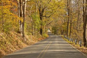
River Road between Shawnee & Bushkill, Pennsylvania, by the National Park Service.
Although the park was set aside for outdoor recreation, it is also rich in history, encompassing significant Native American archaeological sites and structures dating to the early Dutch colonial period. The entire region was a frontier of the French & Indian War. Historic rural villages from the 18th and 19th centuries remain intact on the New Jersey side, which retains much of the flavor of 100 years ago. Still standing today are Mountain Side House (Coppermine Inn) at Turtle Beach, Delaware View House at Wallpack Bend, and Hotel Ferncliff in the center of Bevans, now called Peters Valley.
Remnants of the railroad days can be seen in several areas. A small section of the Delaware Valley Railway bed is now part of the Railway Avenue Trail in Bushkill, Pennsylvania, and just under a mile of the New York, Susquehanna, and Western Railroad bed is now the Karamac Trail in New Jersey. The Delaware, Lackawanna, and Western Railway’s single track remains in use through the Gap between the river and Route 611, and occasionally an excursion train from Steamtown National Historic Site reaches Point of Gap Overlook.
More landscapes of past settlements and buildings are scattered throughout the park. Some of these include:
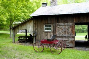
Carriage at Millbrook Village, New Jersey by the National Park Service
Millbrook Village – In 1832, a local farmer built a grist mill along the newly-finished Columbia-Walpack Turnpike, crossing a stream known as “Van Campens Mill Brook.” By 1875, Millbrook had reached a peak of 75 inhabitants and about 19 significant buildings. However, by 1910, the mill, store, and hotel had closed. Today, only a handful of original Millbrook buildings remain. Other buildings have been relocated from other sites or newly constructed to depict village life in the valley during the late 19th and early 20th centuries. Several buildings are open on summer weekends.
Minisink Archeological Site – Located in Sussex County, New Jersey, and Pike County, Pennsylvania, this site was once occupied by the Munsee-speaking Lenape tribe, who lived here for the majority of the 17th and 18th centuries. Hundreds of early stone tools were recovered at the site, and it is one of the most extensive, best-preserved, and most intensively studied archaeological locales in the Northeast. The site was declared a National Historic Landmark in 1993.
Village of Bevans– Now called Peters Valley, this once charming farm village has been adapted as the Peters Valley School of Craft. Self-guided tours of the historic grounds and studios are available on Saturday and Sunday afternoons during the summer.
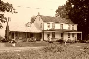
Foster-Armstrong Farm is located on Old Mine Road in Montague, New Jersey.
Foster Armstrong House & Neldon-Roberts Stonehouse – Built in the late 1700s, the Foster Armstrong House in Montague, New Jersey, boasts a beehive oven and a fireplace in every room. Just a few miles away, the Neldon-Roberts Stonehouse was once a schoolhouse and still retains its original wide wooden plank flooring, fireplace, and deep windows. Volunteers staff the two houses on select summer Sundays. The Foster Armstrong House was listed on the National Register of Historic Places in July 1979.
Walpack Center & Van Campen Inn – The village of Walpack Center, New Jersey, was once a bustling community. Today, the Walpack Historical Society maintains a small museum in one of the oldest buildings in town, the Rosenkrans House. The Van Campen Inn is located on the other side of Walpack Ridge. Originally built as a farmhouse, the Van Campen Inn provided shelter for travelers during the colonial period. Volunteers from the Walpack Historical Society staff the Van Campen Inn along Old Mine Road and the Rosenkrans House in the historic Walpack Center on summer Sundays.
Old Mine Road – Constructed in the mid-1700s, Old Mine Road connected the Hudson River in New York and Philadelphia, Pennsylvania, to the Pahaquarry Mines in New Jersey and provided an essential conduit for New Jersey farmers taking crops to area markets, making it one of the oldest commercial roads in the country. Today, Old Mine Road stitches together sections of several roads into the park’s central passage in New Jersey and still retains much of the flavor of 100 years ago, making it a popular driving and biking route. At Fort Carmer, the Van Campen Inn, and at the Hamilton Ridge Trail near Millbrook, visitors can still walk on the original unpaved roadbed once traipsed by Dutch farmers, colonial Americans, and soldiers of the French & Indian and Revolutionary Wars.
Pahaquarry Copper Mine, Warren County, New Jersey, courtesy Wikipedia
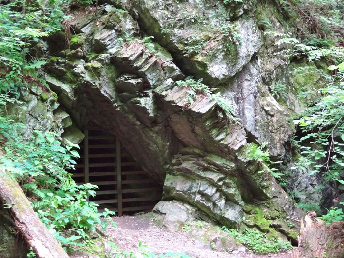
Pahaquarry Copper Mine – An abandoned copper mine on the west side of Kittatinny Mountain in Warren County, New Jersey. Active mining was attempted here for brief periods during the mid-18th, mid-19th, and early 20th centuries, but it was never successful despite advances in mining technology and improved mineral-extraction methods.
These are just a few historic sites in the National Recreation Area. In Pennsylvania, others include the Zimmermann House and Farm in Pike County; the Ramirez Solar House in Milford; the Turn Store and Tinsmith’s Shop in Bushkill; the Dingmans Ferry Dutch Reformed Church in Dingmans Ferry; the Metz Ice Plant in Milford; and several others. Visitors can see the Andrew Snable House and Shoemaker-Houck Farm in Walpack Center, the Millville Historic District north of Montague, and more in New Jersey.
More Information:
Delaware Water Gap National Recreation Area
1978 River Road
Bushkill, Pennsylvania 18324
570-426-2452
Also See:

Marshall Falls near the Delaware Water Gap in Pennsylvania by James F. Queen, 1856.
National Parks, Monuments & Historic Sites
Sources:
Antoine Dutot Museum
National Park Foundation
National Park Service
Wikipedia