
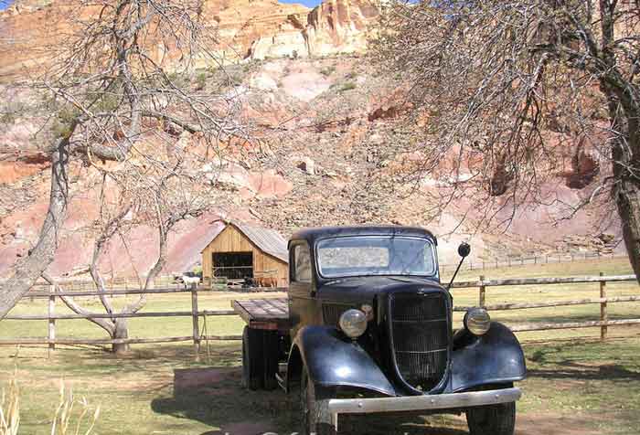
An old truck sits near a barn in Fruita, Utah. Photo by Kathy Alexander.
The old Mormon settlement of Fruita sits in Capitol Reef National Park. Amazingly, this community, surrounded by thousands of square miles of desert and situated along the prone-to-flooding Fremont River, thrived in the late 1800s and early 1900s.
The settlement came late to south-central Utah, as credible explorers had not charted much of the region until 1872. However, in the last half of the century, the Mormons began establishing farming and grazing communities in the high plateau lands West of Capitol Reef National Park. As they sought to form more communities, they moved eastward along the Fremont River.
In 1880, the Mormons established a small community at the junction of the Fremont River and Sulphur Creek, with the first landholder being a man named Niels Johnson. Soon, more families followed, and the small settlement became known as “Junction.”
The industrious families, using the river for irrigation, began planting several crops, including sorghum and alfalfa, but became most famous for their many fruit orchards. Though it never comprised more than 300 acres, Fruita became a significant settlement because of its relatively long growing season and abundant water. The residents planted apple, peach, pear, cherry, plum, walnut, and almond orchards. Later, they added grape orchards.
Luckily, they were less subject to the Fremont River’s frequent flooding than other small settlements, such as Aldrich, Caineville, and Blue Valley.
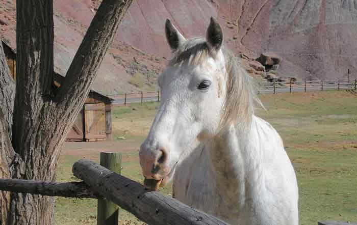
Kathy learned the hard way that this horse likes to nibble on people’s shoulders.
Surviving on their crops and vegetables until the fruit trees matured, the residents made syrup and molasses from the sorghum. Living in a barter society, the community prospered by trading crops and products for items they couldn’t produce.
In 1884, the townspeople built a passage through Capitol Gorge that extended to Caineville and Hanksville. This 37-mile primitive, difficult roadway, called the “Blue Dugway,” amazingly continued to serve as the primary route until after World War II.
In 1896, residents built a one-room schoolhouse as a community center for dances and socials. A couple of stores and a small lodge were later added.
Though a Mormon settlement, it also had a frontier mentality early on. While it never sported a saloon or a Wild West atmosphere like so many early towns in the West, it did tend to live on the fringe of the Mormon culture – sometimes harboring fugitives, never having a church, tolerating drinking, and even sporting a few moonshiners within its midst.
By the turn of the century, the small community numbered about ten families, and its abundant fruit earned it the nickname “the Eden of Wayne County.” A few years later, in 1902, the settlement’s name was changed from “Junction” to “Fruita.” The town was never incorporated.
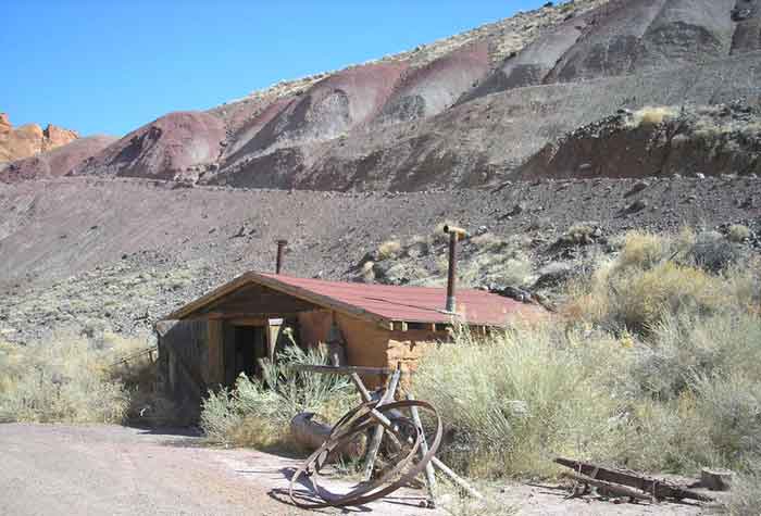
An old garage near Fruita, Utah, by Kathy Alexander
Fruit growers usually picked the fruit before it fully matured and hauled it by wagonload to bigger towns like Price and Richfield. As roads were developed through the area, some Fruita men worked with state road crews, but annual fruit sales remained the primary source of revenue.
Gifford Home in Fruita, Utah, by Kathy Alexander.
When the Great Depression hit the rest of the nation, Fruita remained largely unaffected because of its remoteness. Its economy had long been based on barter rather than cash.
Manual farming techniques continued until the 20th Century, as the first tractor wasn’t purchased until after World War II. The families continued their quiet existence in the lush Fremont River Valley until 1937, when the Capitol Reef National Monument was established.
Although this didn’t initially affect the isolated community, it would eventually become a death knell for it. After World War II, as people began to travel faster than ever, more visitors moved through the area. In 1940, a road was paved from Richfield to Torrey. In 1952, the pavement was extended to Fruita, and the settlement began to see people in numbers they had never experienced. Still unconcerned by its new National Monument status, several locals began to work for the Park Service.
However, in the 1950s, the government began aggressively buying up private land within the monument’s boundaries. By 1959, the last resident was gone, and Fruita was merged entirely into the park. Unfortunately, many of the original buildings were razed.
Unlike many National Parks, a few buildings were kept, including the schoolhouse, the Gifford farm, the 1908 house and barn, a few outbuildings, and the orchards.
Today, the still-producing orchards dominate the landscape, though they are gradually being changed to centralize the fruit produced. The Gifford home now serves as a museum. The original site of the Niels homestead is now a picnic ground.
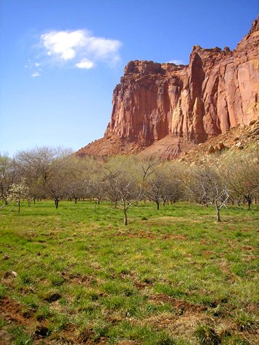
Fruita Orchards by Kathy Alexander.
Near the old townsite of Fruita, the park provides an additional scenic drive (with a fee) that leads to overlooks, canyons, arches, and the site of the old wagon trail, which provides a peek at the Pioneer Register, where early travelers recorded their passage on the canyon walls. Capitol Gorge also features petroglyphs left by the early Fremont Indians.
Fruita is located in south-central Utah, about 80 miles South and East of Richfield. Today, it is the heart and administrative center of Capitol Reef National Park.
More Information:
Capitol Reef National Park
HC 70 Box 15
Torrey, Utah 84775
435-425-3791 x111
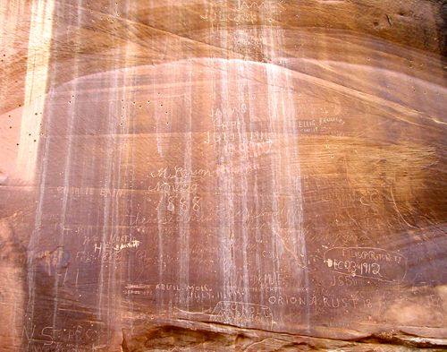
Pioneer Register in Capitol Gorge, Kathy Alexander.
©Kathy Alexander/Legends of America, updated September 2026.
Also See:
Ghost Towns & Mining Camps of Utah
Fremont Indians – Forgotten Ancient Peoples
National Parks, Monuments & Historic Sites
See Sources.