
Canyons of the Ancients, Colorado by Bob Wick, Bureau of Land Management.
Canyons of the Ancients National Monument protects an archaeologically significant landscape in southwest Colorado. Encompassing more than 176,000 acres of federal land, it is administered by the Bureau of Land Management.
The Monument contains the highest known archaeological site density in the United States, with rich, well-preserved evidence of native cultures that have been part of this landscape for at least 10,000 years. The archeological record etched into this landscape is much more than isolated islands of architecture. This cultural landscape contains more than 6,355 recorded sites that reflect all the physical components of past human life: villages, field houses, check dams, reservoirs, great kivas, cliff dwellings, shrines, sacred springs, agricultural fields, petroglyphs, and sweat lodges. Some areas have more than 100 sites per square mile. The number of sites is estimated to be up to 30,000.

Paleo Indian People.
People lived on this landscape as early as the late Pleistocene (or Ice Age), approximately 10,000 years ago. Small bands of Paleoindians hunted large game, such as mammoths and camels, and gathered wild plant foods in cool, moist environments.
Gradually, over several millennia, the climate warmed and became drier. During the Archaic period, beginning about 7,500 years ago, increasing numbers of hunter-gatherers roamed the landscape, expanding their diet to include a wider variety of plants and animals, facilitated by the warmer climate.
Agriculture, introduced from the south about 4,000 years ago, marked the beginnings of Pueblo culture in the Four Corners area. Basketmaker II people began supplementing their diet by growing corn and squash. At that time, people began to adopt a more settled lifestyle, and by about 2,500 years ago, they had become dependent on corn for the majority of their daily calories.
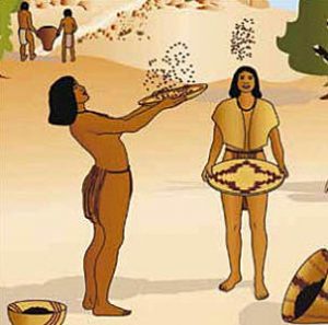
Basket Makers.
Later, Basketmaker III people added beans, an essential protein source, to their crops, began making pottery, and hunted with the bow and arrow. Clusters of small family farms formed the first settled communities across the landscape. About 1,300 years ago, warmer, drier weather during the Pueblo I period prompted many families to relocate to higher elevations such as the Dolores River Valley. These people built many villages, and cultural practices shifted over time from hunting and gathering to farming.
By about 750 AD, the Ancestral Puebloans occupied a widespread region that encompassed the Canyons of the Ancients and much of southwestern Colorado. Their year-round villages began as clustered pit houses. Over time, these ancestors of the modern-day Pueblo Indians developed larger masonry homes with connecting walls above ground. Some of these homes were built at canyon heads where a spring supplied water. Other homes were cliff dwellings.
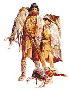
At the end of this period, severe drought drove many people from the region. However, farmers resettled the area during the more favorable climate of the Pueblo II period beginning about 920 AD. As the wild game became depleted, families depended on their crops, and around 1100 AD, domesticated turkeys became an important food source. Soon, communities dotted the landscape in greater numbers than ever before, and during the early Pueblo III period, the population increased substantially around 1170.
In time, factors such as population growth, soil exhaustion, and changing weather compromised the area’s natural resources. In about 1276 AD, a severe, long-term drought began, resulting in poor or failed corn crops. As elk and deer became scarce, the people hunted rabbits, rodents, birds, and even carnivores. Some villagers migrated shortly after the drought began; others remained, attempting to endure the harsh conditions. Sometime after 1277 AD, Sand Canyon Pueblo suffered a devastating attack, possibly by other Pueblo people competing for the meager resources. Many residents were killed, and soon after, the survivors migrated away from the region. By about 1300 AD, these Pueblo ancestors had migrated to New Mexico’s Rio Grande Valley or farther west to where the Acoma, Laguna, Zuni, and Hopi peoples live today.
Ancestral Puebloans
Soon after the Ancestral Puebloans left the monument area, the nomadic Ute and Navajo exploited the natural diversity of the variable topography by moving to lower areas, including the monument’s mesas and canyons, during the cooler seasons. A small number of forked stick hogans, brush shelters, and wickiups are the most obvious remnants of this period of occupation.
Spanish Conquistadors reached northern New Mexico, where they settled in the 16th century. They introduced items for trade, such as guns and horses; new, deadly diseases; and cultural influences in the form of religion, language, and forms of government.
Ute communities were well established in western Colorado when the Spanish first explored the region in the late 1700s. Archaeological evidence indicates that the Ute ancestors arrived in western Colorado centuries earlier. Both Ute and Hopi oral histories say that Ute and Ancestral Pueblo people lived in the region at the same time. Historically, the Navajo people were based on the south side of the San Juan River, and the Ute groups on the north side. Scholars debate the exact timing of the Navajo’s arrival in the American Southwest, but they were likely in southwestern Colorado by the early 1500s. The Ute and Navajo people also used the Monument’s mesas and canyons for hunting and gathering. Remains of hogan, brush shelters, and wickiups tell their story. Today, many descendant peoples still live in or near their ancestors’ homelands.
Spanish Conquistadors
In July 1776, a party of Spanish explorers — Father Silvestre Velez de Escalante with his superior Francisco Dominguez and eight others — set out from Santa Fe, New Mexico, to find a safe route to California and avoid the Mohave Desert and the Grand Canyon. After several weeks, they camped by a river called El Rio de Nuestra Señora de Los Dolores (The River of Our Lady of Sorrows). Father Escalante found the remains of a village overlooking the river and remarked in his journal that it resembled the living Pueblo villages of New Mexico. As the first archaeological site record in present-day Colorado, it was later named Escalante Pueblo. The Dominguez Pueblo was excavated and named 200 years later.
In the Dolores area, the Spaniards first encountered Ute hunters, who fed them and guided the party onward for several months. Due to food shortages and the approach of winter, the explorers eventually abandoned their goal and returned to Santa Fe. Although unsuccessful, the expedition established a portion of the Old Spanish Trail for later trade between the United States and Mexican territories.
The first Anglo-Americans arrived in the early 19th century, beginning with trappers. With the discovery of precious ores in the last decades of the 19th Century, miners and other settlers moved into the region. By the mid-19th century, the United States government and Native American tribes were at war over land ownership, and multiple skirmishes resulted in casualties on both sides. Such conflicts led to treaties that reduced Ute territories and created reservations—often far from their original tribal homelands. The Navajo had moved south, and the Ute territory was significantly reduced.
Under the Homestead Act of 1862, a citizen 21 years old or head of a household could claim up to 160 acres of public land. Homesteading farmers in this area, like the Ancestral Puebloans, depended entirely on rain and snowfall to grow their crops. The land was cleared by hand, and a garden area was established to feed the family and livestock. Trips to town were rare and required days of planning and travel.

The Anasazi Heritage Center — a museum of the Ancestral Puebloan Culture at the Canyons of the Ancients National Monument. Photo by Carol Highsmith.
The Monument was designated on June 9, 2000, by Presidential Proclamation to protect cultural and natural resources on a landscape scale.
Visitors to Canyons of the Ancients are encouraged to start at the Visitor Center and Museum near Dolores, Colorado, where they can obtain current information about the Monument, obtain maps, and visit the museum’s exhibits, films, and hands-on discovery area. This is also Colorado’s premier archaeological museum of the Ancestral Puebloan (Anasazi) and other Native Cultures of the Four Corners region. The museum features:
– Permanent exhibits on archaeology, local history, and Native American cultures
– Two 12th-century archaeological sites
– Special exhibits and events
– Educational resources for teachers
– A research library of archaeology and anthropology resources
– A research collection of more than 3 million artifacts and records from archaeological projects in southwest Colorado
– A picnic area, a half-mile nature trail, and a gift shop
Other sites to see at the monument include:

Saddlehorn Pueblo at the Canyon of the Ancients
Castle Rock Pueblo – This pueblo, built around a sandstone butte, was erected and occupied from the 1250s to the 1280s AD. The village is contemporary with the seven small cliff dwellings along the lower Sand Canyon Trail. When Crow Canyon Archaeological Center archaeologists conducted limited excavations at Castle Rock in 1993 and 1994, they found at least 16 kivas. While most kivas in this area are circular, one was rectangular—a building shape used by modern Hopi people. The village also includes 40 above-ground rooms, nine possible towers, and a D-shaped enclosure.
Saddlehorn Pueblo – One of the largest pueblos of the 13th century, Sand Canyon Pueblo, built between 1250 and 1280, contains at least 20 multi-family room blocks with 420 rooms, 90 kivas, and 14 towers. A spring runs through the center of the walled site, which could accommodate up to 725 people. Construction was exacting, with care taken to shape stone and to construct some double- and triple-walled structures for stability. Families lived in clusters of rooms that included living, storage, and workrooms, and had their own family kivas. The community shared roofed plazas, great kivas, and towers often connected to kivas. By 1280, new construction had stopped, and people began migrating out of the pueblo.
Double Cliff House – Built in two ledges of an alcove, the Pueblo people must have used a ladder to get to the two upper rooms. There is a window in one of the upper rooms. The alcove has protected the stone masonry and is well preserved. The upper ledge is about 40 feet long. Archaeologists recorded and mapped Double Cliff House in 1965. They found pottery sherds and stone tools that indicate the House was probably used in the thirteenth century (1200s AD).
Corncob House – The neighbors to the north and west of Corncob House had only one alcove in which to build their home. The masonry walls have three feet of double-coursed rock in a wide, shallow U-shape with loose sandy trash behind them, as if to create a flat foundation for another structure or a platform. The midden in front of the site is eroded. Ancient corncobs, two yucca leaf strips tied in knots, and a piece of fiber or loose cordage were found during archaeological excavations at the site in 1965.

Ruins of Lowry Pueblo with the Canyons of the Ancients National Monument by Carol Highsmith.
Lowry Pueblo – This National Historic Landmark consists of eight kivas, a great (community) kiva, and 40 rooms built as high as three stories. The pueblo was constructed around 1060 AD atop abandoned pithouses from an earlier period of occupation. It was occupied by 40 to 100 people at a time for 165 years. The underground great kiva was built about 1103 AD and had murals painted over about five layers of plaster. In about 1110 AD, another kiva was built on top of the original kiva. Based upon the size of the kiva, it’s thought that the Lowry Pueblo may have been a local center for religious gatherings and celebrations. The site is one of the northernmost associated with Puebloan cultures and was designated a National Historic Landmark in 1964. It was incorporated into the Canyons of the Ancients National Monument in 2000.
Sunny Alcove: The architecture includes eight rooms and a kiva. When archaeologists conducted research at Sunny Alcove in 1965, they found corncobs, 67 pottery sherds, and fragments of grinding stones. Sunny Alcove has remarkably preserved wall niches (little shelves). There were once wooden latches near the doorway.
Tucked-Away Two-Story House – The walls of a single room remain at this site; the structure is about two stories high and has a small window facing south. There is a doorway to the west with toeholds and a masonry ledge. There were approximately five rooms, as indicated by the masonry rubble outlines to the west. When archaeologists recorded the site in 1965, they found stone flakes and an edge-ground stone scraper. Pottery sherds identified as Mancos Corrugated, plain gray, whitewater, and Mancos Black-on-white were also recorded. This type of pottery may indicate that the Tucked Away Two-Story House was a residence in the 1100s AD, but the masonry is more consistent with the 1200s AD.
Wall Curves with Bedrock House – This is a small cliff dwelling with one nearly complete room and some wall remnants. The west portion of the site has a T-shaped doorway and a
window facing south in the south wall. There is a second-story doorway and two little windows facing south. When archaeologists recorded the site in 1965, pottery sherds were identified as Mancos Corrugated, Plain Gray, Mancos Black-on-white, Plain White, and Mesa Verde Black-on-white. These types of pottery sherds were made in the twelfth and thirteenth centuries, 1100–1300. A pendant was also found.
Sand Canyon Pueblo – In about 1250 AD, families came together around the head of Sand Canyon to build a large and compact village. A thick, one-story-tall, U-shaped wall surrounded hundreds of square rooms, round kivas, and community structures, including a plaza, a large D-shaped structure, and a great kiva. The village appears designed for defense—perhaps due to regional strife over dwindling resources. A spring was at the heart of the village, giving residents exclusive access to their all-important water source. The thick stone outer wall had small, angled peepholes and few doorways. The towers built against the outside face of the wall also provided good lookouts that could only be entered from inside the village. By 1275 AD, Sand Canyon Pueblo was about three times the size of Cliff Palace (the largest pueblo in Mesa Verde National Park). Approximately 600 people—healthy, judged by the standards of their time—had lived for a generation or more within the village. Primarily depending on rain-fed cornfields, they also had sizable flocks of turkeys.

The ruins of Dominguez Pueblo at Canyons of the Ancients National Monument by Carol Highsmith.
Dominguez Pueblo – Built by the Ancestral Pueblo people in the 1120s AD, this four-room structure was a typical family unit for about four to eight people. The low stone walls would have supported jacal walls made of poles, brush, and earth, with a roof of similar construction. This pueblo exemplifies the everyday household style of the Northern San Juan Tradition: a row of small rooms facing a kiva, or a circular underground chamber. The kiva, no longer visible, was about 11 feet in diameter and probably had a roof with a ladder entrance. It may have served as a place for family members to sleep, eat, and/or seek shelter from adverse weather. It was not possible to stabilize the earthen walls of the kiva, so it was backfilled after excavation in the 1970s. Replacing the soil is often the most effective way to preserve ancient structures. Traces of 18 similar household sites have been found on this hill surrounding the Dominguez Pueblo. Archaeologists determined, by dating the tree rings in wood from the site, that this home was built about 1123 AD—close to the same time as Escalante Pueblo, suggesting that this family probably had some connection with the larger, nearby village.
Escalante Pueblo – Much larger than Dominguez Pueblo, this was more than a simple family dwelling. The original construction reflects the architectural style of Chaco Canyon, New Mexico. The pueblo’s founders built the original structure in 1129 AD, when Chaco was in decline, and its regional influence was waning. Curiously, most of the pottery found here is not Chaco-style but of Northern San Juan (local) types — implying that the potters, at least, were not immigrants. This first occupation ended about nine years later. Another group of Northern San Juan people briefly reoccupied the empty pueblo around 1150 AD. A third and final occupation, involving only a few rooms, took place around 1200 AD.
Canyons of the Ancients also encompasses and surrounds three of the four separate sections of the Hovenweep National Monument, which the National Park Service administers.

Grand Kiva at the Canyon of the Ancients National Monument by Carol Highsmith.
The Monument is located in the Four Corners region of southwestern Colorado, about 50 miles west of Durango, 10 miles west of Cortez, and 12 miles west of Mesa Verde National Park.
©Kathy Alexander/Legends of America, December 2025.
Also See:
Ancient Cities of Native Americans
Old Spanish National Historic Trail
Sources:
Bureau of Land Management
Presidential Proclamation
Wikipedia

Canyon of the Ancients Map by the Bureau of Land Management.