Verdigris River, Independence, Kansas, by the United States Geological Survey.
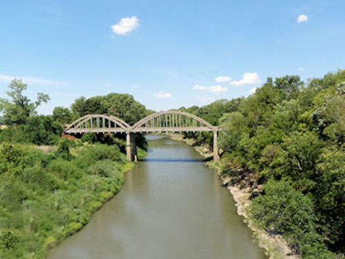
The Verdigris River, a tributary of the Arkansas River in southeastern Kansas and northeastern Oklahoma, is about 280 miles long.
It has a history dating back over two centuries — mentioned by Zebulon Montgomery Pike during his visit to the area in 1806 and Thomas Nuttall in 1818. The river flows through a rich country that, in the early days, produced much in the way of furs. Several trading posts were located along its course from time to time, the most important of which was probably operated by Hugh Glenn in 1819, located about a mile above its confluence with the Arkansas River. Chief Clermont’s band of Osage Indians was located on the stream about this time and is mentioned by Stephen H. Long in his travels.
By the 1834 treaty with the Cherokee Indians, the Verdigris River was designated as part of the boundary of their lands. The name is derived from the French words vert, meaning “green,” and gris, meaning “grey.”

Verdigris River at the Port of Catoosa, Oklahoma by Dave Alexander.
The stream has its source in several small streams, one rising in eastern Chase County, one in northern Greenwood County, and two in southern Lyon County, Kansas. It flows southeasterly across Greenwood County, the extreme southwestern corner of Woodson County, Wilson, and Montgomery County, entering Oklahoma almost due south of Coffeyville. From there, the stream flows through Nowata, Rogers, and Wagoner, Oklahoma counties, uniting with the Arkansas River near Wybark, about three miles from Fort Gibson. Among the more important tributaries of the Verdigris are Willow, Homer, Sandy, Drum, Big Hill, Pumpkin, and Onion Creeks, Paw and Fall Rivers in Kansas, and Big Caney and Little Verdigris Rivers, Bird Creek, and about two dozen smaller streams in Oklahoma.
Dams built by the U.S. Army Corps of Engineers created Toronto Lake near Toronto, Kansas, and Oologah Lake near Oologah, Oklahoma.
From just north of Catoosa, Oklahoma, to its confluence with the Arkansas River, barge traffic is maintained on the river as part of the McClellan-Kerr Navigation System, which consists of a series of locks and dams on both streams and allows commercial navigation between the Tulsa area and the Mississippi River.
©Kathy Alexander/Legends of America, updated January 2026.
Also See:
History Along the Arkansas River
See Sources.