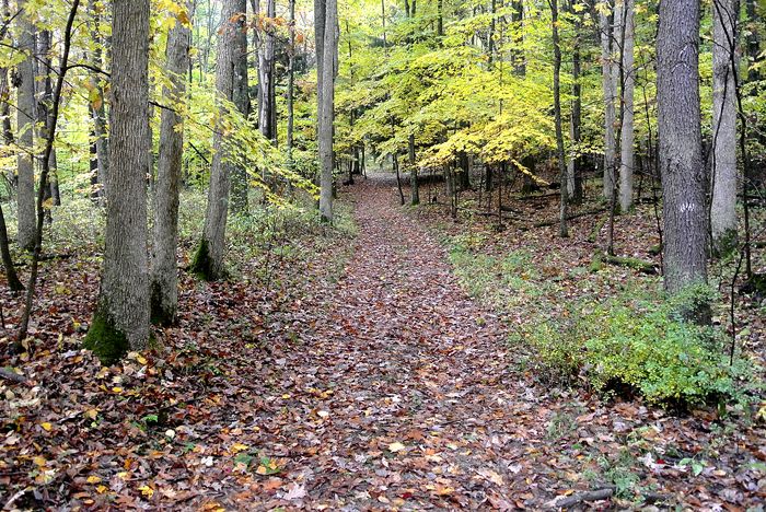
Braddock Road near Fort Necessity, Pennsylvania, courtesy Wikipedia.
Braddock’s Road was a military road built in 1755 in British America. It was the first improved road to cross the ridgelines of the Appalachian Mountains.
The road was constructed by troops of the Virginia Militia and British soldiers under the command of General Edward Braddock. In 1755, Braddock was sent on an expedition to conquer the French-held Ohio Country at the beginning of the French and Indian War. At that time, George Washington was an aide-de-camp to General Braddock, and the expedition gave him his first field military experience.
Starting from Fort Cumberland, Maryland, Braddock’s army cut a military trail through the wilderness, roughly following an ancient Lenape Indian trail. While attempting to remove the French from Fort Duquesne at present-day Pittsburgh, Pennsylvania, on July 9, 1755, he was met with defeat and was fatally wounded. He was carried off the field by George Washington and another officer. Four days after the battle, he died on July 13. He left Washington with his ceremonial sash that he wore with his battle uniform, which, reportedly, Washington carried with him everywhere for the rest of his life. It is on display today at Washington’s home in Mount Vernon, Virginia.
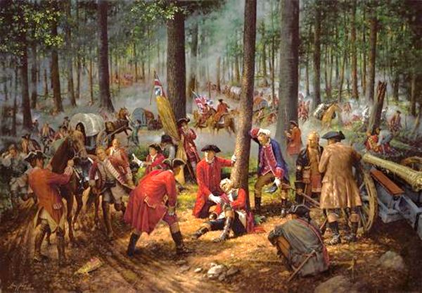
General Edward Braddock’s Death.
General Braddock was buried just west of Great Meadows, where the remnants of the column halted on their retreat to reorganize. George Washington presided at the burial service, as the chaplain had been severely wounded. Years later, road workers found the grave and moved it. It is now marked by a marble monument erected in 1913. It is located one mile west of Fort Necessity, Pennsylvania.
Braddock Road was later used by numerous westward-bound settlers, so much so that in 1806, the Federal Government constructed the first federally funded highway. This highway, first called the National Road, eventually stretched from Cumberland, Maryland, to Vandalia, Illinois. Closely paralleling Braddock’s route, the National Road carried thousands westward and later figured prominently in the Underground Railroad, helping slaves escape before the Civil War. Today, the path is closely followed by U.S. Route 40.
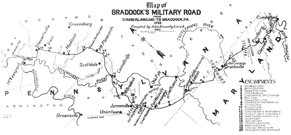
Braddock’s Road Map.
A portion of the original trail can be hiked along a 1½-mile-long pathway at Fort Necessity, Pennsylvania.
©Kathy Alexander/Legends of America, April 2026.
Also See:
National Road – First Highway in America
Tales & Trails of the American Frontier
See Sources.