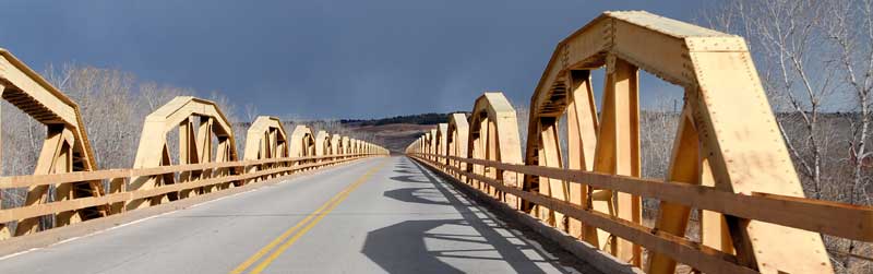
Pony Truss Bridge over the Canadian River, Southwest of Bridgeport, Oklahoma, by Kathy Alexander.
Bridgeport, Oklahoma, is a ghost town in northeastern Caddo County. It was once a busy city on Route 66.
Settlement first began in this area with a stagecoach crossing of the Canadian River and the establishment of many farms that primarily produced cotton. The town received its name in the 1890s as the place where stagecoaches waited to cross the mile-wide river. They were ferried across during high water, and during low water, the teams forded the river, following their paths carefully because there was always a quicksand problem.
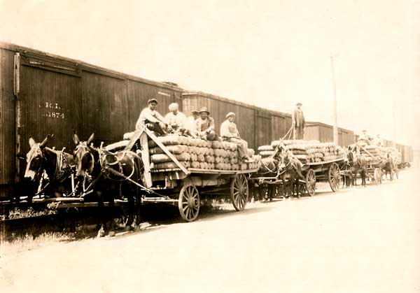
Chicago, Rock Island, and Pacific Railway in Oklahoma.
When the Chicago, Rock Island, and Pacific Railway built a bridge here in 1891, it established a work camp on the South side of the Canadian River Valley, which soon grew into a small settlement overlooking its floodplain. In 1893, a toll bridge was built over the river, and a post office was established in February 1895 in a store located at the South end of the bridge.
In 1898, the Choctaw, Oklahoma & Gulf Railroad extended its tracks westward and built its bridge near the toll bridge. The Enid and Anadarko Railway’s north-south lines, built in 1901, used the same bridge.
In 1901, the Caddo and Wichita Indian lands were opened for settlement, and Bridgeport became a booming tent town. Soon, brick business buildings and good homes replaced the tents, and the town bustled with as many as 3,000 people. At its peak, Bridgeport had 76 businesses, including two banks, a flour mill producing 100 barrels per day, several stores, and two hotels. A waterworks included a 40,000-gallon elevated tank.
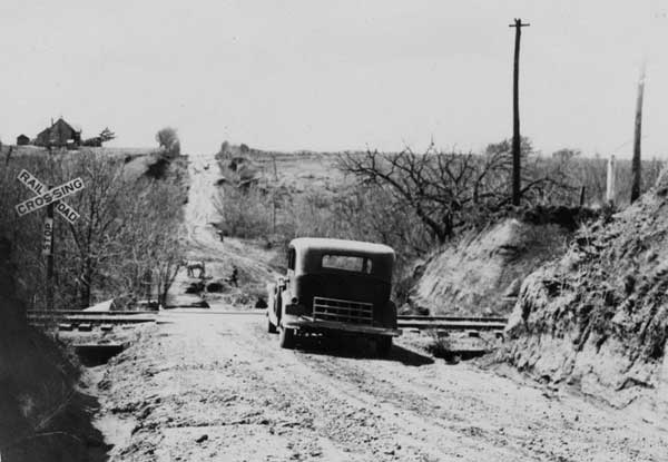
Road between El Reno and Hydro, Oklahoma, 1932.
A postal road was built through Bridgeport in the early 1900s that became a primary roadway for early motorists. A railroad branch line was built between Bridgeport and Anadarko in 1901-02, and the town was incorporated after it was completed in 1902. Early businesses included three banks and numerous small businesses, including the Bridgeport News, which began publication in 1905. It became the town’s longest-running newspaper, continuing until 1927. Served by the crossing rail lines, Bridgeport appeared destined to become an important town as the chief shipping point for a large area.
But Bridgeport would face several issues in the near future, including the unpredictable Canadian River and a town feud. During these peak years, many people found the water on the West side of Bridgeport clear and pure, while on the East side, where most buildings stood, it was filled with gypsum crystals. This sparked a major debate among residents, who felt the post office should be on the west side, leading to a bitter feud. The depot also stood on the West side. Some businessmen soon decided to move the post office in the middle of the night. They also moved the big three-story frame hotel to a corner location on the West side. This enraged many merchants on the East side, and many of them moved their buildings and goods to the nearby town of Hinton.
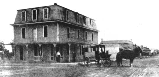
Bridgeport, Oklahoma Hotel, 1907.
In 1907, the railroad bridge was demolished when a freight car jumped the track and struck a span. This train, carrying cars of livestock and household goods belonging to German emigrants, fell into the sandy riverbed and immediately began sinking into the quicksand. To save the livestock, men opened the car doors, and ducks, chickens, and geese flew out. The engine, coal car, and caboose were the only things saved. To this day, the other cars with everything inside, as well as the middle section of the bridge, lie buried deep somewhere in the shifting sand of the Canadian River bed. The railroad replaced the bridge the following year.
By 1909, the number of businesses had decreased to 43, and the population had decreased dramatically. In 1910, it had a population of only 428 people.
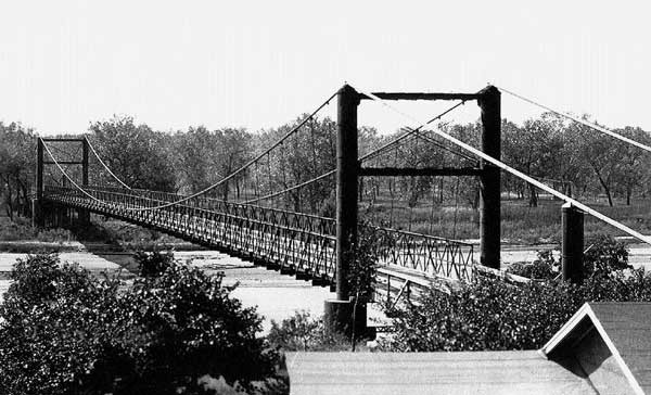
Key Bridge, Bridgeport, Oklahoma, 1929.
In 1914, a flood washed away the railroad bridge, and a new one was soon built.
In 1915, a free bridge replaced the toll bridge, but a few years later, a flood damaged it. The Key Bridge eventually replaced it and charged tolls.
In 1917, the postal road was absorbed into the Ozark Trails network, but Bridgeport’s population was still falling. By 1920, it had 294 residents.
In 1921, Oklahoma City businessman George Kay built the Key Bridge over the Canadian River a mile North of Bridgeport. It was a suspension bridge with a toll: travelers were charged $1.00 for cars and $1.50 for trucks. The bridge spurred the town’s future growth.
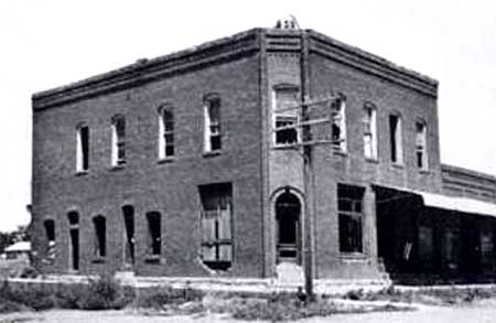
This substantial building, once in Bridgeport, Oklahoma, is long gone today. Photo 1940.
When Route 66 was built through the area in 1926, the Key Bridge became the crossing of the Canadian River. However, Route 66 travelers were outraged by the steep charge to cross the bridge. In 1930, the state of Oklahoma bought the bridge, and it dropped the fee. That year, the town’s population rebounded to 432 people, and it boasted 25 businesses, including a large cotton gin, two grain elevators, two hotels, a bank, and a lumberyard.
Afterward, however, Bridgeport, like so many other towns across the country, suffered during the harsh years of the Great Depression.
In 1933, a new Pony Bridge was built across the Canadian River downriver from Bridgeport. The following year, Route 66 was realigned directly from El Reno to Hydro, bypassing Calumet, Geary, and Bridgeport. Bridgeport immediately began to falter, though the Key Bridge survived another 12 years, meeting local traffic needs before a grass fire in 1948 rendered it unusable. They dismantled the bridge in 1952 and sold it for scrap.
Before the Pony Bridge was built, Bridgeport was the western terminus of a safe crossing of the Canadian River. The new alignment was another blow to the small town, as many residents moved their families and businesses to the new Route 66 alignment. By 1940, Bridgeport’s population had fallen to 302.

Old post office in Bridgeport, Oklahoma.
In 1958, the Interstate 40 bridge was completed, moving the highway more than a mile South of town. By 1960, the town’s population was just 139, and it continued to drop over the following decades.
Today, Bridgeport still has a small population, but it consists mostly of abandoned homes. No businesses are open, but First United Methodist Church, built in 1907, remains active. Unlike most of the buildings in town, the church is in very good condition.
The old post office building still stands on the East side of Market St. between Wichita Ave. and W. Broadway, but no other business buildings remain. The depot has been removed, and sand and grass cover the railroad track spurs.
Former U.S. Route 66 is 0.5 miles south of the town, and Interstate 40 runs one-half mile farther South. The closest access is two miles to the East at Exit 101.
Returning to Route 66, the highway continues West to Hydro, Oklahoma. This section of the old road, surfaced with concrete, is listed on the National Register of Historic Places.
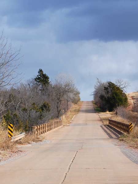
Route 66 Concrete Road between Bridgeport and Hydro, Oklahoma by Kathy Alexander.
©Kathy Alexander/Legends of America, updated October 2026.
Also See:
Sources:
Bridgeport Index
Okc Talk
Oklahoma Historical Society
Wikipedia