Pio Pio-Maksmaks, Walla Walla Indian.
A Sahaptin tribe that lived for centuries on the Columbia River Plateau in northeastern Oregon and southeastern Washington, their name is translated several ways, but most often as “many waters.” While the people have their own distinct dialect, their language is closely related to the Nez Perce. The tribe included many groups and bands often referred to by their village names, such as Wallulapum and Chomnapum.
A hunter-gatherer tribe, they lived in “tents” that were easy to move. However, their lodgings differed from those of many other nomadic tribes in that they were larger and covered with tule mats rather than hides. Called a longhouse, it was made out of lodge poles, much like a tepee, but was much longer, sometimes as much as 80 feet in length. Resembling a modern-day “A” frame house, the lodge poles were covered with mats made of tule, a plant that grows freely along waterways. When the tribe moved, the mats were gathered and moved, and the lodge poles were left behind.
Beginning in the early 1700s, the Walla Walla people raised great herds of horses, making their lifestyle much easier as they gathered seasonal plants. They also traveled across the Rocky Mountains to trade dried roots and salmon to the Plains Indians for buffalo meat and hides.
White travelers encountered the people during the Lewis and Clark Expedition in 1805. The explorers were warmly welcomed by Chief Yellepit, whose village of about 15 lodges was situated on the Columbia River near the mouth of the Walla Walla River. The two groups communicated through a Shoshone woman who had been captured by the Walla Walla and the expedition’s guide and interpreter, Sacagawea, who was also Shoshone. Though Yelleppit offered the expedition to stay with the village, Lewis and Clark were hurrying to reach the Pacific Ocean. However, they promised to spend a few days on their return. In April 1806, as the explorers began their return east, the expedition spent several days with the Walla Walla, during which gifts were exchanged and goods traded. Two of the items left by the expedition with the tribe were a peace medal engraved with a portrait of Thomas Jefferson and a small American flag. In their documentation, Lewis and Clark estimated the tribe’s population at 1,600; however, this figure likely included other bands now recognized as independent.

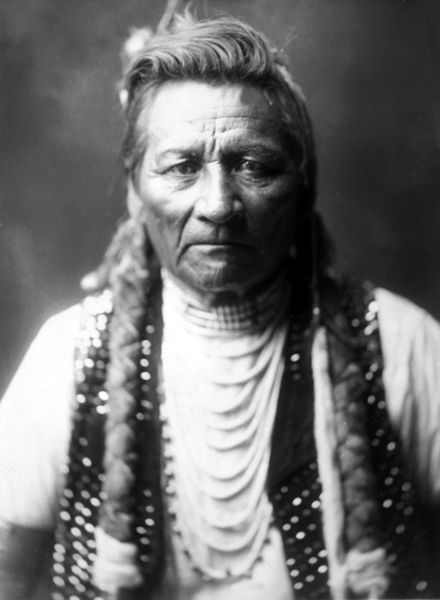
Walla Walla Indians.
The next non-native to encounter the Walla Walla people was a trader named David Thompson of the Canadian-British North West Company, who arrived in 1811. About five miles upriver from Chief Yellepit’s village, he staked a pole with a note claiming the territory for the British Crown and declaring that the North West Company intended to build a trading post at the site. Continuing downriver, Thompson stopped at Yellepit’s village, where he discovered the American “claims” in the form of Yellepit’s flag and medal. Though neither Lewis and Clark nor Thompson had much power to lay claim to the region, Yellepit supported Canadians setting up a trading post nearby.
By 1855, thousands of settlers had arrived along the Oregon Trail, and the emigrants had an insatiable demand for land and resources. In response, the new Washington Territory governor, Isaac Stevens, began to heavily pressure the Walla Walla and other area tribes to sign treaties ceding land and moving to reservations.
In May and June 1855, Stevens and Joel Palmer, Superintendent of the Oregon Territory, enacted three treaties at the Walla Walla Council. The Walla Walla, Umatilla, and Cayuse tribes were coerced into moving from 4,000,000 acres of tribal lands to a reservation in northeastern Oregon, which was eventually reduced to 72,000 acres. Other treaties were also established at the council with the Yakama, Palouse, and other tribes.
That same year, gold was discovered on the recently established Yakama reservation, and conflict erupted between encroaching white miners and tribes of the Plateau. Many tribes eventually united under the leadership of Yakama chief Kamiakin, marking the start of the Yakima War. Though the Walla Walla were initially not involved in the conflict, they were eventually pulled into it along with the Umatilla and Cayuse.
Today, many Walla Walla live on the Confederated Tribes of the Umatilla Indian Reservation. The Walla Walla shared the land and a governmental structure with the Cayuse and the Umatilla tribes as part of the Confederated Tribes of the Umatilla. The three bands were united as a single tribal government in 1949 when the tribal leaders adopted a Constitution and bylaws. The confederate tribes currently have an enrollment of over 2,800 tribal members. The reservation is located in Pendleton, Oregon, near the Blue Mountains.
More Information:
Confederated Tribes of the Umatilla Indian Reservation
46411 Timine Way
Pendleton, Oregon 97801
541-276-3165
©Kathy Alexander/Legends of America, updated November 2025..
Also See:
Indian Conflicts of Washington
Native American Photo Galleries
See Sources.