
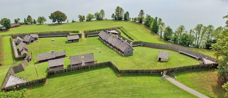
Fort Loudoun, Tennessee, courtesy of Tennessee State Parks.
Fort Loudoun, Tennessee, was a British fort in Monroe County. It was constructed between 1756 and 1757 to garner support from the Cherokee Tribe for the British at the outset of the French & Indian War. The fort was one of the first significant British outposts West of the Appalachian Mountains. John William Gerard de Brahm designed the fort, while Captain Raymond Demeré supervised its construction; Demeré’s brother, Paul Demeré, commanded the fort’s garrison. It was named for the Earl of Loudoun, the commander of British forces in North America at the time.
As early as 1708, British officials discussed building a fort in Cherokee territory. The Province of South Carolina viewed trade with the Cherokee as vital but struggled to regulate it because most Cherokee towns were remote in the Appalachian Mountains. British traders often exploited the Cherokee, leading to rising anti-British sentiments among their leaders. The British believed that a fort and garrison would help them regulate trade more effectively.
Support for the fort grew in 1743 when James Glen was appointed governor of South Carolina. He saw it as a way to expand British control into the interior of North America, where France held territories along the Mississippi and Ohio Rivers, including New Orleans. During King George’s War (1744–1748), the fort received backing from British officials due to the French threat from Fort Toulouse in central Alabama, but support waned after the war ended.

French and Indian War by Jackson Walker.
The outbreak of the French & Indian War in 1754 revived British interest in the fort. The Cherokee were still allies of the British, but French influence within the tribe had grown considerably. A faction of the tribe based at Great Tellico had switched its support to the French. The Cherokee towns were highly decentralized, and their chiefs made independent alliances.
The British Crown provided Governor Robert Dinwiddie of Virginia with funds to construct a fort. However, Dinwiddie allocated only a small portion of these funds to Governor Glen for this purpose and spent most of the remainder on the Braddock Expedition in 1755. After this expedition ended in disaster, Dinwiddie sought assistance from the Cherokee to defend Virginia’s frontier. The Cherokee agreed to supply 600 warriors, and in return, Virginia and South Carolina promised to build a fort in the West to protect Cherokee families while the men were away fighting.
The construction of the fort was a collaborative effort between Virginia and South Carolina. However, bureaucratic delays hindered the South Carolina contingent, allowing the Virginians, led by Major Andrew Lewis, to reach the Cherokee “mother town” of Chota in the Little Tennessee River Valley on June 28, 1756—several weeks ahead of the South Carolinians. Rather than wait for their counterparts, Lewis’s party began work on a fort across the Little Tennessee River from Chota. This structure, known as the “Virginia Fort,” was square, measuring 105 feet on each side, with walls made of earthen embankments topped by a 7-foot palisade. Lewis’s orders were to construct the fort, so after its completion in early August 1756, the Virginians returned home.
This outpost, the westernmost of its kind in the United States, was strategically positioned on a bend of the Little Tennessee River, providing a clear view of the waterway and allowing defenders to protect the area from potential attackers better.
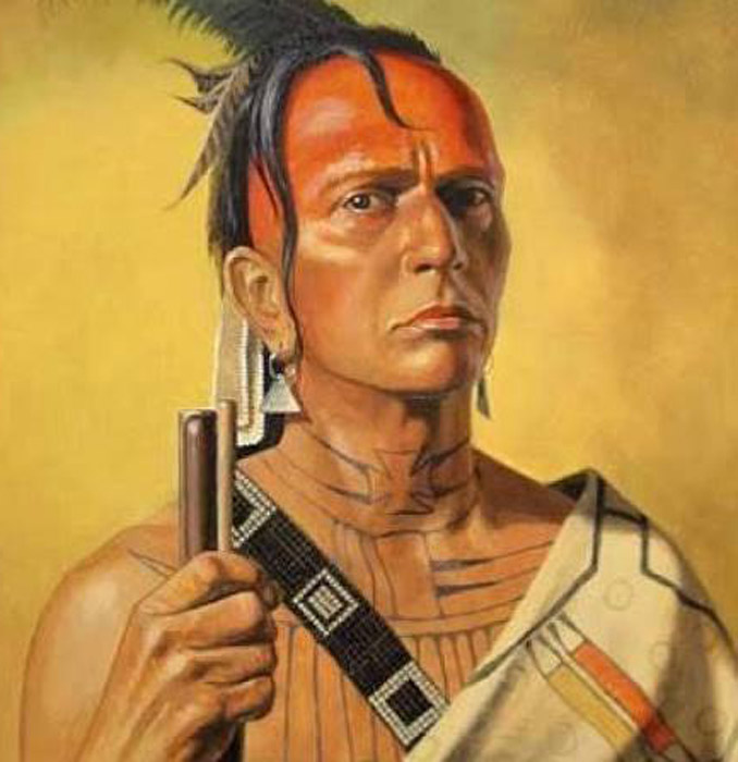
Cherokee Chief Attakullakulla.
Although Governor Glen’s political foes ousted him in May 1756, his successor, William Henry Lyttelton, was committed to completing the fort. An advance party led by William Gibbs crossed the mountains and arrived at Great Hiwassee in early August. They reached Tomotley on August 6, 1756, where Gibbs stayed in the home of Cherokee Chief Attakullakulla.
On September 21, 1756, 80 British regulars under Captain Raymond Demeré, along with two provincial companies of 60 men each, left Fort Prince George on the South Carolina frontier. Accompanied by 60 pack horses, they traveled around 100 miles in ten days, arriving in Tomotley on October 1, where they were greeted by Cherokee leader Old Hop and 200 others. Contractor John Elliott managed the transport of the fort’s 300-pound cannons over the mountains, while Officer John Stuart negotiated a purchase of corn from the Cherokee to prevent starvation.
John William Gerard de Brahm, a German-born engineer, oversaw the repair of Charleston’s fortifications and was later tasked with designing a new fort. He and his colleague, Demeré, had a significant disagreement over the fort’s location and design. Demeré preferred a site chosen earlier that year by a scout named John Pearson, but de Brahm rejected it, arguing that it was too exposed. Instead, he advocated for a location further upstream that provided a commanding view of the river. Demeré objected, stating that this site lacked suitable land for the garrison to cultivate crops.
According to Demeré, de Brahm became furious during their discussion and even took out his pistol, offering it to Demeré and suggesting that he could shoot him in the head. Eventually, the two reached a compromise and agreed on the fort’s current location, near the confluence with the Tellico River.
Construction of the fort began on October 5, 1756, following an elaborate diamond-shaped design by De Brahm. It featured bastions at each corner, each with three cannons. Positioned on a hillside, two bastions were at the top and two lower down, creating sloping walls. The walls stretched 300 feet (91 meters) and were surrounded by a ditch a yard deep and 10 feet wide, planted with a honey locust hedge.
In November and December 1756, Demeré and De Brahm argued over the fort’s design. Demeré disapproved of De Brahm’s plans for the outer and inner palisades and found the idea of two auxiliary fortresses near the river too complex. They also disagreed on whether to discharge the provincial soldiers; De Brahm believed the fort was nearly complete, while Demeré argued it was still uninhabitable. On December 24, De Brahm abruptly left for South Carolina, claiming the fort was finished, which angered Demeré. The Cherokees, confused by his departure, referred to him as “the warrior who ran away in the night.”
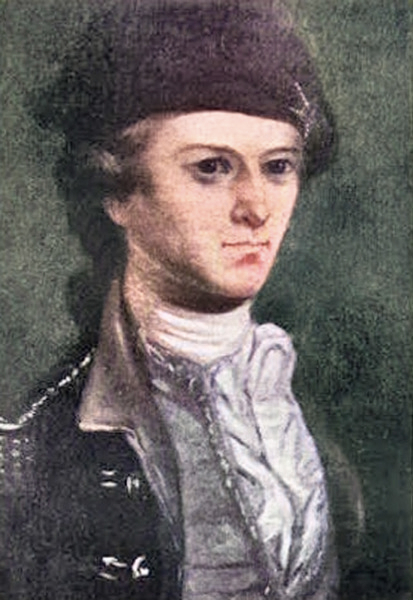
Captain Raymond Demeré.
After De Brahm’s departure, Demeré changed the palisade design to a more permanent structure, featuring 15-foot upright logs, eight feet of which extended at a 15-degree angle. The fort’s interior, covering about two acres, included a powder magazine, blacksmith shop, barracks, officers’ quarters, and supply buildings. The garrison also built drains, troughs for salting beef, a meathouse, and a charcoal pit. The walls and bastions were completed by March 26, 1757, with Demeré reporting that the fort was finished later, on May 30. Governor Lyttelton named the fort after John Campbell, 4th Earl of Loudoun, the new commander-in-chief of British forces in North America.
Life at the fort was mostly routine. Guards changed several times a day, and at night, five guard dogs patrolled the area. The blacksmith repaired Cherokee guns and tools, while the garrison sourced food mainly through hunting, fishing, and farming, supplemented by some supplies from the Cherokee. Sixty women and children, dependents of the soldiers, also lived there.
In June 1757, a 36-man unit, led by Lieutenant James Adamson and Ensign Richard Coytmore, attacked hostile Indians threatening the Cherokee at Great Tellico, killing three and driving the rest away. In September, Paul Demeré attended the Cherokee’s Green Corn Dance and encouraged them to attack the French and their allies. He convinced several Cherokee, including Attakullakulla, to join the Forbes Expedition against Fort Duquesne, but Attakullakulla left in frustration over delays.
After the fort’s completion, Demeré requested a replacement due to illness. His brother, Paul Demeré, arrived on August 6, 1757, with reinforcements. By November, the garrison built a guardhouse and storage buildings, and Demeré’s residence was completed by early 1758. The fort’s well was finished by June 1758, during which the garrison also planted 700 acres of crops.
William Richardson, a Presbyterian missionary, arrived at Fort Loudoun in late 1758. He reported the Little Tennessee River had frozen over on December 19 and noted a persistent rumor of an impending French attack. He baptized a child of one of the soldiers and delivered sermons on Christmas.
Relations between the Cherokee and the British began to deteriorate in late 1758. During the Forbes Expedition that year, a group of Cherokee warriors, who had been assigned to fight northern Indians allied with the French, scalped and killed one or more white settlers. They then displayed the scalps to the British, falsely claiming they belonged to their enemies to collect a promised bounty.

Cherokee Indian
Suspicious of their actions, British soldiers disarmed Attakullakulla and several other warriors who had not been involved in the incident, and they briefly detained them. Virginia Lieutenant Governor Francis Fauquier was able to calm Attakullakulla, but some Cherokee warriors, still angry about this treatment, retaliated by raiding Virginia’s frontier settlements as they returned to the Tennessee Valley. In response, the settlers killed several Cherokee, which escalated the situation rapidly out of control.
In the meantime, William Richardson, the Presbyterian missionary, said that the Cherokee were heavy drinkers and uninterested in his message about the Gospel. Frustrated, he left the fort on February 6, 1759.
In April 1759, Moytoy of Citico led a raid into Virginia that killed several settlers. Both Demeré and Attakullakulla demanded the surrender of some of those responsible, but no Cherokee were given up.
Fearing open warfare, Governor Lyttelton imposed an embargo on the sale of guns and ammunition to the Cherokee in August 1759. As a result, some Cherokee in Great Tellico and Citico sought weapons from the French. In early September, a soldier from Fort Loudoun, an English merchant, and a British park horseman were killed, and their scalps were traded for French ammunition.
Due to rising tensions, Demeré began preparing Fort Loudoun for a possible siege in September 1759. On September 9, after the Cherokee attempted to drive off the fort’s cattle, Demeré ordered them brought inside the fort. There, they were butchered, and the meat was salted for preservation. In November, John Stuart arrived with 70 reinforcements, which increased the fort’s garrison to 200. By January 1760, Demeré reported that the fort had stockpiled enough meat for four months and sufficient corn for several weeks.
After 16 Cherokee chiefs were killed at Fort Prince George, South Carolina, on February 16, 1760, the Cherokee laid siege to Fort Prince George in an attempt to rescue their hostages. The fort’s commander was killed, and his replacement massacred all of the hostages and fended off the attack. The garrison held out for several months, but dwindling supplies forced them to surrender in August. On their return to South Carolina, they were attacked by Cherokee, resulting in the deaths of over 24 soldiers and the capture of many survivors, who were later ransomed.
Outraged by the killings at Fort Prince George, the Cherokee, led by Standing Turkey and Willenawah, launched an attack against Fort Loudoun on March 20, 1760. The fort’s cannons prevented them from getting close enough to inflict serious damage, however, and after firing on the fort for four days, the Cherokee settled in for a long siege. In June 1760, a force of 1,300 British regulars led by Archibald Montgomerie destroyed several of the Lower Towns in South Carolina. It invaded the Middle Towns in North Carolina, but after encountering stiff opposition at Etchoe Pass, the force retreated to Charleston. During the same period, a force led by William Byrd III marched down the Holston River valley from Virginia with plans to relieve the fort, but their progress was very gradual.
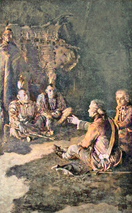
Paul Demeré and John Stuart meeting with the Cherokee at Chota.
Attakullakulla, who remained on good terms with the garrison, was expelled from the Council at Chota for warning the garrison that Oconostota had planned a ruse to lure them out of the fort. In early June 1760, Demeré reduced the rations to one quart of corn for three men. In early July, the garrison ran out of bread and was forced to subsist on horse meat. A dispatch in late July described the condition of the fort’s garrison as “miserable beyond description.” News of Montgomerie’s retreat further demoralized the garrison, and men began deserting. On August 6, Demeré called a council of war, which determined it was “impracticable to hold out any longer.” Stuart and James Adamson met with Oconostota and Standing Turkey at Chota to negotiate the fort’s surrender. The fort, its cannon, and gunpowder would be turned over to the Cherokee, while the soldiers would be allowed to keep their personal arms and baggage.
The flag was lowered at the fort for the final time on August 8, 1760, and the garrison set out for Fort Prince George the following day. They camped for the night at the mouth of Cane Creek, along the Tellico River near modern Tellico Plains. On the morning of August 10, some 700 Cherokee suddenly attacked the camp. The garrison briefly returned fire before surrendering. In the melee, three officers, twenty-three privates, and three women were killed. Demeré was reportedly forced to dance and had dirt stuffed in his mouth before he was executed. Stuart, the only officer to survive the assault, was ransomed by Attakullakulla. The remaining garrison and their families were taken captive. Most were ransomed in the ensuing months.
Following reports that the Cherokee were blocking roads into the Overhill country, Lyttelton prepared to march against them in October. A Cherokee delegation led by Oconostota arrived in Charleston seeking peace, but Lyttelton, suspicious of their intentions, detained them for their safety. He then traveled to Fort Prince George with 1,700 troops and the captives, arriving on December 9. After negotiating a peace treaty with Attakullakulla, he freed Oconostota and other captives, promising to release the rest if the Cherokee who had killed white settlers were surrendered.
Settlers may have used salvaged stones from Fort Loudoun to construct the Tellico Blockhouse in the 1790s, an outpost located across the river from the fort.
Louis Phillipe, the future King of France, visited the blockhouse while in exile in the United States in 1797 and noted that Fort Loudoun was mostly rubble and brush. He suggested the site of the fort had been poorly selected.
After the Cherokee relinquished control of the area with the signing of the Calhoun Treaty in 1819, ownership of the fort’s ruins changed hands several times.
The Colonial Dames of America placed a marker at the site of the fort in 1917.
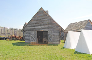
Fort Loudon, Tennessee Blacksmith Shop, by Kathy Alexander.
The Fort Loudoun Association and the Works Progress Administration launched the “Fort Loudoun Restoration Project” in September 1935, with plans to reconstruct the fort based on historical and archaeological research. Excavations at the site, which began in February 1936, were supervised by Hobart S. Cooper. Cooper was advised by archaeologists William S. Webb and Thomas M.N. Lewis. Historians Samuel Cole Williams, Philip Hamer, and Mary Rothrock provided historical research, and the U.S. Army Corps of Engineers provided engineering advice. These excavations determined the locations of the inner and outer palisades, the powder magazine, and the chimney bases of several structures.
The Tennessee Valley Authority provided 250,000 cubic yards of landfill to raise the fort site by 26 feet, bringing it above the reservoir’s operating levels. Care was taken to preserve the original terrain and hillslope. Shortly after this was completed, the palisade, powder magazine, blacksmith shop, two troops’ quarters, a temporary barracks, a storehouse, one of the gun platforms, and a Cherokee house were reconstructed there. Artifacts from the excavations were displayed inside the visitor center.
The fort was designated as a National Historic Landmark in 1965.
The Fort Loudoun Association turned over ownership of the fort to the state in 1978 for the establishment of a state park.
The fort was moved and reconstructed above the water level of Tellico Lake, which was created in 1979. It is now the focus of Fort Loudoun State Historic Park.
There are five miles of moderate hiking trails that loop around the park. Trail maps are available at the park office, on the website, and on the mobile app. Fort Loudoun has 30 picnic sites, with grills at each table. There is one pavilion that accommodates up to 50 people. Reservations can be made online or by calling the park. Restrooms are available in the picnic area. Kayaks andStand-Up Paddleboards are available for daily rent, except on garrison weekends and during special events. Visitors are welcome to use the kayak launch if they bring their own canoe or kayak.
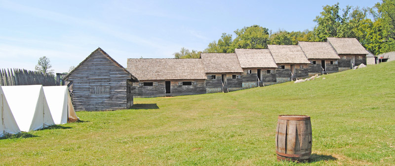
Fort Loudon, Tennessee Barracks by Kathy Alexander.
Fishing is available year-round from a 50-foot, accessible fishing pier that projects over Tellico Lake. A Tennessee fishing license is required.
There are monthly interpretive programs that recreate the daily life of the original troops of Fort Loudoun. Programs are appropriate for all ages. The visitor center holds a bookstore and gift shop. The merchandise reflects the colonial theme of Fort Loudoun.
The visitor center houses an exhibit area with artifacts recovered during an archaeological dig of the fort site. Visitors can watch “The Fort Loudoun Story,” an award-winning 15-minute video about the site’s history, in the auditorium. Hours for the visitor center are 8:00 a.m. to 4:30 p.m. daily.
The Sequoyah Birthplace Museum, which is operated by the federally recognized Eastern Band of Cherokee Indians, stands just West of the fort, on the other side of Highway 360. The museum includes a burial mound containing over 200 burials excavated during the Tellico Archaeological Project. Monuments to the Overhill towns of Tanasi and Chota, the “mother town” of the mid to late 18th century, are located along Bacon Ferry Road, just off Highway 360 about 12 miles South of Fort Loudoun.
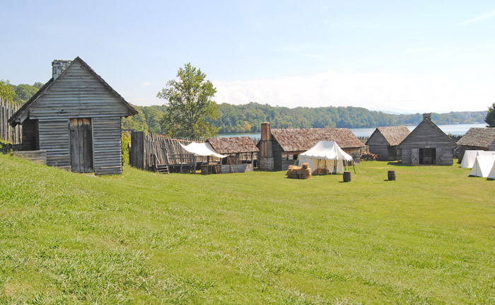
Fort Loudon, Tennessee by Kathy Alexander.
The site of the Tellico Blockhouse is located across the Little Tennessee River to the East of Fort Loudoun. Researchers uncovered the blockhouse and its associated structures during the Tellico Archaeological Project and have now marked them with wooden posts and stones. Several artifacts excavated from the blockhouse site are on display at the Fort Loudoun visitor center.
The Tennessee Valley Authority’s Fort Loudoun Dam, which stands to the North in Lenoir City, and its associated lake are named for the fort.
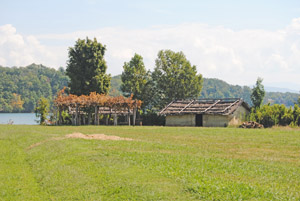
Fort Loudon, Tennessee outbuildings by Kathy Alexander.
The park includes the McGhee/Carson Wildlife Area, which displays the ruins of a former antebellum home and cemetery, offering insights into Tennessee’s Civil War-era plantations, slavery, and local history. The park also features exhibits on women’s history and Native American history, particularly Cherokee history.
Fort Loudoun is now situated on an island created by Tellico Lake at the junction of the Little Tennessee and Tellico Rivers. State Route 360 (Unicoi Turnpike) passes across the island, connecting the state park to Vonore to the North and the rural areas of Monroe County and the Cherokee National Forest to the South.
Fort Loudoun is a popular recreation destination, known for bass fishing, boating, and birdwatching. The tailwater area immediately below the dam is an excellent site for viewing a variety of waterbirds, including herons, cormorants, gulls, osprey, and bald eagles.
Fort Loudoun Reservoir, located on the Tennessee River at Knoxville, is the uppermost in the chain of nine Tennessee Valley Authority reservoirs that form a continuous navigable channel from there to Paducah, Kentucky, 652 miles away.
©Kathy Alexander/Legends of America, updated August 2026.
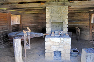
Interior of building in Fort Loudoun, Tennessee by Kathy Alexander.
Also See:
Forts & Presidios Photo Gallery
Soldiers & Officers in American History
Trading Posts of the Fur Trade
Sources:
Visit Knoxville
Fort Loudoun Brochure
Tennessee State Parks
Tennessee Valley Authority
Wikipedia