
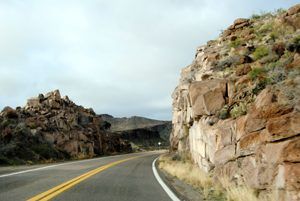
When traveling Route 66, visitors choose whether to go through Yucca or Oatman. Photo by Kathy Alexander.
Two Route 66 alignments run from Kingman, Arizona, Southwest to the California border. The pre-1952 alignment along the Oatman Highway is the most beautiful, offering numerous photo opportunities, legendary Route 66 icons, and a peek at the wild Old West in historic Oatman, Arizona. However, a later alignment bypassed Oatman, allowing travelers to move through the area more quickly via the Yucca Bypass.
Though the earlier route is more scenic, it runs through the notorious Sitgreaves Pass, once the most intimidating stretch of Route 66, with steep grades, a narrow road, and sharp hairpin curves. Regular vehicles should have no problem, but visitors should know the highway does not allow vehicles over 40 feet. Think about coming into Oatman from the South through Topock; it’s an easier route if this is you. Another consideration for big rig RVs or vehicles pulling trailers is that parking is extremely limited in Oatman. Get there early, or you may not find a place to park.
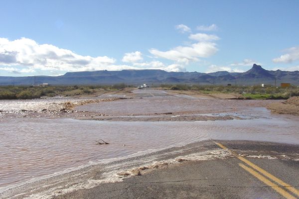
Oatman Highway Flooded.
Occasionally, Oatman Road closes just South of Kingman due to heavy rains and melting snow from the mountains. During heavy precipitation, it may be wise to check road conditions before traveling.
In any case, if you can take Oatman Road, it’s well worth the trip. However, if bypassing Oatman is the better choice for you, the post-1952 alignment through Yucca, Arizona, provides a small peek at a few Route 66-era signs and dusty tourist accommodations.
©Kathy Alexander/Legends of America, updated October 2026.
Also See:
Arizona Route 66 Photo Galleries
Sources:
Kicks on Arizona’s Route 66
Snyder, Tom; Route 66: Traveler’s Guide and Roadside Companion; St. Martin’s Press, New York, NY; 2000
Wikipedia

Return to Route 66