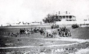
The military road from Fort Leavenworth to Fort Riley, Kansas, was blazed shortly after Fort Riley was created in 1853.
On May 10, 1849, Captain Howard Stansbury started from Fort Leavenworth. He laid out the military road to Fort Kearny, Nebraska, which, for some distance, followed the California Trail from St. Joseph, Missouri, by way of the Blue River. Shortly after the establishment of Fort Riley, a line of communication was established between Fort Leavenworth and that post, which later was extended to Fort Larned.
By an act of Congress approved on March 3, 1853, $11,125 was appropriated for bridges and establishing communications between Fort Leavenworth and the Republican forks of the Kansas River. These bridges crossed the Big Blue River, Delaware River, Soldier Creek, and other small streams. Expenditures were also provided for cutting down some hills on the route.
Congress and the Secretary of War believed significant military advantages would be derived from its completion. It would render the communication between these two military posts and depots more certain and rapid and would facilitate the movement of troops.
Used during the 1850s and 1860s, the road entered Pottawatomie County near St. Marys Mission, crossed St. Marys and Belvue Townships, then west across the Vermillion River to Vieux Crossing. It then left the Oregon Trail, moving southwest through Louisville. Leaving Louisville, it crossed Rock Creek just below the dam, then crossed Louisville Springs Park and moved southwest. It then entered St. George Township and entered Blue Township, crossed the Big Blue River on a ferry operated by Samuel Dyer at the mouth of Juniata Creek. Later, a bridge was built, but it was washed out by a flood in 1856. It went to the Rocky Ford area following an old Indian Trail, west along Wildcat Creek, then crossed over the hill to Eureka Valley and Fort Riley, about four miles north of Manhattan.
“At the time Fort Riley was located, there were no settlements in the immediate country around it, but there was one family at the bridge across the Blue (Samuel D. Dyer, of Juniata) nineteen miles east, and a Catholic mission and Pottawatomie village at St. Marys, fifty-two miles east, where good Father Duerinck had established a college and was gathering in the youthful Pottawatomies and teaching them to become good citizens, with admirable success. Here, Mrs. Bertram kept the only hotel worthy of the name between Fort Riley and Fort Leavenworth. Captain Alley’s store at Silver Lake, the Pottawatomie homes, and the trading post at Hickory Point (Jefferson County) finished the list of settlements, save here and there, at intervals, a squatter’s cabin.”
— Percival G. Lowe
In 1859, Louisville, Kansas, was honored by a visit from Horace Greeley, a New York Tribune journalist. He and Albert D. Richardson, another journalist, were making their way to the Colorado gold fields. Because of the high water at Rock Creek, they were compelled to stay two or three days in Louisville. They stopped at a log cabin belonging to Robert Wilson on the banks of Rock Creek near the dam. The journalists then passed through Manhattan, with Greeley describing it as “a flourishing Yankee settlement of two or three hundred people.”
© Kathy Alexander/Legends of America, updated October 2023.
Also See:
Sources:
Blackmar, Frank W.; Kansas: A Cyclopedia of State History, Vol I; Standard Publishing Company, Chicago, IL 1912
Kansas Collection
Riley County, Kansas
University of Oklahoma


