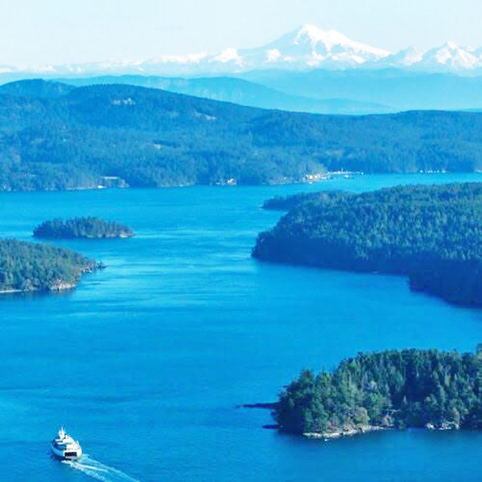
San Juan Islands, Washington.
San Juan Island National Historical Park, also known as American and English Camps, is a U.S. National Historical Park owned and operated by the National Park Service on San Juan Island in Washington. The park consists of the sites of the British and U.S. Army camps during a boundary dispute over ownership of the island.
Located in the Salish Sea, San Juan Island is the westernmost of the main San Juan Islands. This island group is separated from Vancouver Island in British Columbia by the Haro Strait, and from the Washington mainland by the Rosario Strait.
The islands were first settled around 11,000 years ago, coinciding with the retreat of the continental ice shelf at the end of the Last Glacial Period. The original inhabitants were the ancestors of six central Coast Salish tribes. Archaeological evidence indicates that these communities engaged in hunting and gathering on the islands between 6,000 and 8,000 years ago. Additionally, shell middens found in both the English and American Camp areas suggest that thriving villages existed on the islands before the arrival of Europeans.
At that time, the island’s temperate climate, rich soil, timber, and marine resources attracted Native Americans who, for thousands of years, netted salmon, hunted game, and gathered camas roots.
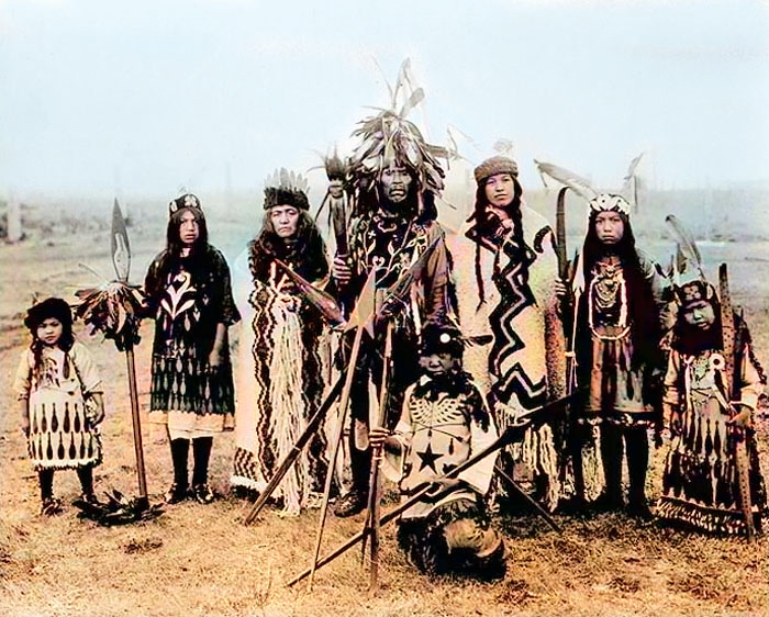
San Juan Islands Natives.
Because of the harsh Winter weather off the Strait of Juan de Fuca, it’s likely that the American Camp area only hosted seasonal encampments for fishing and food gathering. Still, the sheltered bay likely made the English Camp an ideal site for year-round settlement. An excavation by a team from the University of Washington’s Burke Museum of Natural History and Culture established extensive evidence of various human uses of the area around the English Camp. Still, it was unclear whether it was a site of year-round settlement.
These islands were first explored, charted, and named in the 1790s by Spain and Great Britain, and later by the United States. Each staked claims to the Oregon Country—the present states of Washington, Oregon, and Idaho, and parts of Wyoming, Montana, and British Columbia.
Exploration by Europeans brought smallpox to the area by the 1770s, devastating the local population.
Spain withdrew by 1800, and the British and the Americans agreed to a joint occupation of the region in 1818.
As early as 1845, the Hudson’s Bay Company, based at Fort Victoria, Canada, seven miles across the Haro Strait, claimed San Juan Island as an English outpost.
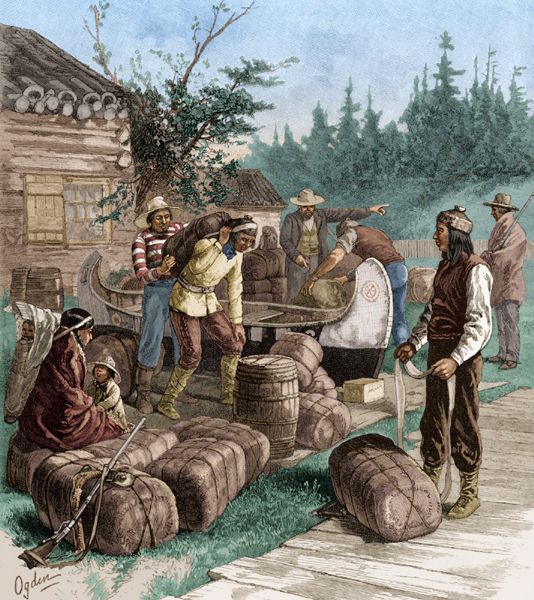
Hudson’s Bay Company Trading Post.
In June 1846, the Treaty of Oregon was signed in London, which settled most of the northwestern border. The boundary was set along the 49th parallel, from the Rocky Mountains to the middle of the “channel” separating Vancouver Island from the mainland, then South to the Strait of Juan de Fuca and West to the Pacific Ocean. There are two channels: Haro Strait, nearest Vancouver Island, and Rosario Strait, nearer the mainland. The San Juan Islands lie between them. Both sides claimed the entire island group.
Both sides pursued their territorial claims, with Americans homesteading on San Juan Island, and the British Hudson’s Bay Company establishing a farm on the southern tip of the island.
By 1851, the company established salmon-curing stations along the island’s western shoreline.
By 1853, the islands were also claimed as U.S. possessions in the newly created Washington Territory, creating a state of limbo that lasted almost 20 years.
That year, the Hudson’s Bay Company established Belle Vue Sheep Farm on the island’s southern shore, near Cattle Point on San Juan Island, by Chief Factor and Governor of the Colony of Vancouver Island, James Douglas. It was established to assert British rights to the San Juan Islands off the coast of Vancouver Island, where the water boundary line between Vancouver Island and the American mainland remained unresolved after the Oregon Treaty of 1846. The move was political, but the island’s fertile soil and grazing lands also turned immediate profits. Word of good farmland spread quickly to the mainland, and by the spring of 1859, at least 18 Americans had settled claims that the British believed were illegal. Today, it is the site of the American Camp.
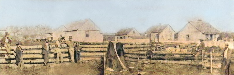
Belle Vue Sheep Farm, September 1859.
In 1854, the Collector of Customs for Washington threatened to seize Hudson’s Bay Company sheep for non-payment of American taxes. The following year, a party of armed American citizens, under the direction of Sheriff Barnes, landed on the island and confiscated 34 Hudson’s Bay Company rams as compensation for the British refusal to pay local taxes.
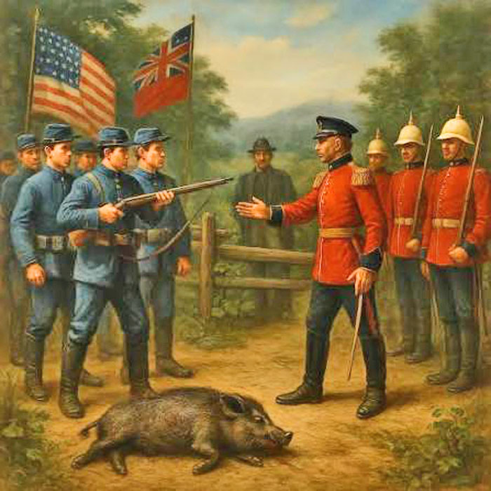
“Pig War” in Washington, courtesy National Park Service.
An uneasy peace ended on June 15, 1859, when Lyman Cutlar, an American, shot a Hudson’s Bay Company pig rooting in his garden, sparking an international dispute known as the Pig War. In the unrest that followed, over 600 American troops were stationed on the island, and permanent American fortifications and houses were constructed.
When British authorities threatened Cutlar with arrest and his countrymen with eviction from the island, a delegation sought protection from Brigadier General William S. Harney, commander of the U.S. Army’s Department of Oregon. Harney ordered a company of infantry commanded by Captain George E. Pickett to San Juan Island. American Camp began on a grassy slope about 200 yards from the shoreline of Griffin Bay. Captain George E. Pickett and 64 men of Company D, 9th Infantry landed there on July 27, 1859.
Pickett changed locations five days later, perhaps in search of level ground, but more likely because British naval guns were looking down his throat. It wasn’t until the arrival of reinforcements under the command of Lieutenant Colonel Silas Casey on August 10 that the post found its permanent home. Casey had decided to move after spending two stormy nights at Pickett’s second camp.
“We are encamped in a rather exposed situation about the wind, being at the entrance of the Straits of Fuca. The weather at times is already quite inclement.”
— Lieutenant Colonel Silas Casey
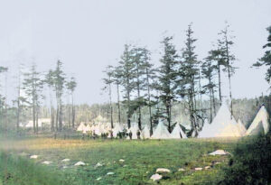
Casey’s Camp, October 1859.
On August 22, Casey ordered his growing force of 450 men to pull up stakes and relocate to the North slope of the ridge just North of the Hudson’s Bay Company barns — once home to the pig that strayed and started the whole mess two months before. Casey ordered large, conical Sibley tents shipped from Fort Steilacoom to the new site, which Casey deemed “a very good position for an entrenched camp.” The tents would supplement the clapboard buildings Pickett had already shipped over from Fort Bellingham, among these the hospital, barracks, laundress, and officers’ quarters.
The veteran colonel also ordered Corps of Engineers 2nd Lieutenant Henry Martyn Robert to begin work on an earthen fortification on the ridgetop East of the new camp, with a commanding view of both the strait and the bay. In the meantime, the British riding at anchor in Griffin Bay were nothing short of impressed with the colonel’s enterprise.
“It is very strongly placed in the most commanding position at this end of the island, well sheltered in the rear and on one side by the Forest and on the other side by a Commanding eminence.”
— Captain James Prevost, commander of the H.M.S. Satellite.
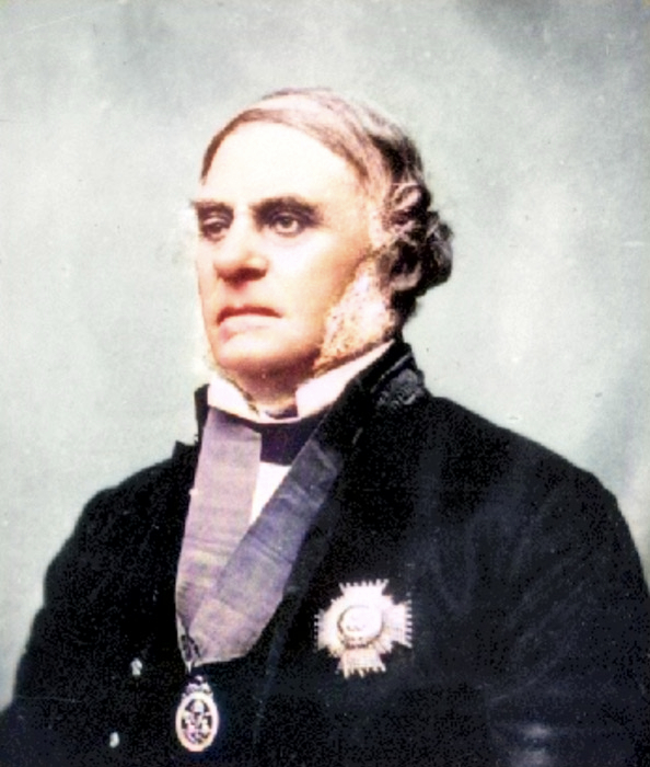
British Governor and Hudson’s Bay Company chief factor James Douglas.
When word of the crisis reached Washington, D.C., both governments agreed to send Lieutenant General Winfield Scott, US Army commander, to contain the affair. He arrived by steamer in late October, and within a week he and Douglas agreed to reduce their forces to no more than 100 US soldiers and a single British warship. The American homesteaders requested military protection, resulting in the establishment of American Camp. By November 1859, cooler heads prevailed, and an agreement was reached, in which both sides would maintain camps on the island until the dispute could be resolved through diplomacy.
On March 21, 1860, Royal Marines landed and set up “English Camp” on Garrison Bay, 13 miles northwest of American Camp. For the next 12 years, San Juan Island would remain under joint military occupation.
The period of military occupation was peaceful; a road was built between the two camps, and Americans in the village of San Juan engaged in commerce with both encampments.
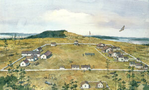
American Camp, NPS Painting by Richard Schlecht.
In 1861, the Governor and his Committee recommended that operations on the island be wound up as soon as possible, as a result of the continual disruption of Hudson’s Bay Company sheep by American squatters and whisky sellers, the subsequent demoralization of Hudson’s Bay Company employees, as well as the fact that the British government was unwilling to support an establishment on a disputed island.
In 1862, Chief Trader Charles John Griffin left the island and returned to Canada, leaving Robert Firth, a shepherd, to manage the farm.
Belle Vue Sheep Farm was leased to Robert Firth from 1864 to 1873.
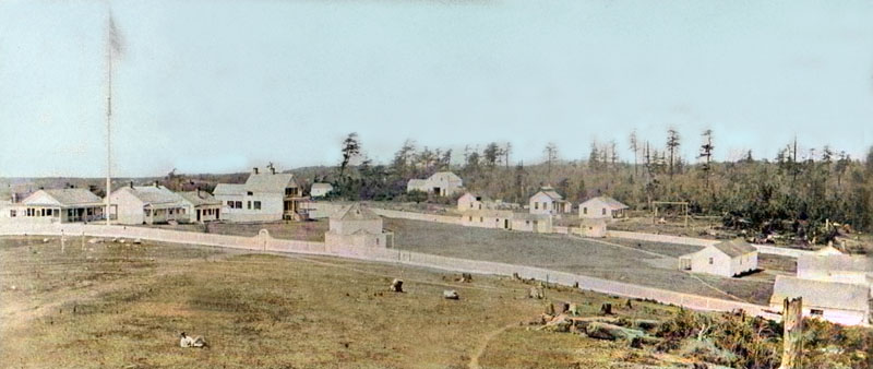
American Camp, about 1868.
As part of the 1871 Treaty of Washington, the two countries agreed that Kaiser Wilhelm I of Germany would arbitrate the matter of the islands. The following year, he declared the boundary the Haro Strait, adding the San Juan Islands to American territory.
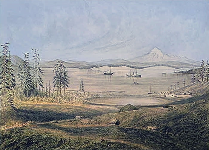
San Juan Village and Griffin Bay, Washington.
The San Juan Islands’ interior waterways and narrow passages provided a covered anchorage for warships. A spyglass from the American Camp prairie could track every sortie from Victoria and Esquimalt Harbors and beyond. This was a significant advantage in an age when commerce and warfare in the region moved primarily by sea.
The Royal Marines left in November 1872, and the American camp was reduced in size and scope. The buildings and properties were sold as surplus or abandoned.
American Camp remained a U.S. military installation until July 17, 1874. Eight companies from four regiments – all regular army and under the command of 15 different officers – manned the post through some of the most tumultuous years of American history. They endured isolation, bad food, worse quarters, and crushing boredom. Some soldiers were willing to risk company punishment – such as carrying a 40-pound log around the post all day – to numb themselves with the rotgut whisky of old San Juan Town. Some committed suicide and others deserted. But most endured and contributed to the legacy of peace we celebrate today.
The British camp was homesteaded in 1876 by William Crook, a farmer and carpenter, whose son built a house there in the early 20th century.
The Crook family donated their property to the state beginning in the 1950s, and Washington acquired land around the American Camp beginning in 1951.
The camp sites were designated a National Historic Landmark in 1961, and listed on the National Register of Historic Places in 1966. That year, these properties formed the core of what became San Juan Island National Historical Park.
The park expanded slightly in 2013.
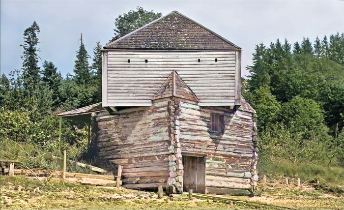
English Camp Blockhouse.
The English Camp site is on Garrison Bay on the island’s northwestern shore. Today, the Union Jack still flies there, raised and lowered daily by park rangers, making it one of the very few places without diplomatic status where U.S. government employees regularly hoist another country’s flag. Surviving buildings from the British occupation include a commissary, barracks, blockhouse, and hospital; the latter was sold and moved from the site, but was later acquired by the park and returned.
The American Camp site is on the island’s southernmost peninsula and partially overlaps the original Hudson’s Bay Company farm. The park property also includes the original site of San Juan village on the North shore of the peninsula, which was abandoned after the dispute ended and was entirely burned in 1890. The camp site includes three surviving buildings from the American military occupation: two officers’ quarters and the house and working quarters of the camp laundress.
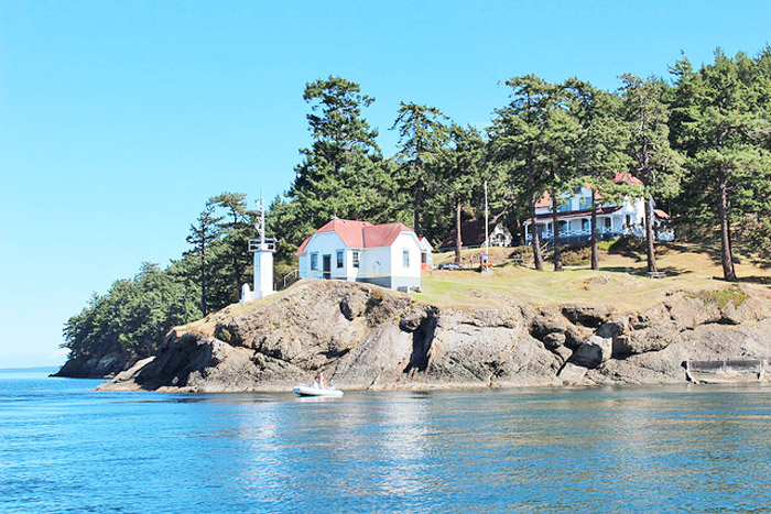
San Juan Island Lighthouse.
The park encompasses 2,146 acres, divided between two sites: American Camp on the South end of San Juan Island and English Camp on the northwest side of the island. Entry to both areas is free, and each includes a visitor center. American Camp has three mapped hiking trails, including one to the summit of Mount Finlayson. English Camp includes the Bell Point Trail, Young Hill Trail, and Mitchell Hill Trail Network. American Camp includes South Beach on the Strait of Juan De Fuca, with views of the Olympic Mountains, and July 4 Beach on Griffin Bay. Both English and American Camps have kayak launches.
The American Camp prairie is home to the world’s only viable population of the island marble butterfly. The butterfly was thought extinct for 90 years before being rediscovered in 1998 and was listed as endangered in 2020. Bird species commonly spotted at American Camp include bald eagle, Harrier (bird), Harlequin duck, American goldfinch, Great horned owl, and Osprey. Foxes are commonly spotted, especially on the American Camp prairie, where they prey on rabbits. Orcas, humpback whales, and gray whales can occasionally be spotted from both parks.
The San Juan Islands National Historical Park offers serene sunsets, access to a historic lighthouse, and world-class hiking.
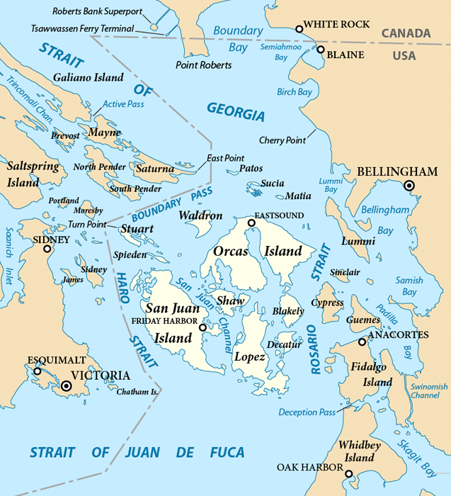
San Juan Islands, Washington Map, courtesy of Wikipedia.
Now, several sites in the original American Camp on the Southwest side of the island and English Camp on the North side offer a multitude of learning opportunities, fun activities, and outdoor adventures.
Also See:
©Kathy Alexander/Legends of America, updated August 2026.
Sources:
National Park Service
National Park Service – 2
North American Forts
Visit San Juan Islands
Wikipedia