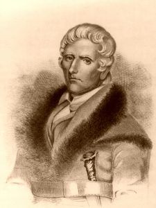
Up to this period, very little was known by the English of the country south of the Ohio River. In 1754, James M. Bride, with some others, had passed down the Ohio River in canoes, landed at the mouth of the Kentucky River, and marked the initials of their names and the date on the barks of trees. On their return, they were the first to give a particular account of the beauty and richness of the country to the inhabitants of the British settlements. No further notice seems to have been taken of Kentucky until 1767, when John Finlay, an Indian trader, with others, passed through a part of the rich lands of Kentucky — then called by the Indians “the Dark and Bloody Ground.” Finlay, returning to North Carolina, fired the curiosity of his neighbors with the reports of the discoveries he had made. In consequence of this information, Colonel Daniel Boone, in company with Finlay, Stewart, Holden, Monay, and Cool, set out from their residence on the Yadkin River, in North Carolina, on May 1, 1769.
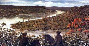
After a long and fatiguing march over a mountainous and pathless wilderness, they arrived on the Red River. Here, from the top of an eminence, Boone and his companions first beheld a distant view of the beautiful lands of Kentucky. The plains and forests abounded with wild beasts of every kind; deer and elk were common; the buffalo were seen in herds, and the plains were covered with the richest verdure. The glowing descriptions of these adventurers inflamed the imaginations of the borderers, and their sterile hills and mountains beyond lost their charms compared to the fertile plains of this newly-discovered Paradise in the West.
In 1770, Ebenezer Silas and Jonathan Zane settled Wheeling, West Virginia. In 1771, such was the rush of emigration to western Pennsylvania and western Virginia, in the region of the Upper Ohio River, that every kind of breadstuff became so scarce that for several months, a significant part of the population was obliged to subsist entirely on meats, roots, vegetables, and milk, to the entire exclusion of all breadstuffs. Hence, that period was long after, known as “the starving year.” Settlers, enticed by the beauty of the Cherokee country, emigrated to East Tennessee, and hundreds of families also moved farther south to the mild climate of West Florida, which at this period extended to the Mississippi River. In the summer of 1773, Frankfort and Louisville, Kentucky, were laid out. The following year was signalized by “Dunmore’s War,” which temporarily checked the settlements.
In the summer of 1774, several other parties of surveyors and hunters entered Kentucky, and James Harrod erected a dwelling on or near the site of Harrodsburg, around which afterward arose “Harrod Station.” In the year 1775, Colonel Richard Henderson, a native of North Carolina, on behalf of himself and his associates, purchased from the Cherokee all the country lying between the Cumberland River and Cumberland Mountains and Kentucky River, and south of the Ohio River, which now comprises more than half of the State of Kentucky. The new country he named Transylvania. The first legislature sat at Boonsborough and formed an independent government on liberal and rational principles. Henderson was very active in granting lands to new settlers. The legislature of Virginia subsequently crushed his schemes, claiming the sole right to purchase lands from the Indians, and declared his purchase null and void. But, as some compensation for the services rendered in opening the wilderness, the legislature granted to the proprietors a tract of land, twelve miles square, on the Ohio River, below the mouth of Green River.
In 1775, Daniel Boone, in the employment of Henderson, laid out the town and fort afterward called Boonsborough. From this time, Boonsborough and Harrodsburg became the nucleus and support of emigration and settlement in Kentucky. In May, another fort was built under the command of Colonel Benjamin Logan, named Logan’s Fort. It stood on the site of Stanford in Lincoln County and became an important post.
In 1776, the jurisdiction of Virginia was formally extended over the colony of Transylvania, which was organized into a county named Kentucky. The first court was held at Harrodsburg in the spring of 1787. At this time, the American Revolution was in total progress, and the early settlers of Kentucky were particularly exposed to the incursions of the Indian allies of Great Britain. The early French settlements in Illinois country, now having that power, formed important points around which the British assembled the Indians and instigated them to murderous incursions against the pioneer population.
The year 1779 was marked, in Kentucky, by the passage of the Virginia Land Laws. At this time, claims of various kinds existed on the western lands. Commissioners were appointed to examine and judge these various claims as they might be presented. These having been provided for, the residue of the rich lands of Kentucky was in the market. As a consequence of the passage of these laws, a vast number of emigrants crossed the mountains into Kentucky to locate land warrants: and in the years 1779-80 and 1781, the great and absorbing topic in Kentucky was to enter a survey and obtain patents for the richest lands, and this, too, in the face of all the horrors and dangers of an Indian war.
Although the main features of the Virginia land laws were just and liberal, a significant defect existed in their not providing for a general survey of the country by the parent state and its subdivision into sections and parts of lections. Each warrant-holder was required to do his own survey and had the privilege of locating according to his pleasure; interminable confusion arose from want of precision in the boundaries. In unskillful hands, entries, surveys, and patents were piled upon each other, overlapping and crossing in inextricable confusion; hence, when the country became densely populated, vexatious lawsuits and perplexities arose. Such men as Simon Kenton and Daniel Boone, who had done so much for the welfare of Kentucky in its early days of trial, found their indefinite entries declared null and void and were dispossessed, in their old age, of any claim upon that soil for which they had periled their all.
For a time only, the close of the American Revolution suspended Indian hostilities, and the Indian war was again carried on with renewed energy. This arose from the failure of both countries to execute the treaty’s terms fully. By it, England was obligated to surrender the northwestern posts within the Union’s boundaries and return slaves taken during the war. The United States, on its part, had agreed to offer no legal obstacles to the collection of debts due from her citizens to those of Great Britain. Virginia, indignant at the removal of her slaves by the British fleet, by law prohibited the collection of British debts. At the same time, England, in consequence, refused to deliver the posts, so she held them for more than ten years until Jay’s Treaty was concluded.
Settlements rapidly advanced. Simon Kenton having, in 1784, erected a block-house on the site of Maysville, — then called Limestone — that became the point from whence the stream of emigration, from down its way on the Ohio River, turned into the interior.
In the spring of 1783, the first court in Kentucky was held at Harrodsburg. At this period, establishing a government independent of Virginia appeared to be paramount as a consequence of troubles with the Indians. For this object, the first convention in Kentucky was held at Danville in December 1784, but it was not consummated until eight different conventions had been held, running through a term of six years. The last was assembled in July 1790; on February 4, 1791, Congress passed the act admitting Kentucky into the Union, and in April, she adopted a State Constitution.
Before this, unfavorable impressions prevailed in Kentucky against the Union, in consequence of the inability of Congress to compel a surrender of the northwest posts and the apparent disposition of the northern States to yield to Spain, for twenty years, the sole right to navigate the Mississippi River to the Gulf of Mexico, the exclusive right to which was claimed by that power, it being within her dominions. Kentucky was suffering under the horrors of Indian warfare and having no government of her own; she saw that beyond the mountains could not afford them protection. When, in the year 1786, several States in Congress showed a disposition to yield the right of navigating the Mississippi River to Spain for certain commercial advantages, which would inure to their benefit, but, not in the least to that of Kentucky, there arose a universal voice of dissatisfaction. Many favored declaring the independence of Kentucky and erecting an independent government west of the mountains.
Spain was then an immense land-holder in the west. She claimed all east of the Mississippi River lying south of the 31st degree of north latitude and all west of that river to the ocean.
In May 1787, a convention was assembled at Danville to remonstrate with Congress against ceding the Mississippi River’s navigation to Spain. Still, it having been ascertained that Congress, through the influence of Virginia and the other southern States, would not permit this, the convention had no occasion to act upon the subject.
In 1787, quite a sensation arose in Kentucky in consequence of a profitable trade having been opened with New Orleans by General James Wilkinson, who descended thither in June with a boatload of tobacco and other productions of Kentucky. Previously, all those who ventured down the river within the Spanish settlements had their property seized. The Spanish Minister held out the lure that if Kentucky would declare her independence from the United States, the navigation of the Mississippi River should be opened to her, but this privilege would never be extended. At the same time, she was a part of the Union as a consequence of existing commercial treaties between Spain and other European powers.
In the winter of 1788-99, the notorious Dr. John Connolly, a secret British agent from Canada, arrived in Kentucky. His object appeared to be to sound the temper of her people and ascertain if they were willing to unite with British troops from Canada and seize upon and hold New Orleans and the Spanish settlements on the Mississippi River. He dwelt upon the advantages it must be to the people of the west to hold and possess the right to navigate the Mississippi River, but his overtures were not accepted.
At this time, settlements had been commenced within the present limits of Ohio. Before giving a sketch of these, we glance at the western land claims.
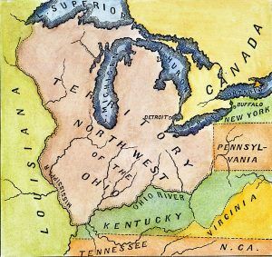
The claim of the English monarch to the Northwestern Territory was ceded to the United States by the treaty of peace, signed in Paris on September 3, 1783. During the pendency of this negotiation, Mr. Oswald, the British commissioner, proposed the Ohio River as the western boundary of the United States, and, but for the indomitable persevering opposition of John Adams, one of the American commissioners, who insisted upon the Mississippi River as the boundary, this proposition would have probably been acceded to.
The States who owned western un-appropriated lands under their original charters from British monarchs, with a single exception, ceded them to the United States. In March 1784, Virginia ceded the soil and jurisdiction of her lands northwest of the Ohio River. In September 1786, Connecticut ceded her claim to the soil and jurisdiction of her western lands, except that part of the Ohio River known as the “Western Reserve,” To that, she ceded her jurisdictional claims in 1800. Massachusetts and New York ceded all their claims. Besides these were the Indian claims asserted by the right of possession. These have been extinguished by various treaties, from time to time, as the inroads of emigration were rendered necessary.
The Indian title to a large part of the territory of Ohio had been extinguished. Before settlements were commenced, Congress found it necessary to pass ordinances for surveying and selling the lands in the Northwest Territory. In October 1787, Manasseh Cutler and Winthrop Sargeant, agents of the New England Ohio Company, made a large purchase of land bounded south by the Ohio River and west by the Scioto River. Its settlement commenced at Marietta in the spring of 1788, the first made by the Americans within Ohio. A settlement had been attempted within the limits of Ohio, on the site of Portsmouth, in April 1785, by four families from Redstone, Pennsylvania. However, difficulties with the Indians compelled its abandonment.
About the time of the settlement of Marietta, Congress appointed General Arthur St. Clair, Governor; Winthrop Sargeant, Secretary; Samuel Holden Parsons, James M. Varnum, and John Cleves Symmes, Judges in and over the Territory. They organized its government and passed laws, and the governor erected the county of Washington, embracing nearly the eastern half of the present limits of Ohio.
In November 1788, the second settlement within the limits of Ohio was commenced at Columbia, on the Ohio River, five miles above the site of Cincinnati, and within the purchase and under the auspices of John Cleves Symmes and associates. Shortly after, settlements were commenced at Cincinnati and North Bend, sixteen miles below, both within Symmes’s purchase. In 1790, another settlement was made at Gallipolis by a colony from France — the name signifying the city of the French.
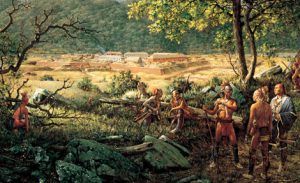
On January 9, 1789, a treaty was concluded at Fort Harmer, at the mouth of the Muskingum River, opposite Marietta, by Governor St. Clair, in which the treaty, which had been made four years previous, at Fort McIntosh, on the site of Beaver, Pennsylvania, was renewed and confirmed. It did not, however, produce the favorable results anticipated. The Indians, the same year, committed numerous murders, which occasioned the alarmed settlers to erect block houses in each new settlement. In June, Major Doughty, with 140 men, commenced the erection of Fort Washington on the site of Cincinnati. General Josiah Harmer arrived at the Fort with 300 men during the summer.
Negotiations with the Indians proved unfavorable; General Josiah Harmer marched in September 1790 from Cincinnati with 1,300 men, less than one-fourth of whom were regulars, to attack their towns on the Maumee River. He succeeded in burning their towns, but in an engagement with the Indians, part of his troops met with a severe loss. The following year, a larger army was assembled at Cincinnati under General St. Clair, composed of about 3,000 men. With this force, he commenced his march toward the Indian towns on the Maumee River. Early in the morning of November 4, 1791, his army, while in camp on what is now the line of Darke and Mercer Counties, within three miles of the Indiana line and about 70 miles north of Cincinnati, was surprised by a large body of Indians, and defeated with terrible slaughter. A third army, under General Anthony Wayne, was organized. On August 20, 1794, they met and ultimately defeated the Indians on the Maumee River, about 12 miles south of the site of Toledo. The Indians, at length, becoming convinced of their inability to resist the American arms, sued for peace. On August 3, 1795, General Wayne concluded a treaty at Greenville, sixty miles north of Cincinnati, with eleven of the most powerful northwestern tribes, in a grand council. This gave peace to the West for several years, during which the settlements progressed rapidly. Jay’s Treaty, which concluded November 19, 1794, was a most important event to the prosperity of the West. It provided for the withdrawal of all the British troops from the northwestern posts. In 1796, the Northwestern Territory was divided into five counties. Marietta was the seat of justice of Hamilton and Washington counties; Vincennes of Knox County; Kaskaskia of St. Clair County; and Detroit of Wayne County. The settlers, out of the limits of Ohio, were Canadian or Creole French. The headquarters of the northwest army were removed to Detroit, at which point a fort had been built by De la Motte Cadillac as early as 1701.
Initially, Virginia claimed jurisdiction over a large part of Western Pennsylvania as being within her dominions. Yet, it was not until after the close of the American Revolution that the boundary line was permanently established.
Then this tract was divided into two counties. Westmoreland extended from the mountains west of the Alleghany River, including Pittsburgh, and the entire country between the Kishkeminitas and the Youghiogheny Rivers. The other, Washington, comprised all south and west of Pittsburgh, inclusive of all the country east and west of the Monongahela River.
At this period, Fort Pitt was a frontier post, around which had sprung up the village of Pittsburgh, which was not regularly laid out into a town until 1784. The settlement on the Monongahela at “Redstone Old Fort,” or “Fort Burd,” as it originally was called, having become an important point of embarkation for western emigrants, was the following year laid off into a town under the name of Brownsville. Regular forwarding houses were soon established here, by whose lines goods were systematically wagoned over the mountains, thus superseding the slow and tedious mode of transportation by pack-horses, to which the emigrants had previously been obliged to resort.
In July 1786, The Pittsburgh Gazette, the first newspaper issued in the west, was published; the second was the Kentucky Gazette, established at Lexington in August of the following year. As late as 1791, the Alleghany River was the frontier limit of the settlements of Pennsylvania, the Indians holding possession of the region around its northwestern tributaries, except for a few scattering settlements, which were all simultaneously broken up and exterminated in one night in February of this year, by a band of 150 Indians. During Harmer, St. Clair, and Wayne campaigns, Pittsburgh was the army’s great depot.
By this time, agriculture and manufacturing had begun to flourish in western Pennsylvania and Virginia, and extensive trade was carried on with the settlements on the Ohio River and the lower Mississippi River, with New Orleans and the rich Spanish settlements in its vicinity. Monongahela whiskey, horses, cattle, and agricultural and mechanical implements of iron were the principal export articles. The Spanish government soon after much embarrassed this trade by imposing heavy duties. The first settlements in Tennessee were made in the vicinity of Fort Loudon, on the Little Tennessee River, in Monroe County, East Tennessee, in about 1758. Forts Loudon and Chiswell were built at that time by Colonel Byrd, who marched into the Cherokee country with a regiment from Virginia. The next year, war broke out with the Cherokee. In 1760 the Cherokee besieged Fort Loudon, into which the settlers had gathered their families, numbering nearly 300 persons. The latter was obliged to surrender for want of provisions but, agreeably to the terms of capitulation, were to retreat unmolested beyond the Blue Ridge. When they had proceeded about 20 miles on their route, the Indians fell upon them and massacred all but nine, not even sparing the women and children.
This war thus broke up the only settlements. The next year, the celebrated Daniel Boone made an excursion from North Carolina to the waters of the Holstein River. In 1766 Colonel James Smith, with five others, traversed a great portion of Middle and West Tennessee. At the mouth of the Tennessee River, Smith’s companions left him to explore farther in Illinois. At the same time, in company with an African-American lad, he returned home through the wilderness after an absence of eleven months, during which he saw “neither bread, money, women, nor spirituous liquors.”
Other explorations soon succeeded, and permanent settlements were first made in 1768 and 1769 by emigrants from Virginia and North Carolina, who were scattered along the branches of the Holstein, French Broad, and Watauga Rivers. The jurisdiction of North Carolina was extended in 1777 over the Western District, which was organized as the county of Washington and extended westward to the Mississippi River. Soon after, some of the more daring pioneers made a settlement at Bledsoe’s Station, in Middle Tennessee, in the heart of the Chickasaw Nation, and separated several hundred miles, by the usually traveled route, from their kinsmen on the Holstein.
Several French traders had previously established a trading post and erected a few cabins at the “Bluff” near the site of Nashville. To the same vicinity Colonel James Robertson, in the fall of 1780, emigrated with 40 families from North Carolina, who were driven from their homes by the marauding incursions of Tarleton’s cavalry, and established “Robertson’s Station,” which formed the nucleus around which gathered the settlements on the Cumberland. The Cherokee, having commenced hostilities upon the frontier inhabitants about the commencement of the year 1781, Colonel Campbell, of Virginia, with 700 mounted riflemen, invaded their country and defeated them. At the close of the American Revolution, settlers moved in large numbers from Virginia, North and South Carolina, and Georgia. Nashville was laid out in the summer of 1784 and named after General Francis Nash, who fell at Brandywine.
The people of this district, in common with those of Kentucky and on the tipper Ohio River, were deeply interested in navigating the Mississippi River. Under the tempting offers of the Spanish governor of Louisiana, many were lured to emigrate to West Florida and become subjects of the Spanish.
North Carolina, having ceded her claims to her western lands, Congress, in May 1790, erected this into a territory under the name of the “Southwestern Territory,” according to the provisions of the ordinance of 1787, excepting the article prohibiting slavery.
The territorial government was organized with a legislature, and a legislative council, with William Blount as their first governor. Knoxville was made the seat of government. A fort was erected to intimidate the Indians, by the United States, in the Indian country, on the site of Kingston. From this period until the final overthrow of the northwestern Indians by Wayne, this territory suffered from the hostilities of the Creek and Cherokee, who were secretly supplied with arms and ammunition by the Spanish agents, with the hope that they would exterminate the Cumberland settlements. In 1795 the territory contained a population of 27,262, of whom about 10,000 were slaves. On June 1, 1796, it was admitted into the Union as the State of Tennessee.
By the treaty of October 27, 1795, with Spain, the old sore, the right to navigate the Mississippi River, was closed, and that power ceded to the United States the right of free navigation.
The Territory of Mississippi was organized in 1798, and Winthrop Sargeant was appointed Governor. By the ordinance of 1787, the people of the Northwest Territory were entitled to elect Representatives to a Territorial Legislature whenever it contained 5,000 males of full age. Before the close of 1798, the Territory had this number, and members of a Territorial Legislature were soon chosen. In 1799, William H. Harrison was chosen as the first delegate to Congress from the Northwest Territory. In 1800, the Territory of Indiana was formed, and the next year, William H. Harrison was appointed Governor. This Territory comprised the states of Indiana, Illinois, Wisconsin, and Michigan, a vast country with less than 6,000 whites, mainly of French origin. On April 30, 1802, Congress passed an act authorizing a convention to form a constitution for Ohio. This convention met at Chillicothe in the succeeding November, and on the 29th of that month, a constitution of the State Government was ratified and signed. By that act, Ohio became one of the States of the Federal Union. In October 1802, the whole western country was thrown into a ferment by the suspension of the American right of depositing goods and produce at New Orleans, guaranteed by the treaty of 1795 with Spain. The whole commerce of the west was struck at a vital point, and the treaty was violated. On February 25, 1803, the port was opened to provisions on paying a duty, and in April following, by orders of the King of Spain, the right of deposit was restored.
After the treaty of 1763, Louisiana remained in possession of Spain until 1803, when it was again restored to France by the terms of a secret article in the treaty of St. Ildefonso concluded with Spain in 1800. France held but brief possession; on April 30, she sold her claim to the United States for the consideration of fifteen million dollars. On the 20th of the succeeding December, General Wilkinson and Claiborne took possession of the country for the United States and entered New Orleans at the head of the American troops.
On January 11, 1805, Congress established the Territory of Michigan and appointed William Hull, Governor. This same year, Detroit was destroyed by fire. The town occupied only about two acres, completely covered with buildings and combustible materials, except the narrow intervals of fourteen or fifteen feet used as streets or lanes. A strong and secure defense of tall and solid pickets surrounded the whole.
During this period, the conspiracy of Aaron Burr began to agitate the western country. In December 1806, a fleet of boats, with arms, provisions, and ammunition, belonging to the confederates of Burr, were seized, upon the Muskingum, by agents of the United States, which proved a fatal blow to the project. In 1809, the Territory of Illinois was formed from the western part of the Indiana Territory and named for the powerful tribe that once occupied its soil.
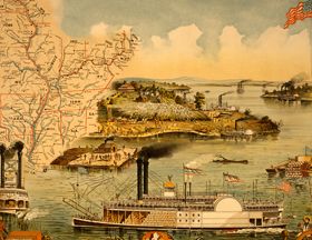
The Indians, who, since the Treaty of Greenville, had been at peace about 1810, began to commit aggressions upon the inhabitants of the west under the leadership of Tecumseh. The following year, they were defeated by General Harrison, at the battle of Tippecanoe, in Indiana. This year was also distinguished by the voyage, from Pittsburgh to New Orleans, of the steamboat New Orleans, the first steamer ever launched upon the western waters.
In June 1812, the United States declared war against Great Britain. In this war, the west was the principal theater. Its opening scenes were as gloomy and disastrous to the American arms as its close was brilliant and triumphant.
At the close of the war, the population of the Territories of Indiana, Illinois, and Michigan was less than 50,000. But, from that time onward, the tide of emigration again went forward with unprecedented rapidity. On April 19, 1816, Indiana was admitted into the Union, and Illinois, on December 3, 1818. The remainder of the Northwest Territory, as then organized, was included in the Territory of Michigan, of which that section west of Lake Michigan bore the name of the Huron District. This part of the west increased so slowly that, by the census of 1830, the Territory of Michigan contained, exclusive of the Huron District, but 28,000 souls, while that had only a population of 3,640. Emigration began to set in more strongly to the Territory of Michigan because steam navigation had been successfully introduced upon the great lakes of the west. The first steamboat upon these immense inland seas was the Walk-in-the-Water, which, in 1819, went as far as Mackinaw; yet, it was not until 1826 that a steamer rode the waters of Lake Michigan, and six years more had elapsed before one had penetrated as far as Chicago, Illinois.
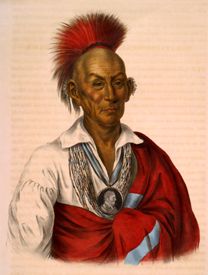
The year 1832 was signalized by three important events in the history of the west — the first appearance of the Asiatic Cholera, the Great Flood in the Ohio River, and the Black Hawk War.
The west has suffered serious drawbacks, in its progress, from inefficient systems of banking. One bank frequently was made the basis of another, and that of a third, and so on throughout the country. In establishing a bank, some three or four shrewd agents or directors would collect a few thousand in specie that had been honestly paid in and then make up the remainder of the capital with the bills or stock from some neighboring bank. Thus, each bank’s connection with others was so intimate that when one or two gave way, they all went down together in one common ruin.
In 1804, the year preceding Louisiana Purchase, Congress formed from part of it the “Territory of Orleans,” which was admitted into the Union in 1812 as the State of Louisiana. In 1805, after the Territory of Orleans was erected, the remaining part of the purchase from the French was formed into the Territory of Louisiana, of which the old French town of St. Louis was the capital. This town, the oldest in the Territory, had been founded in 1764, by M. Laclede, agent for a trading association, to whom had been given, by the French government of Louisiana, a monopoly of the commerce in furs and peltries with the Indian tribes of the Missouri and upper Mississippi Rivers. The Territory’s population in 1805 was inconsequential and consisted mainly of French Creoles and traders scattered along the banks of the Mississippi and the Arkansas Rivers. Upon the admission of Louisiana as a State, the name of the Territory of Louisiana was changed to that of Missouri. From the southern part of this, in 1819, the Territory of Arkansas was erected, which then contained but a few thousand inhabitants, who were mainly in detached settlements on the Mississippi and on the Arkansas Rivers, in the vicinity of the “Post of Arkansas.” The first settlement in Arkansas was made on the Arkansas River, about the year 1723, upon the grant of the notorious John Law, but, being unsuccessful, was soon after abandoned. In 1820, Missouri was admitted into the Union and Arkansas in 1836.
Michigan was admitted as a State in 1837. The Huron District was organized as the Wisconsin Territory in 1836 and was admitted into the Union, as a State, in 1848. The first settlement in Wisconsin was made in 1665, when Father Claude Allouez established a mission at La Pointe, at the western end of Lake Superior. Four years after, a mission was permanently established at Green Bay: and eventually, the French also established themselves at Prairie du Chien. In 1819, an expedition under Governor Cass explored the territory and found it to be little more than the abode of a few Indian traders scattered here and there. At about this time, the Government established military posts at Green Bay and Prairie du Chien. About 1825, some farmers settled in the vicinity of Galena, which had then become a noted mineral region. Immediately after the war with Black Hawk, emigrants flowed in from New York, Ohio, and Michigan, and the flourishing towns of Milwaukee, Sheboygan, Racine, and Southport were laid out on the borders of Lake Michigan. After the same war, the lands west of the Mississippi River were thrown open to emigrants, who commenced settlements in the vicinity of Fort Madison and Burlington in 1833. Dubuque had long before been a trading post and the first settlement in Iowa. It derived its name from Julien Dubuque, an enterprising French Canadian who, in 1788, obtained a grant of 140,000 acres from the Indians, upon which he resided until he died in 1810 when he had accumulated immense wealth by lead mining and trading. In June 1838, Iowa was erected into a Territory, and in 1846, it became a State.
In 1849, Minnesota Territory was organized; it then contained a little less than 5,000 souls. The first American establishment in the Territory was Fort Snelling, at the mouth of St. Peters, or Minnesota River, founded in 1819. The French and the English occupied this country with their fur trading forts. Pembina, on the northern boundary, is the oldest village, established in 1812 by Lord Selkirk, a Scottish nobleman, under a grant from the Hudson’s Bay Company.
But, here, the adventurous spirit of emigration does not pause. The blue waters of the far distant Pacific were the only barrier to the never-ceasing human tide. The rich valleys of Oregon and the golden sands of California then became the lures to attract thousands from the comforts of home, civilization, and refinement in search of fortune and independence in distant wilds.
By Henry Howe, 1857 – Compiled and edited by Kathy Alexander/Legends of America, updated January 2023.
Also See:
Adventures in the American West
Westward Expansion & Manifest Destiny
About the Author and Article: This article was a chapter in Henry Howe’s book Historical Collections of the Great West, published by George F. Tuttle, of New York, in 1857. Henry Howe (1816 -1893) was an author, publisher, historian, and bookseller. Born in New Haven, Connecticut, his father owned a popular bookshop and a publisher. Henry would write histories of several states. His most famous work was the three-volume Historical Collections of Ohio. As he collected facts for his writing, he also drew sketches which helped create interest in his work. The article as it appears here is not verbatim, as it has been edited for the modern reader; however, the content essentially remains the same.

