
Santa Fe Trail in New Mexico
McNees Crossing on the Santa Fe Trail in New Mexico
Combined Route:
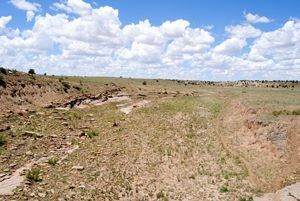
Santa Fe Trail & Route 66 in the Pecos River Valley
The Santa Fe Trail, in the days of its greatest fame, extended from Independence, Missouri, to Santa Fe, the capital city of the province of New Mexico. There were practically no settlements of white people between these points and, indeed, few permanent Indian towns. The City of Santa Fe was founded about 1610; the exact date is unknown. In the prosperous days of the Santa Fe trade, it contained about 3,000 inhabitants.
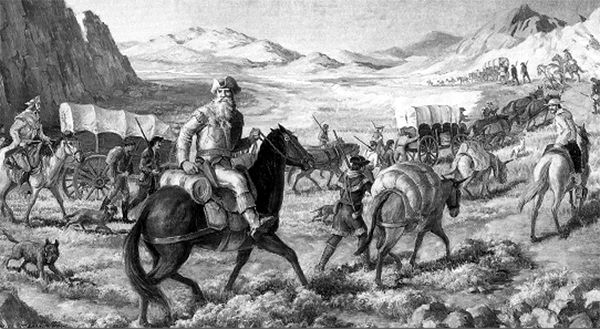
William Becknell blazes the Santa Fe Trail.
Captain William Becknell made the first successful venture to Santa Fe over the Santa Fe Trail. With him were four trusted companions, who left Arrow Rock on the Missouri River near Franklin, Missouri, on September 1, 1821. After arriving in Santa Fe on November 16, 1821, and making an enormous profit, Becknell made plans to return, thus blazing the path that would become known as the Santa Fe Trail.
In New Mexico, there were two main routes — the Cimarron Cutoff and the Mountain Route. From these two paths, several other alternate routes formed to accommodate the numerous communities that sprang up along the way to provide goods, services, food, shelter, and water to the many wagon trains passing through. The many smaller trails merged again along the Las Vegas-Santa Fe Corridor into New Mexico.
The Santa Fe Trail New Mexico National Scenic Byway follows today’s highways and roads near the original Santa Fe Trail paths.

Rabbit Ears, New Mexico
The Cimarron Route entered New Mexico from the Oklahoma panhandle north of present-day Clayton. Several significant sites exist along this route, including McNee’s Crossing, Point of Rocks, and the Rock Crossing of the Canadian River.
New Mexico Highway 406 intersects McNees Crossing, where the trail forded the North Canadian River. The crossing of Corrumpa Creek in Union County is 3.8 miles southwest of the Oklahoma state line. This rock crossing, which is still visible, was named for a young trader, Robert McNees, who was killed here by Indians in 1828. The site was also used as a campground, and a group of traders celebrated the Fourth of July here in 1831. The byway then makes its way west out of Clayton on U.S. 56 past the Rabbit Ear Mountains, an important landmark on the trail.
Another notable marker, Point of Rocks, is north of U.S. 56, about 22 miles east of Springer in Colfax County. This was once a popular campsite with a nearby spring. The party of Santa Fe merchant J.W. White was attacked near here in 1849, and 11 graves are located at the site. Now a private ranch, it is open to the public.
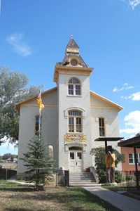
The Santa Fe Trail Museum in the old Colfax County Courthouse in Springer, New Mexico by Kathy Alexander.
The Rock Crossing of the Canadian River, also in Colfax County, was used by Indians from early times and later by travelers on the Cimarron Route. The crossing has a natural stone floor for a short distance only. Upstream it is sandy and hard to cross, while downstream, a deep and rocky canyon makes it impossible to cross. This spot was considered the real entry into Mexico, and Mexican troops were sometimes sent this far to escort traders back to Santa Fe. It was also the site of several Indian raids on the caravans. The crossing is located on private land two miles south of US Highway 56.
Springer, located six miles west of where the trail crossed the Canadian River, is home to the Santa Fe Trail Museum, housed in the 1882 Colfax County Courthouse. The byway leaves Springer on the east I-25 frontage road bound for Wagon Mound, the last major landmark on this stretch of the road. In 1850 a party of 10 men accompanying the express mail wagon on the Cimarron route were killed by Jicarilla Apache near here.
The trail then continues to make its way to Watrous, where it joins with the Mountain Branch of the trail. Trading ranches and stage stations along the Cimarron Route included the Samuel B. Watrous Ranch House and Store, Barclay’s Fort Site north of Watrous, and the Sapello Stage Station known as Gregg Tavern Stage Station or Barlow & Sanderson Stage Station in Watrous.
Raton Pass, New Mexico
Along the Mountain Route, which entered New Mexico from Colorado, significant sites include the site of the Lucien Maxwell House, Ocate Crossing, and Fort Union National Monument.
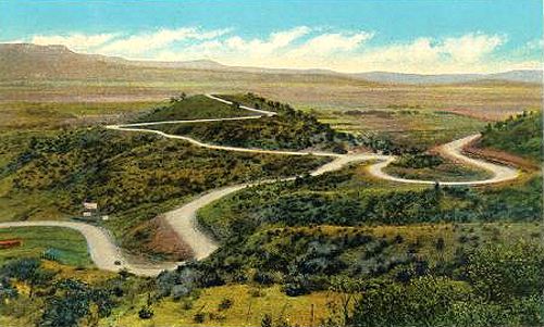
Crossing Raton Pass was the hardest part of traveling the Mountain route. Richens “Uncle Dick” Wootton established a toll road through the pass-through here in 1865, charging $1.50 for wagons, 25¢ for horses, and 5¢ for each head of stock. Indians used the road for free. Interstate 25 parallels the old road.
The byway follows Moulton Street southeast to Second Street in Raton, first known as Willow Springs. It became a water stop for stagecoaches and a freight stop on the Santa Fe Trail. The Santa Fe Trail National Scenic Byway picks up south of Raton on U.S. 64 and runs through Cimarron. Settled around 1844, it became the headquarters of the 1.75-million-acre Maxwell Land Grant in 1857. Wagon trains entered the plaza from the east after crossing the Cimarron River. Lucien Maxwell built the Aztec Mill, which survives as the Old Mill Museum in Cimarron. It is located on 17th Street and is open in the summer.
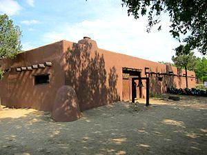
Kit Carson Museum, Rayado, New Mexico courtesy Wikipedia.
The trail then made its way to Rayado, 12 miles south of Cimarron. Rayado started from a Santa Fe Trail campsite established by Lucien Maxwell in 1848; it was the point at which the Mountain Route and two of its side trails rejoined. There was a military camp at Rayado in the early 1850s to help protect this portion of the Mountain Route. Today, Maxwell’s old has been restored.
Ocate Crossing in Mora County was a watering point and campsite. This route was heavily used during and after the Civil War, and trail travelers often mentioned it. General Stephen Watts Kearny’s Army of the West crossed here in 1846 and camped nearby.
The Fort Union National Monument in Mora County is near the junction of the Cimarron and Mountain routes. Fort Union was a major military post on the Santa Fe Trail during the period from 1851 to 1891, and for a time, it was the largest American military post in the Southwest. Founded primarily to protect the trail, the fort’s original structures had already deteriorated by the Civil War, and a fortification was built. After the Civil War, a third Fort Union was completed, which included a garrison and traditional post, a regional quartermaster depot, and an arsenal on the original fort’s site.
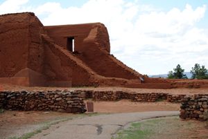
One of the most significant sites along the route from Watrous to Santa Fe is Pecos National Historic Park in San Miguel County. This is the Pecos Pueblo site, which was the easternmost pueblo visited by Francisco Coronado in 1541. The pueblo was still inhabited when the Santa Fe Trail opened in 1821, but it was abandoned around 1838. The abandoned pueblo was used as a campsite by trail travelers and was often mentioned in their journals. Other sites along this stretch of the combined trail include Las Vegas Plaza, Tecolote, San Miguel del Vado, Apache Canyon, Kearny Gap, and Glorieta Pass. Trading ranches included Kozlowski’s Stage Station, Pigeon’s Ranch, and Johnson’s Ranch Site.
The Santa Fe Trail ends in Santa Fe, New Mexico.
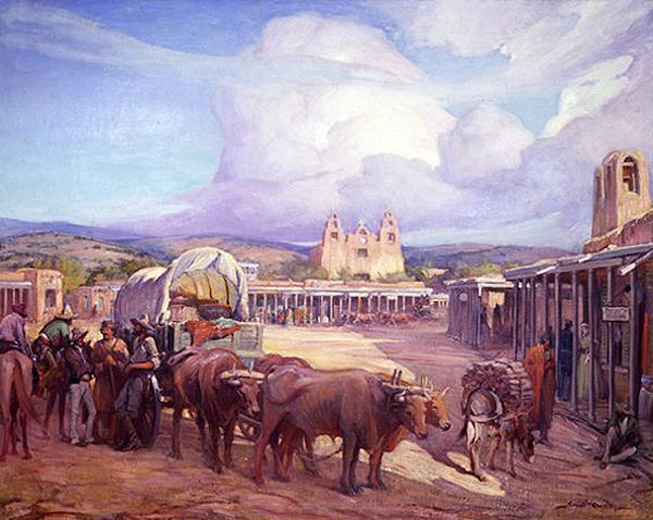
Ultimately, travelers reached the end of the trail, the Santa Fe Plaza. Established in about 1610 by Don Pedro de Peralta, the Plaza has long stood as the commercial, social, and political center of Santa Fe. It would have teamed with carts, goods, livestock, traders, and townspeople during the 19th century at the height of the Santa Fe Trail. Buildings constructed in the Pueblo, Spanish and Territorial styles ring the Plaza, reflecting this historic place’s diverse cultural history. One of the most noted historic buildings on the Plaza is the Palace of the Governors. Constructed in 1610, the Palace of the Governors served for 300 years as the seat of the Spanish, Mexican, and American territorial government in New Mexico. It is the oldest extant public building in the United States and now is part of the Museum of New Mexico.
Extensive use of the Santa Fe Trail ceased by 1880, but its legacy, lore, and influence live on. Goods, ideas, and diverse cultural interactions traversed the Santa Fe Trail for nearly 60 years. The mixing of cultures and ideas that followed created a unique experience that lives on today.
© Kathy Weiser-Alexander/Legends of America, updated April 2021.
Also See:
Santa Fe Trail – Highway To the Southwest
Santa Fe Trail Photo Print Gallery
Sources: See Santa Fe Trail Site Map & Writing Credits