Cimarron Branch of the Santa Fe Trail in Kansas
Cimarron Branch of the Santa Fe Trail
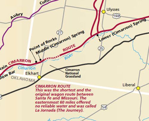
The Cimarron Route of the Santa Fe Trail was shorter and faster than the Mountain Route, but the easternmost 50 to 60 miles of the route crossed a dry and rugged land that was called La Jornada (The Journey) because there was almost no water. This was the most often used route from Missouri to Santa Fe, New Mexico during its early days. However, later, the Mountain Route became more popular due to the risk of Indian attacks on the Cimarron Route.
Haskell County
The Cimarron branch of the Santa Fe Trail entered Haskell County near the northeast corner and passed southwest between the now extinct towns of Ivanhoe and Santa Fe. A marker is situated north of the abandoned townsite of Santa Fe near the Ivanhoe Cemetery. The trail then continued southwest moving out of the county midway of its western border. Wild Horse Lake was to the north of the trail, but there were no important stopping places along its 27-mile course in the county.
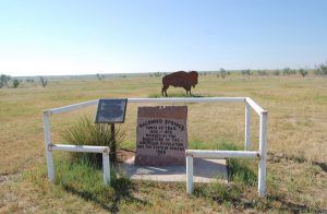
Wagon Bed Spring, Kansas by Kathy Alexander.
The trail entered Grant County midway of its eastern boundary and continued its southwesterly course, crossing the North Fork of the Cimarron River before making its way to the well-known “Lower Springs,” later known as the “Wagon Bed Spring” on the Cimarron River. This stopping-place was in the extreme south part of the county, near the old townsite of Zionville, and was the point on the Cimarron River to which it joined with the route to the Upper Crossing and Chouteau Island in Kearny County.
Wagon Bed Spring was a welcome oasis as pioneers traveling on the Cimarron Cutoff from Gray County had passed some 60 miles between the Arkansas River and the spring. Known as the “Jornada,” the stretch was a perilous route for people and animals in dry seasons when wagon trains often ran out of water. Here also fierce Plains Indians frequently attacked and plundered the caravans.
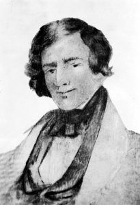
Jedediah Strong Smith
Near Wagon Bed Spring, the noted Western explorer and fur trader, Jedediah Strong Smith, was lost for four days without water in 1831. Just as neared the river, he was killed by Comanche Indians.
Wagon Bed Spring is on the north bank of the Cimarron River about 11 miles south and 1/2 miles west of Ulysses, Kansas. The site can be accessed and the Wagon Bed Spring Chapter has set up a display near the original Lower Springs location, which depicts the way the Spring looked in Trail days. Many trail ruts can be seen in the area.
Stevens County
Through Stevens County, the trail paralleled the Cimarron River in its course through the northwest part of the county, but there were no important camping places or landmarks. In their travels, pioneers sometimes kept fairly close to the river, but at times were several miles away; hence there were really two routes – the “river” and the “upland.”
Morton County
Morton County has some 30 miles of the old trail within its borders. Entering the county about eight miles south of its northeast corner, the trail continued along the Cimarron River until it came to the Middle or Cimarron Spring situated about nine miles north of present-day Elkhart, Kansas. After Wagon Bed (or Lower Spring), Middle Spring was the next reliable water source for travelers in the Cimarron Valley. This made it a major stopping point and a campsite on the Santa Fe Trail. The site can be accessed by traveling 8 miles north of Elkhart on Kansas Highway 27, and about 1 mile west on a dirt road through Cimarron National Grassland to a small enclosed park on the north side of the road.
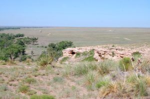
Point of Rocks in Southwest, Kansas by Kathy Alexander.
The trail then made its way to yet another site called Point of Rocks, situated today in the Cimarron National Grassland. This site was a lookout along the Cimarron Valley for both Indians and traders, with one branch of the Trail running between the rock and the river. This landmark is still surrounded by grasslands, where wagon ruts can be seen. It is located just about ½ mile west of the Middle Spring.
The trail continued through Morton County, passing out of the county about seven miles north of the southwest corner. The Cimarron Route of the Santa Fe Trail, after leaving the present boundaries of Kansas continued to follow the Cimarron River, first on one side of the stream, and then on the other, through the present states of Colorado and Oklahoma, for a distance of some sixty or sixty-five miles, when it entered the northeast corner of New Mexico.
© Kathy Alexander/Legends of America, updated June 2022.
“Having neglected to carry water with us, we were compelled to do without it for two days and nights after leaving the Arkansas River, and when we did come to a cool, sparkling stream, both animals and men were almost to the point of perishing.”
— Milton E. Bryan, on the Jornada, 1828


West to Colorado Santa Fe Trail
Also See:
Mountain Branch Through Western Kansas
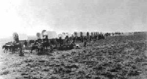
Wagon Train
Santa Fe Trail – Pathway to the Southwest